Area Overview for SE16 3AD
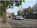
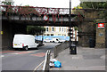
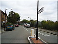
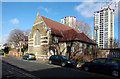
Photos of SE16 3AD


Area Information
Living in SE16 3AD means residing within a small residential cluster defined by postcode SE16 3AD, covering a land area of just 1160 square metres. This specific locality hosts a population of 1,839 people, creating a distinct neighbourhood identity within the broader Southwark landscape. Residents here manage daily life in a compact environment where proximity to key transport nodes defines the experience. The area is situated in England, offering a micro-community feel that differs from sprawling suburban developments. For anyone considering homes in SE16 3AD, the reality is one of density and efficiency rather than expansive grounds. The sheer concentration of population presents a lively local atmosphere where neighbours are often within earshot. You will find that life revolves around the immediate vicinity and the wider network of stations just beyond the postcode boundary. This small footprint means that everything from the local primary school to major tube lines is a short journey away. The character of SE16 3AD is shaped by its size, making it a specific, well-defined pocket of London housing.
- Area Type
- Postcode
- Area Size
- 1160 m²
- Population
- 1839
- Population Density
- 13394 people/km²
Homes in SE16 3AD reflect a market driven by rental demand and compact living spaces. The accommodation type data confirms that flats predominate over terraced or semi-detached houses in this specific postcode. With only 21% of residents owning their homes, the area functions primarily as a rental market where properties change hands frequently through tenancy agreements rather than sales. This high rate of renting suggests a concentration of investors and landlords managing units within the 1160 square metre zone. For a buyer looking at this tiny area, the opportunity to purchase freehold homes may be limited compared to owner-occupied suburbs. The scarcity of ownership means that if you are viewing a property, it is likely being managed by an agent on behalf of an absent owner. The nature of the housing stock implies efficient use of space, typical of South London postcodes. You must be prepared for a landscape where leases are common and social communities are often built through shared buildings rather than street-based interaction. The small size of the cluster limits scalability, keeping property values tied to the immediate local influence of the station and schools.
House Prices in SE16 3AD
No properties found in this postcode.
Energy Efficiency in SE16 3AD
Your daily life in SE16 3AD benefits from a dense array of amenities located within practical reach of the residential cluster. Retail options include five major shops, with Iceland Old Kent, Lidl Old, and Iceland Bermondsey serving as key destinations for groceries and general goods. Travelers will appreciate the five rail stations nearby, specifically South Bermondsey, Surrey Quays, and Queens Road Peckham, which provide direct access to the rest of London. Five Metro stations like Bermondsey and Borough Station are also close by, adding depth to your commute choices. If you prefer water transport, five ferry piers including Wapping Pier and Masthouse Terrace Pier offer river crossing options. Road users can access three bus services that link to major coach stations such as Green Line Coach Station and London Victoria. For aviation access, London City Airport stands as the sole airport option listed in close proximity. This concentration of five major grocery retailers means you rarely need to travel far for essentials. The lifestyle here is defined by abundance of choice; you can shop, travel by rail, tube, ferry, or bus without leaving the city limits. The availability of multiple Iceland and Lidl stores suggests a focus on convenience and value for the local population.
Amenities
Schools
Families looking for education options in SE16 3AD have access to Ilderton Primary School, which serves as the key local institution. This school is a primary facility and holds an Ofsted rating of outstanding, indicating a high standard of education. The presence of just one named school in the immediate vicinity suggests that families often rely on this single option or travel to the wider Southwark borough for secondary education. For parents considering living in SE16 3AD, the proximity to Ilderton Primary is a significant factor given its top-tier rating. The concentration of schooling data highlights a lack of multiple secondary choices listed directly in the postcode bubble. If you have children, the outstanding rating of Ilderton Primary provides a strong educational foundation just steps away from the residential cluster. There are no other schools listed in the provided data, so parents must consider travel times to the nearest comprehensive or academies beyond the immediate boundary. The single school offering means less competition for local entry spots but potentially longer commutes for older children.
| Rank | School | Type | Entry gender | Ages |
|---|---|---|---|---|
| 1 | Ilderton Primary School | primary | N/A | N/A |
Explore more schools in this area
Go to Schools tabDemographics
The community in SE16 3AD is defined by a mature resident base with a median age of 47 years. Most commonly, the population consists of adults between the ages of 30 and 64. You will find that home ownership stands at 21%, indicating a significant number of tenants rather than owners within this cluster. The predominant form of accommodation here is flats, which aligns with the high density of 158,466 people per square kilometre. While specific data on economic deprivation is not included in the provided profile, the high population density and low home ownership levels suggest a dynamic rental market. The demographic profile shows a White population as the predominant ethnic group. For families or professionals looking at this area, the age skew towards older adults means a quieter, perhaps more established neighbourhood vibe compared to university-heavy districts. The lack of young children in the primary age bracket is evident from the age statistics. Buyers should expect a neighbourhood where long-term residents have shaped the local culture. The mix of long-term tenancy and younger adults creates a stable, adult-oriented environment.
Household Size
Accommodation Type
Tenure
Ethnic Group
Religion
Household Composition
Age
Household Deprivation
NS-SEC
Explore more demographic insights in this area
Go to Demographics tabPlanning
Planning Constraints
- Flood RiskPremium
- Ramsar Wetland SitesPremium
- Area of Outstanding Natural BeautyPremium
- Protected Nature ReservePremium
- Protected WoodlandPremium
- Crime RiskPremium