Area Overview for SE16 2TU
Photos of SE16 2TU
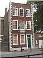
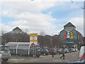
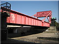
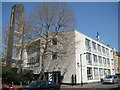
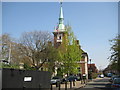
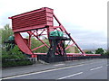
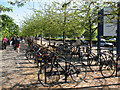
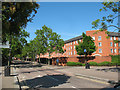
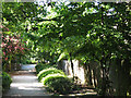
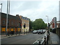
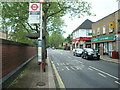
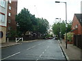
100 photos from this area
Area Information
Key information about the SE16 2TU including its size, population, and administrative classification.
- Area Type
- Postcode
- Area Size
- 6740 m²
- Population
- 2600
- Population Density
- 6103 people/km²
House Prices in SE16 2TU
15
Properties
£458,707
Average Sold Price
£86,000
Lowest Price
£880,000
Highest Price
Showing 15 properties
| Address | Type | Beds | Baths | Last Sale Price | Last Sale Date | |
|---|---|---|---|---|---|---|
| 66 Lower Road, London, SE16 2TU | Terraced | 6 | 4 | £880,000 | Aug 2025 | |
| 56 Lower Road, London, SE16 2TU | Terraced | 1 | 1 | £640,000 | Jul 2015 | |
| 68 Lower Road, London, SE16 2TU | house | 4 | - | £525,000 | Sep 2012 | |
| 58 Lower Road, London, SE16 2TU | Terraced | 4 | - | £460,000 | Jul 2012 | |
| 64 Lower Road, London, SE16 2TU | house | 6 | 1 | £370,000 | Nov 2006 | |
| 62 Lower Road, London, SE16 2TU | Semi-detached | 3 | 1 | £249,950 | Apr 2001 | |
| 60 Lower Road, London, SE16 2TU | Terraced | - | - | £86,000 | Mar 1995 | |
| 66B Lower Road, London, SE16 2TU | Terraced | 5 | 5 | - | - | |
| 54 Lower Road, London, SE16 2TU | Terraced | 3 | - | - | - | |
| The Blue Mango Salon Limited, Ground Floor, Seven Islands Leisure Centre, 70-86 Lower Road, London, SE16 2TU | shop | - | - | - | - |
Page 1 of 2
Energy Efficiency in SE16 2TU
Amenities
Schools
| Rank | School | Type | Entry gender | Ages |
|---|
Explore more schools in this area
Go to Schools tabDemographics
Household Size
Two person
most common
Accommodation Type
Flats
most common
Tenure
19
majority
Ethnic Group
White
most common
Religion
N/A
most common
Household Composition
N/A
most common
Age
47
median
Adults (30-64 years)
most common
Household Deprivation
N/A
with no deprivation
NS-SEC
50
in Lower managerial occupations
Explore more demographic insights in this area
Go to Demographics tabPlanning
Planning Constraints
- Flood RiskPremium
- Ramsar Wetland SitesPremium
- Area of Outstanding Natural BeautyPremium
- Protected Nature ReservePremium
- Protected WoodlandPremium