Area Overview for SE15 4EA
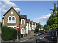
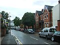
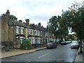
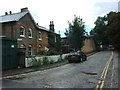
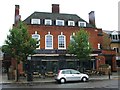
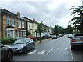
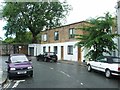
Photos of SE15 4EA

Area Information
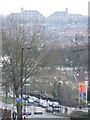
Living in SE15 4EA means residing in a very small residential cluster defined by a specific postcode. This area covers just 3631 square metres, creating an extremely compact living environment. The population stands at 1561 people, making this one of the most densely concentrated districts in the country. You will find a neighbourhood where proximity is the defining feature of daily life. The sheer density of 429858 people per square kilometre suggests a space where homes sit close together. This intensity shapes the character of the community, affecting noise levels, local friendliness, and access to shared resources. The area represents a specific slice of South London life, detached from the broader borough narrative by its tiny physical footprint. When considering homes in SE15 4EA, you are purchasing a stake in a micro-community rather than a sprawling suburb. The location offers immediate access to wider transport networks despite its small size. Every resident here manages life within a confined geographical boundary that prioritises direct access to essentials. Understanding the scale of this postcode is vital for anyone looking for a traditional suburban experience. Instead, you enter a setting where convenience and density define the routine. The layout supports a fast-paced lifestyle centred on what is immediately available during a walk across the postcode.
- Area Type
- Postcode
- Area Size
- 3631 m²
- Population
- 1561
- Population Density
- 10569 people/km²
The property market in SE15 4EA is heavily influenced by the physical constraints of the location and the type of housing available. Accommodation types are primarily flats, a style that maximises living space within the limited 3631 square metre area. This housing stock suits those who prefer low-maintenance living or wish to explore the region without committing to a large house. With 51% home ownership, the area offers a pathway to equity for buyers willing to invest in a flat. The remaining 49% rental population indicates a steady demand for short-term or long-term lets within the postcode. Buyers looking at homes in SE15 4EA must consider the density implications of this small residential cluster. The predominance of flats means that external noise or light pollution may be more noticeable than in houses set back from the street. However, living in this setting provides immediate access to amenities without the need for a car. The market reflects a mix of stability and investment potential, given the significant proportion of owner-occupied properties. This balance makes the area attractive to those who want a foothold in South London without venture into the most expensive properties of central London. The character of the housing is defined by vertical living rather than expansive gardens. Understanding the 51% ownership rate helps buyers gauge the prevailing sentiment of the residents.
House Prices in SE15 4EA
Showing 21 properties
| Address | Type | Beds | Baths | Last Sale Price | Last Sale Date | |
|---|---|---|---|---|---|---|
| 55 Ondine Road, London, SE15 4EA | Semi-detached | 4 | 3 | £1,332,418 | Jul 2022 | |
| 79 Ondine Road, London, SE15 4EA | Semi-detached | 4 | 2 | £1,105,000 | Sep 2019 | |
| 75A Ondine Road, London, SE15 4EA | Flat | - | - | £675,000 | Dec 2018 | |
| 65 Ondine Road, London, SE15 4EA | house | 4 | - | £710,000 | Sep 2010 | |
| 67 Ondine Road, London, SE15 4EA | house | - | - | £543,000 | Jan 2008 | |
| 75B Ondine Road, London, SE15 4EA | Flat | - | - | £153,500 | Jun 2001 | |
| 59 Ondine Road, London, SE15 4EA | Semi-detached | 4 | 1 | - | - | |
| 69A Ondine Road, London, SE15 4EA | Flat | - | - | - | - | |
| 69B Ondine Road, London, SE15 4EA | Flat | - | - | - | - | |
| 77B Ondine Road, London, SE15 4EA | Flat | - | - | - | - |
Energy Efficiency in SE15 4EA
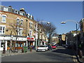
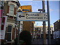
Daily life in SE15 4EA is supported by a wide array of amenities located within practical reach. Retail options include Tesco East, Co-op Dulwich, and M&S East Dulwich SF, ensuring you can stock a pantry without leaving the vicinity. Transport links are equally extensive, with rail access near Peckham Rye Station, Denmark Hill Station, and North Dulwich. Metro stations at Oval, Stockwell Station, and Kennington Station provide fast underground journeys. Ferry terminals like Masthouse Terrace Pier, Wapping Pier, and Vauxhall St George Wharf Pier offer unique water-based travel possibilities. Additionally, bus services near Green Line and Victoria Coach Station cover longer-distance travel needs. This diverse mix of retail and transport hubs makes living in SE15 4EA highly convenient. You can shop for groceries, collect parcels, and plan trips from local supermarkets and coach stations. The proximity of major stations means you have multiple choices for commuting or visiting friends. Tenants and owners alike benefit from having a supermarket and national retailers like M&S close by. The combination of five retail outlets, five rail stops, five metro stations, three bus hubs, and five ferry points creates a robust support network. This density of amenities means you rarely need a car for routine tasks.
Amenities
Schools
Families considering SE15 4EA have access to one specific primary education option nearby: The Belham Primary School. This institution sits close enough for residents to enrol their children without travelling far from home. The school holds a good Ofsted rating, which signals a standard of education that meets or exceeds government expectations. While the data lists only this one school, the proximity suggests a focus on primary education for the local community. The availability of just one primary option indicates that secondary schools likely lie further away or in adjacent postcodes. For parents in SE15 4EA, this means early education is conveniently located, but high school choices require a wider search. The presence of The Belham Primary School supports families with young children directly within the 3631 square metre cluster. Its good rating provides reassurance for those moving to the area specifically for schooling. The limited list of schools in the immediate vicinity highlights the need to check catchment areas beyond the immediate neighbourhood for older students. This single-school focus simplifies the decision-making process for families at the start of their educational journey.
| Rank | School | Type | Entry gender | Ages |
|---|
Explore more schools in this area
Go to Schools tabDemographics
The community in SE15 4EA reflects the needs of established adults rather than a transient population. The median age is 47 years, indicating a mature resident base likely seeking stability in their housing choices. Most residents fall into the 30 to 64 years age range, suggesting families in their prime working years or individuals nearing retirement. Home ownership rates stand at 51%, showing a balanced split between owners and renters within this small cluster. This figure implies that roughly half of the residents have purchased properties, while the other half are likely paying a monthly fee to live there. Accommodation is dominated by flats, which suits the high-density nature of 3631 square metres. The predominant ethnic group is White, aligning with broader demographic trends in parts of South London. With 51% of residents owning their homes, the area supports both long-term investors and people looking to settle down. The age profile of 47 suggests a neighbourhood where children may be grown or still in education. This demographic mix influences local shop offerings, social activities, and community engagement. The concentration of adults aged 30 to 64 creates a stable environment where neighbours know each other. The mix of ownership types ensures a dynamic street scene without the monotony of a single demographic grouping.
Household Size
Accommodation Type
Tenure
Ethnic Group
Religion
Household Composition
Age
Household Deprivation
NS-SEC
Explore more demographic insights in this area
Go to Demographics tabPlanning
Planning Constraints
- Flood RiskPremium
- Ramsar Wetland SitesPremium
- Area of Outstanding Natural BeautyPremium
- Protected Nature ReservePremium
- Protected WoodlandPremium