Area Overview for SE15 4DD
Photos of SE15 4DD

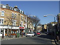
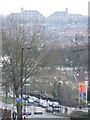
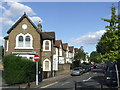
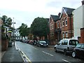
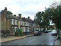
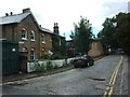
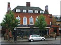
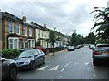
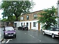
95 photos from this area
Area Information
Key information about the SE15 4DD including its size, population, and administrative classification.
- Area Type
- Postcode
- Area Size
- 7446 m²
- Population
- 1561
- Population Density
- 10569 people/km²
House Prices in SE15 4DD
44
Properties
£628,250
Average Sold Price
£97,000
Lowest Price
£1,400,000
Highest Price
Showing 44 properties
| Address | Type | Beds | Baths | Last Sale Price | Last Sale Date | |
|---|---|---|---|---|---|---|
| 39A Oglander Road, London, SE15 4DD | Maisonette | 2 | 1 | £575,000 | Nov 2022 | |
| 35A Oglander Road, London, SE15 4DD | Flat | 2 | 1 | £587,500 | Aug 2022 | |
| 61 Oglander Road, London, SE15 4DD | house | - | - | £1,400,000 | Jul 2018 | |
| 57A Oglander Road, London, SE15 4DD | Flat | 2 | 1 | £525,000 | Jul 2017 | |
| 59 Oglander Road, London, SE15 4DD | Semi-detached | 5 | 1 | £1,280,000 | Feb 2017 | |
| 43 Oglander Road, London, SE15 4DD | Flat | - | - | £428,000 | Dec 2014 | |
| 77 Oglander Road, London, SE15 4DD | house | 4 | 1 | £1,210,000 | Nov 2013 | |
| 63 Oglander Road, London, SE15 4DD | Semi-detached | - | - | £690,000 | Sep 2008 | |
| 75 Oglander Road, London, SE15 4DD | house | - | - | £520,000 | Sep 2006 | |
| 27 Oglander Road, London, SE15 4DD | house | - | - | £495,000 | Apr 2006 |
Page 1 of 5
Energy Efficiency in SE15 4DD
Amenities
Schools
| Rank | School | Type | Entry gender | Ages |
|---|
Explore more schools in this area
Go to Schools tabDemographics
Household Size
Two person
most common
Accommodation Type
Flats
most common
Tenure
51
majority
Ethnic Group
White
most common
Religion
N/A
most common
Household Composition
N/A
most common
Age
47
median
Adults (30-64 years)
most common
Household Deprivation
N/A
with no deprivation
NS-SEC
60
in Lower managerial occupations
Explore more demographic insights in this area
Go to Demographics tabPlanning
Planning Constraints
- Flood RiskPremium
- Ramsar Wetland SitesPremium
- Area of Outstanding Natural BeautyPremium
- Protected Nature ReservePremium
- Protected WoodlandPremium