Area Overview for SE15 4AA
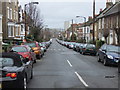
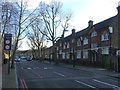
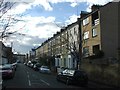
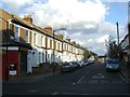
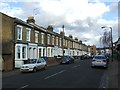
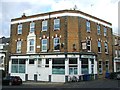
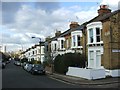
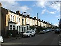
Photos of SE15 4AA


Area Information
Living in SE15 4AA means residing within a very small residential cluster covering just 5526 square metres. This compact postcode area serves 1658 people, creating a dense environment where neighbours are inevitably close by. The population density exceeds 300,000 people per square kilometre, reflecting a high-concentration urban setting typical of London's postcodes. Daily life here is characterised by proximity to extensive transport links rather than open space, as the area itself is built-up. You are situated at the intersection of major transport corridors, with rail, metro, and bus routes immediately accessible. The location acts as a convenient gateway to broader districts like Peckham and Clapham. Residents here benefit from immediate access to multiple transport hubs without needing to travel far outside the postcode boundary. This density offers convenience but also results in a tightly packed living situation. The area functions as a residential hub that relies on its strategic position for connectivity rather than internal spaciousness.
- Area Type
- Postcode
- Area Size
- 5526 m²
- Population
- 1658
- Population Density
- 7937 people/km²
Homes in SE15 4AA exist within a distinct market defined by flat ownership and moderate ownership rates. The housing stock is predominantly composed of flats, which suits the high population density of this 5526 square metre area. With approximately 49% of residents owning their homes, the market appears balanced between long-term owners and renters. This ownership level suggests that more than half of the 1658 residents either rent from landlords or occupy their property through other means. For buyers, this indicates a competitive environment where maintenance of shared structures and service charges are relevant considerations. The area stretches from SE15 towards SE11, so you must verify that your target property falls within the specific boundaries of SE15 4AA. Flats in this postcode typically command different prices compared to terraced houses or detached properties found in adjacent zones. The concentration of flats means you will find micro-apartments, standard city units, and potentially larger family flats depending on the specific building you inspect.
House Prices in SE15 4AA
Showing 44 properties
| Address | Type | Beds | Baths | Last Sale Price | Last Sale Date | |
|---|---|---|---|---|---|---|
| 118 Choumert Road, London, SE15 4AA | Terraced | 3 | 1 | £900,000 | May 2025 | |
| 108 Choumert Road, London, SE15 4AA | Terraced | 3 | 2 | £820,000 | Nov 2022 | |
| 130 Choumert Road, London, SE15 4AA | house | - | - | £1,100,000 | Feb 2022 | |
| 110 Choumert Road, London, SE15 4AA | Terraced | 3 | 1 | £712,000 | Feb 2022 | |
| 126 Choumert Road, London, SE15 4AA | Flat | - | - | £580,000 | Jun 2021 | |
| 132 Choumert Road, London, SE15 4AA | Flat | 2 | 1 | £1,130,000 | Dec 2020 | |
| 112 Choumert Road, London, SE15 4AA | Terraced | 2 | 1 | £760,000 | Oct 2020 | |
| 146 Choumert Road, London, SE15 4AA | house | - | - | £970,000 | Sep 2019 | |
| 156 Choumert Road, London, SE15 4AA | Terraced | 5 | 2 | £1,590,000 | Jul 2019 | |
| 152 Choumert Road, London, SE15 4AA | house | 3 | - | £1,115,000 | Aug 2015 |
Energy Efficiency in SE15 4AA
Residents of SE15 4AA enjoy convenient access to a wide range of amenities within practical reach. For retail needs, Iceland Peckham 2 and Tesco Peckham are located very close by, providing weekly shopping convenience. Your daily errands can be completed near Peckham without needing long journeys. Transport links are extensive, with five major rail stations, five stations each for the Overground and Central lines, plus five ferry piers all accessible nearby. Stations such as Peckham Rye, Denmark Hill, and Oval offer direct connections across the capital. You can also reach London City Airport easily, alongside National Express services from Victoria Coach Station. This connectivity means you are never far from the wider world. Dining options in Peckham complement the retail and transport hubs available to you. The concentration of stations creates a lifestyle defined by movement and access to both local and global destinations.
Amenities
Schools
Families living in SE15 4AA benefit from immediate access to quality educational institutions nearby. The Villa acts as the primary independent school within reach of the postcode. This school holds a good Ofsted rating, providing assurance of educational standards for residents. Independent schooling options like this often come with specific entry requirements and fee structures that differ from state-funded schools. While independent options exist nearby, the mix of school types available in the broader SE15 and SE11 region influences how families plan their education for children. The presence of a school rated good provides a solid foundation for parents choosing educational paths for their offspring. You should check travel times from your specific flat to both The Villa and any state-maintained schools in the vicinity. The proximity of a good-rated institution adds value to properties within the SE15 4AA cluster, though commuting distances to specific classrooms must still be accounted for in your daily routine.
| Rank | School | Type | Entry gender | Ages |
|---|
Explore more schools in this area
Go to Schools tabDemographics
The community in SE15 4AA consists primarily of adults aged between 30 and 64 years. This age range represents the most common demographic group within the 1658 residents. The median age across the area stands at 47 years, indicating a mature population profile. Nearly half of the population, or 49%, owns their home outright. The remaining households likely consist of renters or those purchasing shared ownership properties. The predominant accommodation type consists of flats, aligning with the high density and limited land availability in this postcode. While the data indicates White is the predominant ethnic group, the area reflects the diverse nature of South London living. This demographic mix suggests a community where older professionals and families form the backbone of local life. The high rate of homeownership implies stability, yet the flat-heavy stock suggests many units may be smaller city pads. You are living amongst a demographic that has established roots and clear preferences for urban living.
Household Size
Accommodation Type
Tenure
Ethnic Group
Religion
Household Composition
Age
Household Deprivation
NS-SEC
Explore more demographic insights in this area
Go to Demographics tabPlanning
Planning Constraints
- Flood RiskPremium
- Ramsar Wetland SitesPremium
- Area of Outstanding Natural BeautyPremium
- Protected Nature ReservePremium
- Protected WoodlandPremium