Area Overview for SE15 3SY
Photos of SE15 3SY

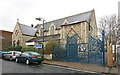
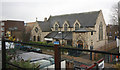
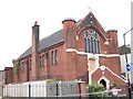
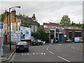
100 photos from this area
Area Information
Key information about the SE15 3SY including its size, population, and administrative classification.
- Area Type
- Postcode
- Area Size
- 7767 m²
- Population
- 1906
- Population Density
- 10165 people/km²
House Prices in SE15 3SY
31
Properties
£222,708
Average Sold Price
£51,250
Lowest Price
£795,000
Highest Price
Showing 31 properties
| Address | Type | Beds | Baths | Last Sale Price | Last Sale Date | |
|---|---|---|---|---|---|---|
| 25 Sandlings Close, London, SE15 3SY | Terraced | 3 | 1 | £795,000 | Apr 2023 | |
| 12 Sandlings Close, London, SE15 3SY | house | - | - | £248,500 | Sep 2018 | |
| 5 Sandlings Close, London, SE15 3SY | Terraced | 3 | - | £515,000 | Mar 2017 | |
| 10 Sandlings Close, London, SE15 3SY | Terraced | 3 | 2 | £560,000 | Feb 2016 | |
| 9 Sandlings Close, London, SE15 3SY | Terraced | 2 | - | £271,080 | May 2013 | |
| 4 Sandlings Close, London, SE15 3SY | Semi-detached | 3 | 2 | £265,000 | Jan 2007 | |
| 24 Sandlings Close, London, SE15 3SY | Terraced | - | - | £125,000 | Aug 2005 | |
| 27 Sandlings Close, London, SE15 3SY | house | - | - | £247,000 | Oct 2004 | |
| 13 Sandlings Close, London, SE15 3SY | Terraced | - | - | £62,500 | Jul 2001 | |
| 8 Sandlings Close, London, SE15 3SY | Terraced | - | - | £128,000 | Apr 2001 |
Page 1 of 4
Energy Efficiency in SE15 3SY
Amenities
Schools
| Rank | School | Type | Entry gender | Ages |
|---|
Explore more schools in this area
Go to Schools tabDemographics
Household Size
One person
most common
Accommodation Type
Flats
most common
Tenure
30
majority
Ethnic Group
black_total
most common
Religion
N/A
most common
Household Composition
N/A
most common
Age
47
median
Adults (30-64 years)
most common
Household Deprivation
N/A
with no deprivation
NS-SEC
33
in Lower managerial occupations
Explore more demographic insights in this area
Go to Demographics tabPlanning
Planning Constraints
- Flood RiskPremium
- Ramsar Wetland SitesPremium
- Area of Outstanding Natural BeautyPremium
- Protected Nature ReservePremium
- Protected WoodlandPremium