Area Overview for SE15 3RW
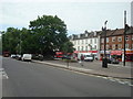
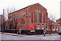
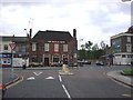
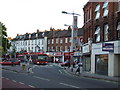
Photos of SE15 3RW


Area Information
SE15 3RW constitutes a specific postcode area covering a small residential cluster measuring 926 square metres within south east London. This compact footprint houses a population of 1,941 people, creating a dense living environment typical of central London boroughs. The area functions as a tightly knit node within the wider transport network, offering immediate access to multiple rail, metro, and ferry connections. Residents benefit from proximity to key commercial hubs, including the Green Line Coach Station and London City Airport, positioning this postcode as a convenient base for commuters and digital workers alike. The concentration of 2,096,833 people per square kilometre reflects the high-intensity urban character of the location. While the physical space is limited, the strategic location provides extensive access to museums, galleries, and retail zones in directions such as Bermondsey and Greenwich. Life here is defined by its centrality and the efficiency of its connections to major transport arteries. Prospective buyers should consider the density characteristic of this cluster when evaluating their daily commute times and the walkability of their immediate surroundings. The area represents a straightforward example of high-density urban living where space is traded for proximity to amenities.
- Area Type
- Postcode
- Area Size
- 926 m²
- Population
- 1941
- Population Density
- 11850 people/km²
The property landscape within SE15 3RW is characterised by a distinct skew toward rental living. With home ownership standing at just 30 per cent, the vast majority of the population resides in rented accommodation. The dominant accommodation type consists of flats, which aligns with the compact 926 square metre footprint of this specific postcode. This structure creates a market heavily influenced by tenant preferences and yield expectations rather than long-term family settlement patterns. Buyers looking at homes in SE15 3RW should expect to encounter a mix of conversions and purpose-built blocks suitable for professionals or small households. The low rate of owner-occupation suggests that the area appeals to investors or renters prioritising location over asset building within the specific boundary. Given the limited land size of this cluster, there is little opportunity for detached housing styles common in suburban zones. Instead, the housing stock focuses on vertical living solutions that maximise square footage in a constrained environment. Potential purchasers must weigh the high demand for these flats against the challenges of navigating a leasing market where tenancy lengths can vary significantly.
House Prices in SE15 3RW
Showing 1 properties
| Address | Type | Beds | Baths | Last Sale Price | Last Sale Date | |
|---|---|---|---|---|---|---|
| Public Convenience, Nunhead Library, Gordon Road, London, SE15 3RW | commercial | - | - | - | - |
Energy Efficiency in SE15 3RW
Daily life in SE15 3RW is supported by a comprehensive range of nearby amenities within walking or short transit distance. Retail options include the Co-op Nunhead, Tesco Peckham, and Tesco East, ensuring convenience shoppers have multiple choices for groceries and essentials. Transport enthusiasts benefit from five nearby rail stops, including Nunhead Station, alongside five metro stations such as Bermondsey Station. For those preferring public buses, three main routes are accessible, including services linked to the Green Line Coach Station. Ferry lovers have access to Masthouse Terrace Pier, Greenland Surrey Quays Pier, and Greenwich Pier for leisure or transport across the river. Five bus routes provide extensive linkages to Victoria and other major terminals. The proximity to London City Airport offers straightforward access for business travel. Residents can easily combine retail trips with leisurely walks to the riverfront. The combination of major supermarkets and diverse transport modes ensures that daily errands and long-distance travel alike are manageable without significant effort or cost.
Amenities
Schools
Families considering SE15 3RW have access to two named primary schools within the immediate vicinity. Peckham Rye Primary School operates as a local institution serving the cluster. Nearby, Rye Oak Primary School holds a good Ofsted rating, providing a verified standard of education for younger children. Both institutions are primary schools, and the absence of noted secondary schools in this specific dataset limits options for older pupils directly within the defined postcode. The presence of a rated primary school supports families with young children who require a school within their walking distance. The mix of schools implies a need for families to look further afield for secondary education if residency in this cluster is permanent. Parents should verify catchment boundaries for both Peckham Rye Primary School and Rye Oak Primary School to ensure continuity of education. The existence of these two specific schools confirms that early years education is accessible, though the range narrows significantly for teenagers.
| Rank | School | Type | Entry gender | Ages |
|---|
Explore more schools in this area
Go to Schools tabDemographics
The community in SE15 3RW is defined by a mature profile, with a median age of 47 years. The most common age range among residents comprises adults between 30 and 64 years old, indicating a neighbourhood settled by working families or established individuals. Home ownership stands at 30 per cent, suggesting that the majority of residents operate within the private rental sector. Accommodation types are predominantly flats, consistent with the high density of the postcode. The area remains ethnically diverse, with White residents forming the predominant group according to current records. This demographic mix reflects a stable, adult-oriented environment rather than a family housing market in the traditional sense. The low level of home ownership combined with the prevalence of flats points toward a high-quality rental market where tenants value location and convenience over building equity. For those seeking to purchase a property in SE15 3RW, the high rental demand may influence market valuations. The population density further cements the status of this area as a hub for professionals who require efficient access to the City or Canary Wharf without the subsidence of larger suburban areas.
Household Size
Accommodation Type
Tenure
Ethnic Group
Religion
Household Composition
Age
Household Deprivation
NS-SEC
Explore more demographic insights in this area
Go to Demographics tabPlanning
Planning Constraints
- Flood RiskPremium
- Ramsar Wetland SitesPremium
- Area of Outstanding Natural BeautyPremium
- Protected Nature ReservePremium
- Protected WoodlandPremium