Area Overview for SE15 2NS
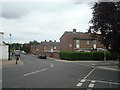
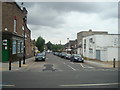
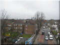
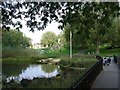
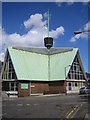
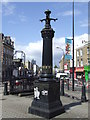
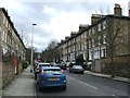
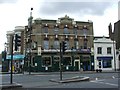
Photos of SE15 2NS
Area Information
Living in SE15 2NS offers a specific residential experience defined by its small postcode cluster within England. This area represents a concentrated pocket of housing rather than a sprawling district, meaning your neighbours are likely just a few hundred metres away. The locale does not fall within an Area of Outstanding Natural Beauty, nor does it contain protected woodlands or nature reserves. Consequently, development constraints related to these designations are non-existent, which can influence local planning decisions. Daily life here is shaped by standard urban living patterns without the buffer of significant green space protections found in other parts of south-east London. You will find yourself in a setting where the environment remains typical for its classification. The absence of major planning constraints suggests a straightforward approach to property maintenance and local development. While the area lacks the scenic restrictions of protected zones, it maintains a clear residential identity. Potential buyers should understand that this postcode covers a limited footprint, creating an intimate community feel. Safety assessments indicate a medium risk profile, requiring residents to adopt standard security precautions. The area serves as a functional part of the larger SE15 postcode region, offering a slice of London life without the complexities of the rarest planning sites. Homes here attract those seeking defined boundaries rather than expansive protected landscapes.
- Area Type
- Postcode
- Area Size
- 4838 m²
- Population
- 2624
- Population Density
- 13388 people/km²
The property market in SE15 2NS operates within the constraints of a small residential cluster. Because specific data on home ownership levels and accommodation types is absent, the market dynamics remain somewhat opaque. You cannot determine if this postcode is primarily an owner-occupied neighbourhood or a high-density rental hub. The housing stock likely consists of varied structures typical for south-east London, but without granularity, you cannot confirm the prevalence of Victorian terraces, post-war estates, or modern conversions. Buyers looking at homes in SE15 2NS must navigate this uncertainty by focusing on the physical property itself. The absence of household type statistics means you cannot predict the typical buyer demographics for the street. Whether you are a first-time purchaser or a family seeking space, the market here relies on general London trends rather than distinct local anomalies. The small geographical spread means that individual property features have more impact on value than in broader districts. You should inspect the property closely rather than relying on area-wide averages that do not exist for this postcode. The reality of buying here involves understanding the specific attributes of each home, as broad market data does not penetrate this narrow boundary.
House Prices in SE15 2NS
Showing 26 properties
| Address | Type | Beds | Baths | Last Sale Price | Last Sale Date | |
|---|---|---|---|---|---|---|
| 7A Colls Road, London, SE15 2NS | Flat | 1 | 1 | £383,140 | Sep 2023 | |
| 18 Colls Road, London, SE15 2NS | Terraced | 3 | 2 | £792,000 | Feb 2023 | |
| 8 Colls Road, London, SE15 2NS | house | 3 | - | £600,000 | Oct 2022 | |
| 1B Colls Road, London, SE15 2NS | Flat | 1 | 1 | £310,000 | Jan 2019 | |
| 19 Colls Road, London, SE15 2NS | Terraced | 3 | 2 | £680,000 | Dec 2015 | |
| 17 Colls Road, London, SE15 2NS | Terraced | 3 | - | £465,000 | Dec 2013 | |
| 7B Colls Road, London, SE15 2NS | Flat | - | - | £150,000 | Sep 2010 | |
| 5 Colls Road, London, SE15 2NS | Terraced | - | - | £185,000 | Mar 2005 | |
| 3 Colls Road, London, SE15 2NS | house | - | - | £270,000 | Mar 2005 | |
| 4 Colls Road, London, SE15 2NS | Terraced | - | - | £77,000 | May 1997 |
Energy Efficiency in SE15 2NS
Amenities
Schools
| Rank | School | Type | Entry gender | Ages |
|---|
Explore more schools in this area
Go to Schools tabDemographics
The community within SE15 2NS reflects the broader housing landscape of this specific postcode cluster. Specific demographic figures such as age distribution, household composition, or deprivation indices are not provided in current records. Without these statistics, you cannot determine the precise proportion of families versus singles or the concentration of young professionals. The absence of population data means the social fabric remains an inference based on the area's residential density rather than a measured reality. You cannot assume a vibrant mix of age groups or income levels without concrete evidence. Home ownership percentages and accommodation types remain unknown for this specific narrowing of the postcode. This lack of detail prevents you from knowing whether the street you consider is dominated by owner-occupiers or let to tenants. The data simply does not extend far enough into this specific cluster to reveal the mix of terraced houses, flats, or converted properties you might encounter. Deprivation levels and educational attainment scores are similarly unavailable, making it difficult to gauge the quality of local amenities relative to neighbouring areas. When you choose to live in SE15 2NS, you are entering an environment where the resident profile is defined by the visible street scene rather than statistical averages. You must rely on on-the-ground observation to understand who neighbours you.
Household Size
Accommodation Type
Tenure
Ethnic Group
Religion
Household Composition
Age
Household Deprivation
NS-SEC
Explore more demographic insights in this area
Go to Demographics tabPlanning
Planning Constraints
- Flood RiskPremium
- Ramsar Wetland SitesPremium
- Area of Outstanding Natural BeautyPremium
- Protected Nature ReservePremium
- Protected WoodlandPremium