Area Overview for SE15 2JB
Photos of SE15 2JB
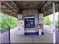
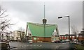
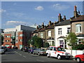
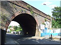
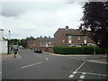
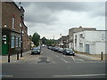
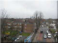
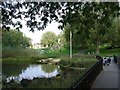
100 photos from this area
Area Information
Key information about the SE15 2JB including its size, population, and administrative classification.
- Area Type
- Postcode
- Area Size
- 5420 m²
- Population
- 1949
- Population Density
- 12003 people/km²
House Prices in SE15 2JB
59
Properties
£401,150
Average Sold Price
£144,500
Lowest Price
£725,000
Highest Price
Showing 59 properties
| Address | Type | Beds | Baths | Last Sale Price | Last Sale Date | |
|---|---|---|---|---|---|---|
| 50A Lausanne Road, London, SE15 2JB | Flat | 3 | 1 | £415,000 | Aug 2025 | |
| 60C Lausanne Road, London, SE15 2JB | Flat | 1 | 1 | £260,000 | Apr 2025 | |
| 76B Lausanne Road, London, SE15 2JB | Maisonette | 2 | 1 | £615,000 | Jul 2021 | |
| 48A Lausanne Road, London, SE15 2JB | Flat | 1 | 1 | £650,000 | May 2021 | |
| 80B Lausanne Road, London, SE15 2JB | Flat | - | - | £400,000 | Nov 2017 | |
| 60A Lausanne Road, London, SE15 2JB | Flat | - | - | £325,000 | Mar 2016 | |
| 88 Lausanne Road, London, SE15 2JB | Terraced | 4 | 1 | £725,000 | Nov 2015 | |
| 74C Lausanne Road, London, SE15 2JB | Flat | - | - | £237,000 | Dec 2011 | |
| 72 Lausanne Road, London, SE15 2JB | Semi-detached | 5 | 2 | £240,000 | Aug 2002 | |
| 66 Lausanne Road, London, SE15 2JB | Terraced | - | - | £144,500 | May 1999 |
Page 1 of 6
Energy Efficiency in SE15 2JB
Amenities
Schools
| Rank | School | Type | Entry gender | Ages |
|---|
Explore more schools in this area
Go to Schools tabDemographics
Household Size
One person
most common
Accommodation Type
Flats
most common
Tenure
37
majority
Ethnic Group
White
most common
Religion
N/A
most common
Household Composition
N/A
most common
Age
47
median
Adults (30-64 years)
most common
Household Deprivation
N/A
with no deprivation
NS-SEC
41
in Lower managerial occupations
Explore more demographic insights in this area
Go to Demographics tabPlanning
Planning Constraints
- Flood RiskPremium
- Ramsar Wetland SitesPremium
- Area of Outstanding Natural BeautyPremium
- Protected Nature ReservePremium
- Protected WoodlandPremium