Area Overview for SE15 2EG
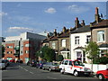
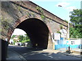
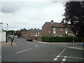
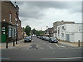
Photos of SE15 2EG


Area Information
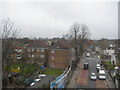
Living in SE15 2EG offers a compact residential experience within a defined cluster of 738 square metres. This postcode area serves a population of 2,624 people, creating an environment where local communities often know one another personally. The density of the area means you are situated in a close-knit setting rather than a sprawling suburb. You will find yourself surrounded by residential neighbours, forming a distinct pocket within the broader South London landscape. The area functions as a specific residential zone where daily life centres on proximate amenities and community interaction. Residents here manage a lifestyle that balances urban convenience with a relatively contained living footprint. Because the area is small, the distance to key facilities is generally short, allowing for efficient daily commutes and quick access to local services. The population figure suggests a settled neighbourhood where houses and flats have been occupied for some time. You will not find the chaotic sprawl of larger districts here. Instead, you engage with a straightforward, organised environment where the boundaries of the postcode define your immediate world. This makes SE15 2EG a predictable choice for those seeking a specific address without the vastness of a wider borough.
- Area Type
- Postcode
- Area Size
- 738 m²
- Population
- 2624
- Population Density
- 13388 people/km²
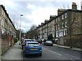
The housing stock in SE15 2EG is defined by the predominance of flats. This type of accommodation shapes the character of the streets and the social dynamics of the area. Only thirty-three per cent of the population owns their homes, which paints a clear picture of the market mix. A large majority of residents in this postcode likely reside in rental properties or do not hold title deeds to their flats. This statistic is significant for anyone considering buying or selling property here. The concentration of flats means that buying a freehold house may be rare, and purchasers should expect to look at leasehold options. You are entering a market where the value of the property is tied to the quality of the building management and the underlying land. The small area size of 738 square metres further constrains the development options available. Consequently, there is limited scope for new housing estates within this specific boundary. Buyers looking for semi-detached or detached homes may need to expand their search slightly beyond this exact postcode. The rental portion of the market is substantial, offering a buffer against price volatility but also reflecting the demand for high-quality flat living arrangements in South London.
House Prices in SE15 2EG
Showing 6 properties
| Address | Type | Beds | Baths | Last Sale Price | Last Sale Date | |
|---|---|---|---|---|---|---|
| Flat 2, Arnold Dobson House, St Marys Road, London, SE15 2EG | Flat | - | - | - | - | |
| Flat 4, Arnold Dobson House, St Marys Road, London, SE15 2EG | Flat | - | - | - | - | |
| Flat 5, Arnold Dobson House, St Marys Road, London, SE15 2EG | Flat | - | - | - | - | |
| Flat 1, Arnold Dobson House, St Marys Road, London, SE15 2EG | Flat | 3 | 1 | - | - | |
| Flat 6, Arnold Dobson House, St Marys Road, London, SE15 2EG | Flat | - | - | - | - | |
| Flat 3, Arnold Dobson House, St Marys Road, London, SE15 2EG | Flat | - | - | - | - |
Energy Efficiency in SE15 2EG
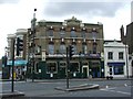
Daily life in SE15 2EG is supported by a robust network of nearby amenities. Retail options within practical reach include Tesco Queens, Budgens Pomeroy, and Sainsburys Peckham. These supermarkets provide essential groceries and household goods without needing a long drive. For rail commuters, Queens Road Peckham Station is a notable local option. You can also reach Nunhead Station and New Cross Gate ELL Railway Station with ease. Greater links are available via metro connections at Deptford Bridge, Elverson Road, and Bermondsey Station. If you prefer water transport, Masthouse Terrace Pier, Greenland Surrey Quays Pier, and Greenwich Pier offer ferry services. London City Airport is also a singular notable amenity nearby for business travellers. The area includes three major bus stations, including the Green Line Coach Station and London Victoria Coach Station Arrivals. This abundance of transport means you have multiple ways to leave the area quickly. You are never far from a shop, a train, or a bus stop. The variety of stations ensures that different transport preferences are accommodated. Residents can choose between rail, metro, ferry, or bus based on their destination and schedule. This connectivity turns SE15 2EG into a well-positioned launchpad for the rest of London.
Amenities
Schools
Families in SE15 2EG have access to several educational institutions near their homes. The St Thomas the Apostle College stands out as a primary school with an outstanding Ofsted rating. This designation indicates that the school meets exceptionally high standards in education and care. It is a key prospect for parents prioritising academic excellence. Beyond this primary institution, you will find The Education Support Centre. This facility provides specific learning and support services for the local community. Southwark Inclusive Learning Service Plus, often abbreviated as Sils+, also operates in the immediate vicinity. It serves as another vital resource for students requiring additional educational assistance. The presence of an outstanding-rated primary school anchors the educational reputation of the area. You do not need to look far for quality education, which adds value to the local property market. The mix of special support services alongside a top-rated primary school suggests a comprehensive approach to local learning. These schools are spread across a small enough area to ensure accessibility for residents in SE15 2EG. You can expect a structured environment where children have access to both high-performance academies and specialist support units.
| Rank | School | Type | Entry gender | Ages |
|---|
Explore more schools in this area
Go to Schools tabDemographics
The community in SE15 2EG is characterised by a mature demographic profile. Thirty-three per cent of households own their homes, indicating a significant portion of residents have long-term stability in the area. This contrasts with the remaining sixty-seven per cent who likely rent. The most common age range for adults is between thirty and sixty-four years, and the median age is forty-seven. This statistic confirms that the primary residents are working professionals and families rather than students or young tourists. The accommodation type listed is flats, suggesting many residents live in shared or high-rise buildings. You will find a predominantly White ethnic group forming the majority of the population. The high median age helps explain the nature of local interactions and community events. With over two thousand residents living in flats, there is a strong sense of shared public space. The age profile means that children are present but the area also hosts many older residents. This mix ensures that services must cater to a wide range of needs without being dominated by any single age group. The thirty-three per cent owner-occupation rate is a concrete figure you can rely on when assessing the financial landscape of the neighbourhood.
Household Size
Accommodation Type
Tenure
Ethnic Group
Religion
Household Composition
Age
Household Deprivation
NS-SEC
Explore more demographic insights in this area
Go to Demographics tabPlanning
Planning Constraints
- Flood RiskPremium
- Ramsar Wetland SitesPremium
- Area of Outstanding Natural BeautyPremium
- Protected Nature ReservePremium
- Protected WoodlandPremium