Area Overview for SE15 2BU
Photos of SE15 2BU
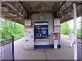
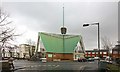
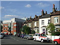
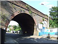
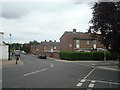
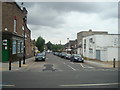
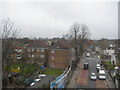
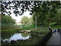
100 photos from this area
Area Information
Key information about the SE15 2BU including its size, population, and administrative classification.
- Area Type
- Postcode
- Area Size
- 4502 m²
- Population
- 1861
- Population Density
- 12292 people/km²
House Prices in SE15 2BU
42
Properties
£332,813
Average Sold Price
£85,000
Lowest Price
£745,000
Highest Price
Showing 42 properties
| Address | Type | Beds | Baths | Last Sale Price | Last Sale Date | |
|---|---|---|---|---|---|---|
| 104 Brayards Road, London, SE15 2BU | Terraced | 3 | 2 | £745,000 | Nov 2019 | |
| 108 Brayards Road, London, SE15 2BU | Terraced | 3 | 1 | £680,000 | Aug 2015 | |
| 110 Brayards Road, London, SE15 2BU | house | - | - | £310,000 | Jan 2012 | |
| 116 Brayards Road, London, SE15 2BU | Terraced | - | - | £329,000 | Aug 2007 | |
| 94 Brayards Road, London, SE15 2BU | Terraced | 1 | 1 | £212,000 | Oct 2003 | |
| 98 Brayards Road, London, SE15 2BU | Terraced | - | - | £200,000 | Mar 2003 | |
| 124 Brayards Road, London, SE15 2BU | house | - | - | £85,000 | Oct 2001 | |
| 90 Brayards Road, London, SE15 2BU | Terraced | - | - | £101,500 | Jun 1998 | |
| 132 Brayards Road, London, SE15 2BU | Terraced | 4 | 1 | - | - | |
| 122C Brayards Road, London, SE15 2BU | Terraced | 4 | 2 | - | - |
Page 1 of 5
Energy Efficiency in SE15 2BU
Amenities
Schools
| Rank | School | Type | Entry gender | Ages |
|---|
Explore more schools in this area
Go to Schools tabDemographics
Household Size
Family (3-5 people)
most common
Accommodation Type
Houses
most common
Tenure
44
majority
Ethnic Group
White
most common
Religion
N/A
most common
Household Composition
N/A
most common
Age
47
median
Adults (30-64 years)
most common
Household Deprivation
N/A
with no deprivation
NS-SEC
42
in Lower managerial occupations
Explore more demographic insights in this area
Go to Demographics tabPlanning
Planning Constraints
- Flood RiskPremium
- Ramsar Wetland SitesPremium
- Area of Outstanding Natural BeautyPremium
- Protected Nature ReservePremium
- Protected WoodlandPremium