Area Overview for SE15 1AF
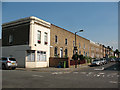
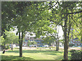
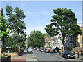
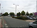
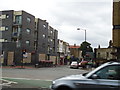
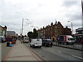
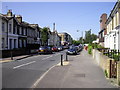
Photos of SE15 1AF
Area Information
Living in SE15 1AF offers a dense, urban experience within a very specific residential cluster measuring just 3691 square metres. You join a local population of 1407 people in what is essentially one of London's most tightly packed neighbourhoods. The area's high density reflects its nature as a concentrated housing block rather than a sprawling suburb. Residents here navigate a landscape where every square metre counts, resulting in a community with no room for sprawl. Daily life centres on proximity to transport hubs and essential services rather than large green spaces. This postcode exists within the SE15 SE postcode district, placing it near the historic core of Peckham and Bermondsey. Your immediate surroundings are defined by the sheer number of people living in such a small footprint. This creates an intense sense of city living where convenience outweighs private space. There is no ambiguity about the scale of this location; it is a microcosm of South London life. You settle into an environment where the rhythm of the day is dictated by major thoroughfares and station announcements. The area functions as a sleeping quarter for thousands who commute outwards during the day or stay within the borough for work.
- Area Type
- Postcode
- Area Size
- 3691 m²
- Population
- 1407
- Population Density
- 18489 people/km²
Homes in SE15 1AF are primarily flats, a fact that defines the entire character of the property market here. Only 30 per cent of residents are owner-occupiers, meaning you are looking at an area that functions largely as a private rental sector or social housing estate. The absence of terraced houses or detached properties is confirmed by the data showing flats as the predominant accommodation type. Most people pay rent rather than a mortgage when they buy or rent in this postcode. This makes SE15 1AF a practical choice for private landlords looking for high-density stock or for tenants seeking urban living without the long commute from outer London. The tiny size of the area at 3691 square metres means inventory is scarce; there are not many listings even within the wider sales market context. Buyers should treat this location as a specialist market niche rather than a standard residential street. High-rise blocks or converted Victorian buildings likely make up the architectural fabric. Investors often prefer this area because the flat layout maximises the number of units per building. If you intend to sell, the value depends heavily on the lease terms and service charges typical of flats, rather than land values seen in larger properties.
House Prices in SE15 1AF
Showing 29 properties
| Address | Type | Beds | Baths | Last Sale Price | Last Sale Date | |
|---|---|---|---|---|---|---|
| 32B Nutcroft Road, London, SE15 1AF | Flat | 2 | 1 | £310,000 | Aug 2023 | |
| 34 Nutcroft Road, London, SE15 1AF | Terraced | 3 | 1 | £725,000 | May 2023 | |
| 28B Nutcroft Road, London, SE15 1AF | Flat | 1 | 1 | £365,000 | Mar 2022 | |
| 54 Nutcroft Road, London, SE15 1AF | Terraced | 3 | 2 | £815,000 | Sep 2021 | |
| 26 Nutcroft Road, London, SE15 1AF | Terraced | 3 | 3 | £722,000 | Apr 2018 | |
| 48 Nutcroft Road, London, SE15 1AF | Terraced | 3 | 2 | £605,000 | Nov 2015 | |
| 56B Nutcroft Road, London, SE15 1AF | Flat | - | - | £250,000 | Sep 2014 | |
| 46B Nutcroft Road, London, SE15 1AF | Flat | - | - | £174,999 | Sep 2007 | |
| 52 Nutcroft Road, London, SE15 1AF | Terraced | 6 | 4 | £149,950 | Jan 2001 | |
| 60 Nutcroft Road, London, SE15 1AF | Terraced | - | - | £96,000 | Aug 1998 |
Energy Efficiency in SE15 1AF
Your daily life in SE15 1AF revolves around a dense network of amenities within practical reach. Five retail locations including Lidl Old, Sainsburys Peckham, and Iceland Old Kent provide immediate grocery needs. Five rail stations and five metro hubs offer diverse transport choices for your daily commute. You will find five ferry options connecting you to nearby banks and districts from three major coach stations. However, the most notable daily convenience is the proximity to London City Airport, which sits within one kilometre of your postcode. This proximity allows for rare private jet access or quick business flights directly from your doorstep. For leisure, you are moments away from the vibrant cultural scene of Peckham and Bermondsey without leaving the postcode. The sheer number of transport links means you rarely need to rely on personal vehicles. Shopping is hyper-local with multiple supermarkets nearby for quick trips. Dining options are concentrated around the transport hubs where you catch the Tube or train into work. Your lifestyle is defined by movement and accessibility, with everything you need located just a short walk away.
Amenities
Schools
| Rank | School | Type | Entry gender | Ages |
|---|
Explore more schools in this area
Go to Schools tabDemographics
The community in SE15 1AF is dominated by adults between 30 and 64 years old, with the median age standing at 47. This indicates a mature demographic where families remain in the area for extended periods or where older professionals have chosen this location for stability. While 30 per cent of residents own their homes, the majority rely on private or social renting. Flats constitute the primary form of accommodation, reflecting the high-density construction typical of this postcode. The local population is predominantly White, aligning with the broader patterns of South East London. With 381233 people per square kilometre, the population density is extreme on a national scale. This figure places SE15 1AF among the most crowded residential zones in the country. The lack of owner-occupiers compared to other areas suggests the housing stock is not built for individual house ownership but for higher-yield rental blocks. Your neighbours will likely have lived in this flat for years, creating a long-term resident community despite the high turnover often associated with city living. The age profile means you will encounter a quiet demographic during daytime hours as parents and professionals engage in work or school runs.
Household Size
Accommodation Type
Tenure
Ethnic Group
Religion
Household Composition
Age
Household Deprivation
NS-SEC
Explore more demographic insights in this area
Go to Demographics tabPlanning
Planning Constraints
- Flood RiskPremium
- Ramsar Wetland SitesPremium
- Area of Outstanding Natural BeautyPremium
- Protected Nature ReservePremium
- Protected WoodlandPremium