Area Overview for SE14 6NL
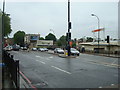
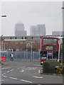
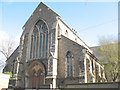
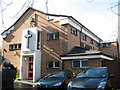
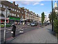
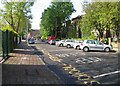
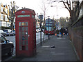
Photos of SE14 6NL
Area Information
SE14 6NL is a small residential cluster occupying just 7,451 square metres within the SE14 postcode area. The population totals 1,893 people, creating a densely populated environment with 254,053 people per square kilometre. This specific postcode covers a tight-knit neighbourhood where daily life is defined by immediate proximity to transport hubs and local shops. Residents here experience a high-intensity urban setting typical of London's Elephant and Castle vicinity. Living in SE14 6NL means navigating a space designed for density rather than sprawl. The area functions as a practical base for commuters and professionals who prioritise access over garden space. You are surrounded by other residents who rely heavily on public infrastructure due to the limited land area. The location sits between major thoroughfares and residential blocks, offering a compact living experience. This postcode represents a slice of a larger, vibrant district. You will find the pace of life quick and the community closely connected by necessity. The sheer number of people packed into this small footprint influences the atmosphere, creating a dynamic but potentially crowded environment. For those seeking efficiency and direct access to the city, this micro-location serves a specific purpose within the broader London property market. It is a place defined by its closeness to everything else rather than isolated quiet.
- Area Type
- Postcode
- Area Size
- 7451 m²
- Population
- 1893
- Population Density
- 8882 people/km²
The property market in SE14 6NL is dominated by rental accommodation. Only 25% of homes are owned by their occupants, indicating that 75% of the housing stock is privately or socially rented. This ratio paints a clear picture of a market geared towards tenants rather than homeowners or investors seeking capital growth through ownership. The vast majority of available properties in this postcode will be listed as rentals. Accommodation types are exclusively flats. You will find terraced villas or detached houses are not standard offerings in this specific 7,451 square metre area. This concentration of flats aligns with the high population density of 254,053 people per square kilometre. High‑rise blocks, converted older buildings, and purpose-built apartment complexes make up the skyline here. This housing form suits singles, couples, and small households who prefer low-maintenance living over traditional gardens. For buyers looking at homes in SE14 6NL, the options are structurally limited to flats. The dominance of rental stock means competition for purchase could be intense if sellers are local landlords seeking to consolidate assets. Tenants face a market where availability depends on landlорd decisions rather than the open buyer-seller dynamic. Understanding this context is vital before you begin your search. The area is not built for large families. The sheer number of flats and the low ownership rate suggest a transient community. You may find it easier to rent a flat here than to buy, given the supply constraints. Property types remain consistent across the postcode, reinforcing the character of a dense urban living zone.
House Prices in SE14 6NL
Showing 4 properties
| Address | Type | Beds | Baths | Last Sale Price | Last Sale Date | |
|---|---|---|---|---|---|---|
| 9 Dixon Road, London, SE14 6NL | Terraced | - | - | - | - | |
| Conference Office, 7 Dixon Road, London, SE14 6NL | commercial | - | - | - | - | |
| 10 Dixon Road, London, SE14 6NL | Terraced | - | - | - | - | |
| International Office, Dixon Road, London, SE14 6NL | Terraced | - | - | - | - |
Energy Efficiency in SE14 6NL
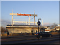
Living in SE14 6NL places you within walking distance of key retail and transport hubs.Retail options include Sainsburys New Cross, Iceland New, and two additional Sainsburys locations. These supermarkets provide daily essentials and competitive grocery prices for residents. You can stock your fridge without travelling far from home, which is convenient for busy lifestyles. Transport amenities are plentiful and diverse. Rail access includes New Cross ELL Railway Station, New Cross Gate ELL Railway Station, and the Deptford station. Metro stations such as Deptford Bridge, Elverson Road, and Cutty Sark DLR Station offer direct links across London. Ferry services depart from Masthouse Terrace Pier, Greenwich Pier, and Greenland Surrey Quays Pier. These water routes add variety to your commute and leisure outings. London City Airport is a notable point of interest just one unit away in the amenities list. This proximity benefits business travellers and those working in the financial district. Bus connections include the Green Line Coach Station and London Victoria Coach Station Arrivals, facilitating long-distance travel for weekends and holidays. The character of SE14 6NL is defined by this dense network of services. You access high street shopping, riverside travel, and rapid transit without needing a car. The presence of multiple supermarket chains ensures shopping flexibility. This amenity-rich environment supports a fast-paced urban lifestyle. Daily convenience is high, with everything within easy reach from your flat.
Amenities
Schools
Families considering schools near SE14 6NL will find two named primary options within practical reach. St James's Hatcham Church of England Primary School serves the local primary age group. Addey and Stanhope School is another primary institution in the vicinity, currently holding a Good rating from Ofsted. These two schools provide state education for younger children in the neighbourhood. For older students attending sixth form or higher education, Goldsmiths College, University of London is listed as a nearby educational facility. This institution serves the "other" category in local listings, suggesting a focus on further or higher education rather than primary schooling. The presence of a university location is significant for young adults and their families in SE14 6NL. The school mix reflects the young demographic of the area. Primary education is available locally, which is convenient for parents. The proximity to Goldsmiths College provides access to tertiary education without needing to travel far into central London. Parents balancing work and school runs value the local presence of Addey and Stanhope School and St James's Hatcham Church of England Primary School. Overall, the educational landscape around SE14 6NL supports early years and university-level study. The list of schools is short but includes a reputable primary choice with a Good Ofsted rating. You can access primary education and university facilities within a short distance of your home. The lack of secondary school names in the data indicates these are either supplied from outside the immediate radius or grouped under broader categories.
| Rank | School | Type | Entry gender | Ages |
|---|
Explore more schools in this area
Go to Schools tabDemographics
The community in SE14 6NL is defined by a young demographic profile. The median age is 22 years, with Young Adults aged 15–29 years being the most common age range. Home ownership stands at 25%, meaning the vast majority of residents rent their properties. This low ownership rate reflects the transient nature of the population and the high demand for rental accommodation in this post-code. Accommodation in SE14 6NL consists almost entirely of flats, catering to singles and couples starting their careers. The population leans towards White ethnicity, though the high density brings together many diverse households within a small radius. With fewer than 3,000 people in this entire cluster, the community feels relatively young and energetic rather than settled or established. You should expect a neighbourhood full of renters, students, and young professionals. The low percentage of owner-occupiers suggests that prices may fluctuate with the wider rental market or that long-term stability is less common here. Deprivation data does not appear in the provided records, so local quality of life is judged strictly by the housing stock and age profile. The area acts as a launchpad for young people moving into London. The mix of ages is narrow, focusing heavily on late teens and twenties. This concentration influences local behaviour, from shop hours to community engagement. You live among a cohort that is building careers rather than raising families or retiring. The flat-based housing stock supports singles and sharers more than large families. This demographic reality shapes the culture of SE14 6NL distinctly.
Household Size
Accommodation Type
Tenure
Ethnic Group
Religion
Household Composition
Age
Household Deprivation
NS-SEC
Explore more demographic insights in this area
Go to Demographics tabPlanning
Planning Constraints
- Flood RiskPremium
- Ramsar Wetland SitesPremium
- Area of Outstanding Natural BeautyPremium
- Protected Nature ReservePremium
- Protected WoodlandPremium