Area Overview for SE14 5LS
Photos of SE14 5LS
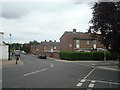
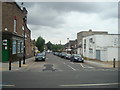
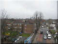
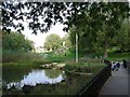
100 photos from this area
Area Information
Key information about the SE14 5LS including its size, population, and administrative classification.
- Area Type
- Postcode
- Area Size
- 5076 m²
- Population
- 1451
- Population Density
- 11452 people/km²
House Prices in SE14 5LS
26
Properties
£591,031
Average Sold Price
£80,000
Lowest Price
£1,280,000
Highest Price
Showing 26 properties
| Address | Type | Beds | Baths | Last Sale Price | Last Sale Date | |
|---|---|---|---|---|---|---|
| 19 Arbuthnot Road, London, SE14 5LS | Terraced | 3 | 2 | £1,280,000 | Feb 2025 | |
| 35 Arbuthnot Road, London, SE14 5LS | Terraced | 3 | 1 | £1,090,000 | Jan 2025 | |
| 3 Arbuthnot Road, London, SE14 5LS | Terraced | 3 | 1 | £825,000 | Jun 2019 | |
| 45A Arbuthnot Road, London, SE14 5LS | Flat | - | - | £399,000 | Apr 2019 | |
| 37 Arbuthnot Road, London, SE14 5LS | house | - | - | £950,000 | Feb 2019 | |
| 27 Arbuthnot Road, London, SE14 5LS | Detached | 3 | 2 | £892,000 | Jul 2018 | |
| 7 Arbuthnot Road, London, SE14 5LS | Terraced | 3 | 1 | £786,000 | Mar 2018 | |
| 33 Arbuthnot Road, London, SE14 5LS | house | 3 | 1 | £820,000 | Dec 2016 | |
| 17 Arbuthnot Road, London, SE14 5LS | house | - | - | £675,000 | Nov 2013 | |
| 43 Arbuthnot Road, London, SE14 5LS | house | 3 | - | £480,000 | Dec 2010 |
Page 1 of 3
Energy Efficiency in SE14 5LS
Amenities
Schools
| Rank | School | Type | Entry gender | Ages |
|---|
Explore more schools in this area
Go to Schools tabDemographics
Household Size
Two person
most common
Accommodation Type
Flats
most common
Tenure
48
majority
Ethnic Group
White
most common
Religion
N/A
most common
Household Composition
N/A
most common
Age
47
median
Adults (30-64 years)
most common
Household Deprivation
N/A
with no deprivation
NS-SEC
47
in Lower managerial occupations
Explore more demographic insights in this area
Go to Demographics tabPlanning
Planning Constraints
- Flood RiskPremium
- Ramsar Wetland SitesPremium
- Area of Outstanding Natural BeautyPremium
- Protected Nature ReservePremium
- Protected WoodlandPremium