Area Overview for SE14 5DN
Photos of SE14 5DN
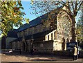


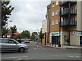
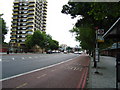

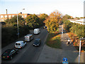
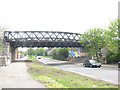
100 photos from this area
Area Information
Key information about the SE14 5DN including its size, population, and administrative classification.
- Area Type
- Postcode
- Area Size
- 1.5 hectares
- Population
- 1867
- Population Density
- 14829 people/km²
House Prices in SE14 5DN
68
Properties
£225,649
Average Sold Price
£41,000
Lowest Price
£530,000
Highest Price
Showing 68 properties
| Address | Type | Beds | Baths | Last Sale Price | Last Sale Date | |
|---|---|---|---|---|---|---|
| 73 Water Lane, London, SE14 5DN | Flat | 1 | 1 | £225,000 | Nov 2025 | |
| 56 Water Lane, London, SE14 5DN | Terraced | 2 | 2 | £490,000 | Jun 2025 | |
| 68 Water Lane, London, SE14 5DN | Terraced | 2 | 2 | £440,000 | Mar 2025 | |
| 47 Water Lane, London, SE14 5DN | Terraced | 2 | 1 | £510,000 | Dec 2024 | |
| 44 Water Lane, London, SE14 5DN | Flat | 1 | 1 | £298,000 | Sep 2024 | |
| 3 Water Lane, London, SE14 5DN | Flat | 3 | 1 | £235,000 | Oct 2023 | |
| 102 Water Lane, London, SE14 5DN | Flat | - | - | £332,000 | Apr 2023 | |
| 13 Water Lane, London, SE14 5DN | Flat | - | - | £257,000 | Oct 2022 | |
| 19 Water Lane, London, SE14 5DN | Terraced | 2 | 1 | £530,000 | Jun 2022 | |
| 65 Water Lane, London, SE14 5DN | Flat | 1 | 1 | £248,750 | Apr 2022 |
Page 1 of 7
Energy Efficiency in SE14 5DN
Amenities
Schools
| Rank | School | Type | Entry gender | Ages |
|---|
Explore more schools in this area
Go to Schools tabDemographics
Household Size
One person
most common
Accommodation Type
Flats
most common
Tenure
33
majority
Ethnic Group
black_total
most common
Religion
N/A
most common
Household Composition
N/A
most common
Age
47
median
Adults (30-64 years)
most common
Household Deprivation
N/A
with no deprivation
NS-SEC
29
in Lower managerial occupations
Explore more demographic insights in this area
Go to Demographics tabPlanning
Planning Constraints
- Flood RiskPremium
- Ramsar Wetland SitesPremium
- Area of Outstanding Natural BeautyPremium
- Protected Nature ReservePremium
- Protected WoodlandPremium