Area Overview for SE13 7UT
Photos of SE13 7UT
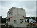
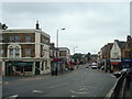
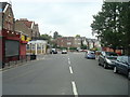
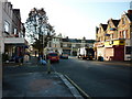
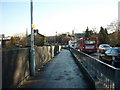
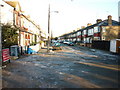
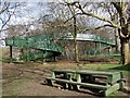
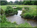

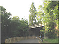


100 photos from this area
Area Information
Key information about the SE13 7UT including its size, population, and administrative classification.
- Area Type
- Postcode
- Area Size
- 1.0 hectares
- Population
- 2205
- Population Density
- 6771 people/km²
House Prices in SE13 7UT
59
Properties
£475,031
Average Sold Price
£101,500
Lowest Price
£1,195,000
Highest Price
Showing 59 properties
| Address | Type | Beds | Baths | Last Sale Price | Last Sale Date | |
|---|---|---|---|---|---|---|
| 47 Ladywell Road, Ladywell, London, SE13 7UT | house | - | - | £850,000 | Dec 2024 | |
| 39 Ladywell Road, Ladywell, London, SE13 7UT | Terraced | 3 | 1 | £610,000 | Aug 2023 | |
| 35 Ladywell Road, Ladywell, London, SE13 7UT | Terraced | 2 | 1 | £600,000 | Sep 2021 | |
| 21 Ladywell Road, Ladywell, London, SE13 7UT | house | - | - | £780,000 | Sep 2021 | |
| 23 LADYWELL ROAD, Ladywell, London, SE13 7UT | Maisonette | 2 | 1 | £591,000 | Jan 2020 | |
| 33 Ladywell Road, Ladywell, London, SE13 7UT | house | - | - | £495,000 | Jan 2020 | |
| 57 Ladywell Road, Ladywell, London, SE13 7UT | house | - | - | £1,195,000 | Jul 2017 | |
| 23A Ladywell Road, Ladywell, London, SE13 7UT | Flat | 1 | 1 | £306,000 | Oct 2016 | |
| 43 Ladywell Road, Ladywell, London, SE13 7UT | Terraced | 3 | - | £550,000 | Mar 2016 | |
| Ground Floor Flat, 51 Ladywell Road, Ladywell, London, SE13 7UT | Retail | 1 | - | £172,000 | Sep 2011 |
Page 1 of 6
Energy Efficiency in SE13 7UT
Amenities
Schools
| Rank | School | Type | Entry gender | Ages |
|---|
Explore more schools in this area
Go to Schools tabDemographics
Household Size
One person
most common
Accommodation Type
Flats
most common
Tenure
39
majority
Ethnic Group
White
most common
Religion
N/A
most common
Household Composition
N/A
most common
Age
47
median
Adults (30-64 years)
most common
Household Deprivation
N/A
with no deprivation
NS-SEC
47
in Lower managerial occupations
Explore more demographic insights in this area
Go to Demographics tabPlanning
Planning Constraints
- Flood RiskPremium
- Ramsar Wetland SitesPremium
- Area of Outstanding Natural BeautyPremium
- Protected Nature ReservePremium
- Protected WoodlandPremium