Area Overview for SE13 7TN
Photos of SE13 7TN
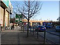
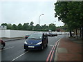

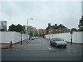
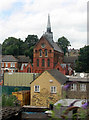
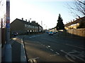

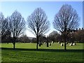
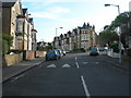
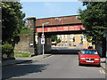


100 photos from this area
Area Information
Key information about the SE13 7TN including its size, population, and administrative classification.
- Area Type
- Postcode
- Area Size
- 6981 m²
- Population
- 2085
- Population Density
- 13863 people/km²
House Prices in SE13 7TN
60
Properties
£624,000
Average Sold Price
£71,000
Lowest Price
£1,280,000
Highest Price
Showing 60 properties
| Address | Type | Beds | Baths | Last Sale Price | Last Sale Date | |
|---|---|---|---|---|---|---|
| 26 Halesworth Road, Ladywell, London, SE13 7TN | house | - | - | £1,280,000 | Mar 2025 | |
| 2 Halesworth Road, Ladywell, London, SE13 7TN | Detached | 5 | 2 | £840,000 | Nov 2024 | |
| 36 Halesworth Road, Ladywell, London, SE13 7TN | Terraced | 5 | 2 | £1,225,000 | Oct 2024 | |
| 22 Halesworth Road, Ladywell, London, SE13 7TN | house | - | - | £840,000 | May 2024 | |
| 44A Halesworth Road, Ladywell, London, SE13 7TN | Flat | - | - | £485,000 | Mar 2021 | |
| 40 Halesworth Road, Ladywell, London, SE13 7TN | house | - | - | £760,000 | Jan 2020 | |
| 10A Halesworth Road, Ladywell, London, SE13 7TN | Flat | - | - | £495,000 | May 2018 | |
| 44 HALESWORTH ROAD, Ladywell, London, SE13 7TN | Maisonette | 3 | 1 | £650,000 | Mar 2017 | |
| 6 HALESWORTH ROAD, Ladywell, London, SE13 7TN | Flat | - | - | £305,000 | Mar 2013 | |
| 20 Halesworth Road, Ladywell, London, SE13 7TN | house | - | - | £565,000 | Oct 2011 |
Page 1 of 6
Energy Efficiency in SE13 7TN
Amenities
Schools
| Rank | School | Type | Entry gender | Ages |
|---|
Explore more schools in this area
Go to Schools tabDemographics
Household Size
Two person
most common
Accommodation Type
Flats
most common
Tenure
42
majority
Ethnic Group
White
most common
Religion
N/A
most common
Household Composition
N/A
most common
Age
47
median
Adults (30-64 years)
most common
Household Deprivation
N/A
with no deprivation
NS-SEC
41
in Lower managerial occupations
Explore more demographic insights in this area
Go to Demographics tabPlanning
Planning Constraints
- Flood RiskPremium
- Ramsar Wetland SitesPremium
- Area of Outstanding Natural BeautyPremium
- Protected Nature ReservePremium
- Protected WoodlandPremium