Area Overview for SE13 7NF
Photos of SE13 7NF


Area Information
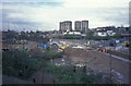
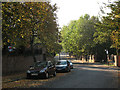
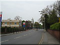
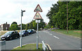
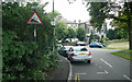
Living in SE13 7NF offers a precise residential experience centred on a specific postcode cluster covering just over three thousand square metres. This small area houses 1,763 people, creating a tightly knit community within a compact footprint. Daily life here moves at a pace suited to those who prioritise proximity to major transport hubs while remaining in a defined residential zone. The location sits in south-east London, offering immediate access to the wider borough of Lewisham and the historic peninsula of Greenwich. You will find yourself surrounded by a mix of shops, stations, and industrial spaces typical of this part of London. Residents of SE13 7NF benefit from being steps away from multiple rail and ferry terminals. The area provides a direct connection to London City Airport for business travellers and leisure tourists alike. Nearest stations include Lewisham Railway Station and Greenwich Station, facilitating quick trips into the city or towards Kent. For those preferring water transport, Greenwich Pier and Cutty Sark for Maritime Greenwich are within easy reach. This postcode represents a specific address in a larger, dynamic zone where you can access significant amenities without travelling far. It is a location for those who value central positioning and established transport links over sprawling suburban space.
- Area Type
- Postcode
- Area Size
- 3173 m²
- Population
- 1763
- Population Density
- 16249 people/km²
The property market in SE13 7NF is defined by a landscape dominated by flats and rental living. Only 16 per cent of residents own their homes, making this a location where tenants outnumber owners by a significant margin. This statistic indicates that the housing stock is geared towards investors, developers, or private landlords rather than traditional owner-occupiers. Consequently, you are most likely to encounter purpose-built blocks or converted buildings suitable for flat living rather than detached houses or semi-detached properties. When considering homes in SE13 7NF, understand that purchasing a property here adds to a predominantly rental community. The prevalence of flats means space is often optimised vertically. Buyers should realise that while the area offers excellent connectivity, the ownership dynamic differs from more traditional family neighbourhoods. This structure often appeals to those seeking investment opportunities or seeking to rent rather than buy. The small area size of roughly 3,173 square metres further constrains new large-scale building, preserving the current character of the residential cluster. You are entering a market where security of tenure through ownership is less common than long-term tenancy agreements.
House Prices in SE13 7NF
Showing 6 properties
| Address | Type | Beds | Baths | Last Sale Price | Last Sale Date | |
|---|---|---|---|---|---|---|
| Flat 6, Aster House, Lewisham Road, Lewisham, SE13 7NF | Flat | - | - | - | - | |
| Flat 2, Aster House, Lewisham Road, Lewisham, SE13 7NF | Flat | - | - | - | - | |
| Flat 3, Aster House, Lewisham Road, Lewisham, SE13 7NF | Flat | - | - | - | - | |
| Flat 5, Aster House, Lewisham Road, Lewisham, SE13 7NF | Flat | - | - | - | - | |
| Flat 1, Aster House, Lewisham Road, Lewisham, SE13 7NF | Flat | - | - | - | - | |
| Flat 4, Aster House, Lewisham Road, Lewisham, SE13 7NF | Flat | - | - | - | - |
Energy Efficiency in SE13 7NF
Life in SE13 7NF places you close to a diverse range of retail, transport, and leisure options. Five metro stations serve the immediate area, including Elverson Road, Deptford Bridge, and Cutty Sark for Maritime Greenwich. This density of transport nodes ensures you can travel by foot or short bus ride to significant destinations. For shopping needs, five major retail outlets are within practical reach, including Tesco Lewisham, Asda Lewisham, and Sainsburys Loampit. These supermarkets provide all the essentials for daily living without the need for a long journey. Transport convenience extends to five railway stations such as Lewisham Railway Station and Greenwich Station, alongside five ferry terminals like Greenwich Pier and Masthouse Terrace Pier. You also have access to London City Airport, situated just one venue away, which adds a premium travel option to your lifestyle. Bus services are anchored by three major stations, including the Green Line Coach Station and London Victoria Coach Station. This interconnected web of public transport allows you to access the entire capital and surrounding counties easily. Local amenities in SE13 7NF are designed for convenience, combining food, travel, and work options in one compact zone.
Amenities
Schools
Families living in SE13 7NF have access to at least one notable educational institution nearby. Morden Mount Primary School operates as a primary school in the vicinity of this postcode. The school holds an Ofsted rating of good, which signifies a solid standard of education and management. While specific secondary schools are not detailed for this immediate cluster, the presence of a primary school with a positive rating provides a foundation for younger children. The school mix available directly around SE13 7NF is modest, consisting mainly of primary education options. This suggests that families with older children may need to look slightly beyond the immediate doorstep for secondary placements, although good local primary education is secured within walking distance or a short bus ride. The good rating of Morden Mount Primary School offers reassurance for parents prioritising academic standards. School transport routes likely connect the postcode to this specific school, integrating the residential cluster with the local education network.
| Rank | School | Type | Entry gender | Ages |
|---|
Explore more schools in this area
Go to Schools tabDemographics
The community in SE13 7NF has a distinct character defined by its age profile and housing tenure. The median age of residents is 47 years, with adults between the ages of 30 and 64 forming the most common demographic group. This suggests a neighbourhood populated by established professionals and families rather than young singles or retirees. Home ownership stands at 16 per cent, meaning the vast majority of households reside in rented accommodation. This high rental proportion shapes the local culture, often reflecting a transient or tenant-heavy environment rather than a stable owner-occupier community. Accommodation in SE13 7NF consists primarily of flats, which aligns with the high rate of renting. These units accommodate the working-age population who choose this location for its transport links. The district is predominantly White ethnically, mirroring wider patterns in parts of south-east London. You are living in an area where the demographic makeup is mature and established. The concentration of adults in their middle years indicates a population that has likely settled in the area for a significant period, despite the underlying rental nature of the housing stock.
Household Size
Accommodation Type
Tenure
Ethnic Group
Religion
Household Composition
Age
Household Deprivation
NS-SEC
Explore more demographic insights in this area
Go to Demographics tabPlanning
Planning Constraints
- Flood RiskPremium
- Ramsar Wetland SitesPremium
- Area of Outstanding Natural BeautyPremium
- Protected Nature ReservePremium
- Protected WoodlandPremium