Area Overview for SE13 7EL
Photos of SE13 7EL
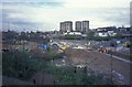
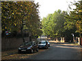
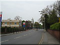
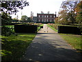


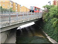
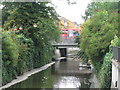
100 photos from this area
Area Information
Key information about the SE13 7EL including its size, population, and administrative classification.
- Area Type
- Postcode
- Area Size
- 3599 m²
- Population
- 1409
- Population Density
- 6860 people/km²
House Prices in SE13 7EL
32
Properties
£218,192
Average Sold Price
£77,500
Lowest Price
£380,000
Highest Price
Showing 32 properties
| Address | Type | Beds | Baths | Last Sale Price | Last Sale Date | |
|---|---|---|---|---|---|---|
| 78 Lewisham Hill, Blackheath, London, SE13 7EL | Maisonette | 2 | 1 | £360,000 | May 2023 | |
| 58 Lewisham Hill, Blackheath, London, SE13 7EL | Maisonette | - | - | £347,500 | Mar 2023 | |
| 76 Lewisham Hill, Blackheath, London, SE13 7EL | Maisonette | 2 | 1 | £380,000 | Jul 2022 | |
| 86 Lewisham Hill, Blackheath, London, SE13 7EL | Maisonette | - | - | £332,000 | Jun 2021 | |
| 44 Lewisham Hill, Blackheath, London, SE13 7EL | Maisonette | - | - | £270,000 | Jan 2019 | |
| 50 Lewisham Hill, Blackheath, London, SE13 7EL | Maisonette | - | - | £221,500 | Aug 2013 | |
| 90 Lewisham Hill, Blackheath, London, SE13 7EL | Flat | 3 | 1 | £181,000 | Aug 2012 | |
| 52 Lewisham Hill, Blackheath, London, SE13 7EL | Maisonette | - | - | £185,000 | Oct 2009 | |
| 36 Lewisham Hill, Blackheath, London, SE13 7EL | Flat | 2 | - | £136,000 | Apr 2008 | |
| 68 Lewisham Hill, Blackheath, London, SE13 7EL | Maisonette | - | - | £165,000 | May 2005 |
Page 1 of 4
Energy Efficiency in SE13 7EL
Amenities
Schools
| Rank | School | Type | Entry gender | Ages |
|---|
Explore more schools in this area
Go to Schools tabDemographics
Household Size
Two person
most common
Accommodation Type
Flats
most common
Tenure
47
majority
Ethnic Group
White
most common
Religion
N/A
most common
Household Composition
N/A
most common
Age
47
median
Adults (30-64 years)
most common
Household Deprivation
N/A
with no deprivation
NS-SEC
59
in Lower managerial occupations
Explore more demographic insights in this area
Go to Demographics tabPlanning
Planning Constraints
- Flood RiskPremium
- Ramsar Wetland SitesPremium
- Area of Outstanding Natural BeautyPremium
- Protected Nature ReservePremium
- Protected WoodlandPremium