Area Overview for SE13 7DG
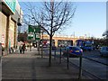
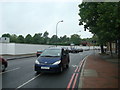
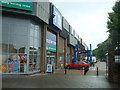
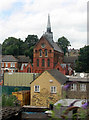
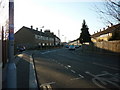
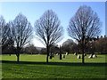
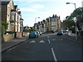
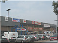
Photos of SE13 7DG

Area Information
SE13 7DG is a compact residential cluster within England, covering an area of just 1.1 hectares. This small postcode serves approximately 1,530 residents, creating a neighbourhood with high population density. You are looking at a specific tiny patch of land that packs a significant number of homes into a limited space. The living in SE13 7DG experience is shaped by this concentrated nature, where daily life unfolds within a tight-knit footprint. Despite its small size, the location offers direct access to the wider transport networks of South London. The area functions as a distinct pocket of housing rather than a sprawling district. Residents navigate a community defined by its proximity to major transport hubs, allowing quick commutes to central London or surrounding boroughs. The sheer number of people per square kilometre suggests a vibrant but potentially intense living environment. You move here expecting a place where neighbours are close, which limits the amount of private green space but maximises connectivity. The area represents a practical choice for those prioritising location over land.
- Area Type
- Postcode
- Area Size
- 1.1 hectares
- Population
- 1530
- Population Density
- 8615 people/km²
The property market in SE13 7DG is overwhelmingly defined by the dominance of owner-occupied homes. With 68 per cent of residents owning their properties, the area functions primarily as an owner-occupied neighbourhood rather than a rental market. Houses constitute the main accommodation type, meaning you will find independent dwellings rather than flats or apartment complexes when searching for homes in SE13 7DG. This high ownership percentage suggests a stable housing stock with a significant number of long-term residents who have purchased directly in the local cluster. The prevalence of houses indicates that the 1.1 hectare area consists largely of terraced or semi-detached property blocks suited to individual families or individuals. When buying here, investors and buyers can expect a market driven by owners seeking to retain or enhance their assets. The data does not suggest a heavy concentration of private landlords or short-term lettings. Instead, the housing composition points to a community where people have bought to live. This structure supports long-term residency and less turnover compared to areas with higher rental percentages.
House Prices in SE13 7DG
Showing 46 properties
| Address | Type | Beds | Baths | Last Sale Price | Last Sale Date | |
|---|---|---|---|---|---|---|
| 80 Embleton Road, Ladywell, London, SE13 7DG | Semi-detached | 4 | 2 | £1,120,000 | May 2024 | |
| 48 Embleton Road, Ladywell, London, SE13 7DG | Terraced | 3 | 1 | £685,000 | Jan 2023 | |
| 102B Embleton Road, Ladywell, London, SE13 7DG | Flat | - | - | £505,000 | Mar 2021 | |
| 96 Embleton Road, Ladywell, London, SE13 7DG | Maisonette | - | - | £585,000 | Feb 2021 | |
| 106 Embleton Road, Ladywell, London, SE13 7DG | house | - | - | £957,000 | Dec 2020 | |
| 54 Embleton Road, Ladywell, London, SE13 7DG | Terraced | 3 | 1 | £550,000 | Nov 2019 | |
| 78 Embleton Road, Ladywell, London, SE13 7DG | Semi-detached | 1 | 1 | £552,500 | Feb 2019 | |
| 60 Embleton Road, Ladywell, London, SE13 7DG | house | 3 | - | £270,000 | Aug 2012 | |
| 104 Embleton Road, Ladywell, London, SE13 7DG | house | - | - | £520,000 | Aug 2010 | |
| 56 Embleton Road, Ladywell, London, SE13 7DG | house | 3 | - | £280,000 | Jun 2010 |
Energy Efficiency in SE13 7DG
Daily life in SE13 7DG benefits from a dense network of amenities within practical reach. Residents have access to five retail venues, including Sainsburys Lewisham, Tesco Loampit, and Sainsburys Loampit. These supermarkets provide immediate access to groceries and daily essentials without the need for long car journeys. Transport links are extensive, with five rail stations nearby, including Ladywell, Lewisham Railway Station, and St Johns. For metro access, you can utilise stations such as Elverson Road, Deptford Bridge, and Cutty Sark for Maritime Greenwich. Five ferry services are also accessible, connecting you to Greenwich Pier, Masthouse Terrace Pier, and Greenland Surrey Quays Pier. London City Airport is situated just one kilometre away, offering direct air travel options for business or leisure. Three bus stations serve the area, featuring connections to Green Line Coach Station, Victoria Coach Station, and London Victoria Coach Station Arrivals. This density of nearby facilities means most errands require minimal travel time. The convenience of these five retail and transport options underpins a lifestyle focused on ease of access to London-wide services.
Amenities
Schools
| Rank | School | Type | Entry gender | Ages |
|---|
Explore more schools in this area
Go to Schools tabDemographics
The community in SE13 7DG is characterised by a mature population profile. The median age stands at 47 years, reflecting a neighbourhood dominated by adults between the ages of 30 and 64. This age range represents the most common demographic group living in the area. With a home ownership rate of 68 per cent, the vast majority of households are owner-occupiers rather than tenants. This high figure indicates a stable, settled community where families and individuals have invested locally over time. The predominant ethnic group is White, which forms the majority of the population within this postcode zone. Houses remain the primary accommodation type, establishing a character defined by traditional independent living rather than high-rise blocks. For those considering the demographic landscape of SE13 7DG, you find a mature setting where long-term residents hold a significant share of the housing stock. This ownership level often correlates with greater investment in local stability and maintenance of properties.
Household Size
Accommodation Type
Tenure
Ethnic Group
Religion
Household Composition
Age
Household Deprivation
NS-SEC
Explore more demographic insights in this area
Go to Demographics tabPlanning
Planning Constraints
- Flood RiskPremium
- Ramsar Wetland SitesPremium
- Area of Outstanding Natural BeautyPremium
- Protected Nature ReservePremium
- Protected WoodlandPremium