Area Overview for SE13 6UG
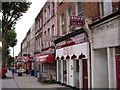
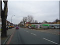
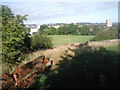
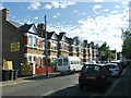
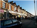
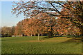
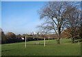
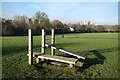
Photos of SE13 6UG
Area Information
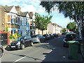
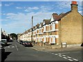
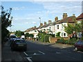
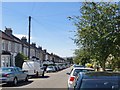
SE13 6UG represents a specific residential cluster within the wider district of Hither Green, located in the London Borough of Lewisham. This small area spans 3097 square metres and houses a population of 1569 residents. You will find the demographic heart of the area beats strong for adults between the ages of 30 and 64 years, suggesting a mature community of established families and professionals. Living in SE13 6UG means residing in a locale where history resonates with the everyday routine. The locality lies exactly where the Prime Meridian crosses through the pedestrian tunnel at Hither Green Station, placing most of the surrounding district within the western hemisphere. Residents of this neighbourhood enjoy a distinct suburban character formed in the late 19th century. Archibald Cameron Corbett began developing the Corbett Estate soon after Hither Green Station opened on 1 June 1895. This transformation turned a rural landscape into a planned residential area featuring late Victorian and Edwardian domestic architecture. Many street names reflect Corbett's Scottish heritage, providing a unique historical thread running through the daily commute. You are stepping into a zone that shifted from a medieval hamlet known as Romborough into a structured suburb, now anchored by significant landmarks like Mountsfield Park. The area offers a quiet, history-rich environment that balances modern convenience with a tangible sense of the past.
- Area Type
- Postcode
- Area Size
- 3097 m²
- Population
- 1569
- Population Density
- 10703 people/km²
The property market in SE13 6UG is not a newly constructed development zone but a mature residential pocket. With homes making up the majority of the grid, the local stock is dominated by flats, which defines the architectural rhythm of the streets. You will observe a balanced but minority ownership rate where 51% of residents own their homes. This statistic paints a picture of a neighbourhood where the majority of the dwellings belong to people who have lived there for years, not a speculative rental market driven by short-term lets. For buyers looking at homes in SE13 6UG, the area presents a classic suburban stock rather than a high-rise block estate. The character of the Corbett Estate, developed from 1896 onwards, sets the standard for the housing stock in this postcode. These properties were built for families who desired a suburban feel yet needed access to the railway line that cut through the centre of the area. The fact that the accommodation type is primarily flats suggests density without the congestion of modern urban developments. You are not competing in a market of brand-new listings or luxury conversions; you are entering a secondary market of established properties. The 51% ownership rate confirms that the area retains its traditional suburban soul, appealing to those who prefer buying a home with history over renting a new build.
House Prices in SE13 6UG
Showing 3 properties
| Address | Type | Beds | Baths | Last Sale Price | Last Sale Date | |
|---|---|---|---|---|---|---|
| Nhs, South London And Maudsley Nhs Rehabilitation Services, 3-5 Heather Close, London, SE13 6UG | commercial | - | - | - | - | |
| 3-5 Heather Close, London, SE13 6UG | Flat | - | - | - | - | |
| 1 Heather Close, London, SE13 6UG | Flat | 2 | 2 | - | - |
Energy Efficiency in SE13 6UG
Living in SE13 6UG means accessing a dense network of amenities within immediate reach. Your daily routine benefits from proximity to five retail outlets, including Tesco Hither, Morrisons Daily, and Co-op Hither. These shops handle all your weekly groceries and household needs without requiring a long drive into the city. Transport links are equally accessible, with five rail stations and five metro lines nearby. You can walk to Hither Green, Lee, or Ladywell stations for your daily train journey, or take a quick ride to Elverson Road and Deptford Bridge on the underground. Leisure and recreation are embedded in the local landscape. Mountsfield Park, which opened in August 1905, offers 28 acres of green space for walks and relaxation. The park sits on the grounds of the former Mountsfield house and includes land acquired from Charlton Athletic's former football ground in 1923. Councillors also provided St Andrew's Church on land donated by the area's developer, Archibald Cameron Corbett. For water-based activities, five ferry services operate nearby, including Greenwich Pier and Masthouse Terrace Pier, launching you towards the Thames. London City Airport stands as a single notable airport facility within the immediate vicinity, blending leisure travel with practical transit. You will find that the area lacks public houses, a legacy of Corbett's Quaker origins and his strict temperance convictions. Instead, your evening entertainment revolves around the parks, the retail parks, and the transport hubs. The combination of five metro lines, five rail stations, and five ferry points means you never lack options for your next outing.
Amenities
Schools
| Rank | School | Type | Entry gender | Ages |
|---|
Explore more schools in this area
Go to Schools tabDemographics
The community in SE13 6UG is defined by a homogenous age profile and tenure structure. Nearly half of the homes here are owned outright or with a mortgage, as home ownership stands at exactly 51%. This figure indicates a stable neighbourhood where residents have a long-term stake in the locality. The dominant accommodation type consists of flats, which shapes the social density and layout of the streets. A predominant ethnic group of White residents characterises the area, reflecting its origins as a settlement planned by a Scottish developer for a specific social cohort. The population skews significantly older than the national average, with a median age of 47 years. Adults aged between 30 and 64 years represent the most common age range, forming the backbone of the local community. This concentration implies a neighbourhood favoured by those past their thirties who value stability and established surroundings over the transient energy of younger student populations. You will find a settled atmosphere where long-term residents know their neighbours, rather than a zone of constant turnover. The 1569 people living within this compact space create a tightly knit environment where community dynamics develop slowly and deliberately. There are no indications of recent urban young-professional migration; the demographic mirror simply shows a mature population comfortable in their homes.
Household Size
Accommodation Type
Tenure
Ethnic Group
Religion
Household Composition
Age
Household Deprivation
NS-SEC
Explore more demographic insights in this area
Go to Demographics tabPlanning
Planning Constraints
- Flood RiskPremium
- Ramsar Wetland SitesPremium
- Area of Outstanding Natural BeautyPremium
- Protected Nature ReservePremium
- Protected WoodlandPremium