Area Overview for SE13 6UB
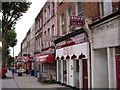
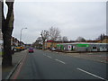
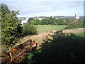
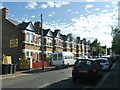
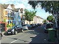
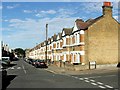
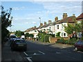
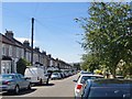
Photos of SE13 6UB
Area Information
Living in SE13 6UB means residing in a specific residential cluster within the historic district of Hither Green, located in the London Borough of Lewisham. This small postcode area covers 6474 m² of land. It supports a population of 1569 people. The density here is extremely high at 242339 people/km², which reflects a tightly packed urban environment. The area lies in south-east London, situated near where the Prime Meridian crosses through the pedestrian tunnel at Hither Green Station. Most of the district actually lies in the western hemisphere. Hither Green transformed from a rural hamlet called Romborough into a suburban area during the late 19th century. This transformation was driven by the arrival of Hither Green Station on 1 June 1895. The neighbourhood is characterised by late Victorian and Edwardian domestic architecture, particularly on the Corbett Estate. You will find streets with Scottish names reflecting the heritage of the original developer, Archibald Cameron Corbett. The original settlement was rebuilt after being destroyed by the Black Death centuries ago. Today, the area retains a distinct residential character separate from the bustling commercial zones nearby. The lack of public houses remains a defining trait of the local neighbourhood. This absence stems from Corbett's Quaker origins and his strict conviction against alcohol. Residents enjoy a setting defined by its historical layers and proximity to major transport links.
- Area Type
- Postcode
- Area Size
- 6474 m²
- Population
- 1569
- Population Density
- 10703 people/km²
When you consider buying homes in SE13 6UB, you are entering a market defined by specific ownership trends and building types. Fifty-one percent of homes are owner-occupied. This signals a stable residential market where long-term residents make up the majority. The predominant accommodation type in this cluster is flats. You will find more flat conversions and apartment blocks than detached or semi-detached houses. This is typical for a small postcode area covering only 6474 m² in a dense urban setting. The high population density of 242339 people/km² reinforces the prevalence of vertical living. The historical context points to the Corbett Estate which built Victorian and Edwardian houses from 1896 onwards. These properties subsequently evolved or were adapted into the flats found today. The median age of 47 suggests buyers in this area are often mature individuals or couples. Retirement or downsizing may be common motivations for purchasing a property there. Given the 51% home ownership figure, selling a property could be quicker as many neighbours might know other owners. The area does not function as a high-volume rental yield zone for landlords. Instead, it serves as a permanent home base for residents. The housing stock is largely complete with no new developments mentioned in the available data.
House Prices in SE13 6UB
Showing 43 properties
| Address | Type | Beds | Baths | Last Sale Price | Last Sale Date | |
|---|---|---|---|---|---|---|
| 23 Benin Street, Hither Green, London, SE13 6UB | house | 4 | - | £745,000 | Aug 2022 | |
| 26 Benin Street, Hither Green, London, SE13 6UB | house | - | - | £685,000 | Jun 2022 | |
| 25 Benin Street, Hither Green, London, SE13 6UB | house | - | - | £757,000 | Feb 2022 | |
| 6 Benin Street, Hither Green, London, SE13 6UB | Terraced | 1 | 1 | £500,000 | Jun 2021 | |
| 16 Benin Street, Hither Green, London, SE13 6UB | house | - | - | £750,000 | May 2021 | |
| 18 Benin Street, Hither Green, London, SE13 6UB | Terraced | 3 | 1 | £735,000 | Mar 2021 | |
| 21 Benin Street, Hither Green, London, SE13 6UB | Terraced | - | - | £220,500 | Jul 2019 | |
| 28 Benin Street, Hither Green, London, SE13 6UB | Terraced | 3 | - | £640,000 | May 2019 | |
| 27 Benin Street, Hither Green, London, SE13 6UB | house | - | - | £613,250 | Sep 2015 | |
| 4 Benin Street, Hither Green, London, SE13 6UB | Terraced | 3 | 2 | £430,000 | Apr 2015 |
Energy Efficiency in SE13 6UB
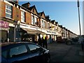
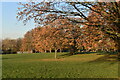
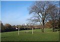
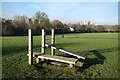
Daily life in SE13 6UB revolves around a limited number of specialised amenities. You can access five retail locations within practical walking distance. These include Tesco Hither, Morrisons Daily, and Co-op Hither. Transport connectivity is the primary lifestyle feature, with five rail stations, five metro lines, and five ferries nearby. Hither Green Station sits at the heart of the area. You can reach Greenwich Pier, Masthouse Terrace Pier, and Greenland Surrey Quays Pier by ferry. London City Airport serves as the single airport option close by. The area features Mountsfield Park, which opened in August 1905. This park covers 28 acres and includes land from Charlton Athletic's former football ground. St Andrew's Church stands on land donated by the original developer Corbett. Manor House Gardens and Manor Park lie closer to the east. The Corbett Estate showcases Victorian and Edwardian domestic architecture built from 1896 onwards. The area lacks public houses due to historical temperance convictions. Road names often reflect Scottish origins from Corbett's heritage. The population of 1569 lives within a compact 6474 m² footprint. This density means shops and transport hubs are very close to residential streets.
Amenities
Schools
| Rank | School | Type | Entry gender | Ages |
|---|
Explore more schools in this area
Go to Schools tabDemographics
The community in SE13 6UB consists largely of Adults in the 30-64 years age range. In terms of age, the median age for residents is 47 years. This indicates a neighbourhood populated by mature people rather than young families or students. Home ownership is prevalent, with 51% of residents owning their properties outright or with a mortgage. Families living in SE13 6UB tend to own rather than rent compared to many other London districts. The predominant accommodation type for this postcode is flats. This suggests a vertical urban living style rather than houses with private gardens. Most people living here identify as White. The area does not have specific data on deprivation metrics provided in the available sources. Instead, the demographic profile paints a picture of an established community. The high home ownership rate of 51% points to stability within the household population. You are looking at an area where long-term residents form the bulk of the population. The flats dominate the housing stock in this 6474 m² area. This concentration of flats combined with the age profile creates a specific social environment.
Household Size
Accommodation Type
Tenure
Ethnic Group
Religion
Household Composition
Age
Household Deprivation
NS-SEC
Explore more demographic insights in this area
Go to Demographics tabPlanning
Planning Constraints
- Flood RiskPremium
- Ramsar Wetland SitesPremium
- Area of Outstanding Natural BeautyPremium
- Protected Nature ReservePremium
- Protected WoodlandPremium