Area Overview for SE13 6QZ
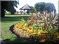
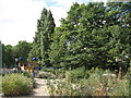
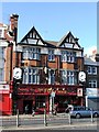
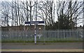
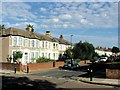
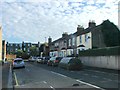
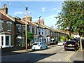
Photos of SE13 6QZ

Area Information
Living in SE13 6QZ means occupying a space defined by high density and urban convenience. This specific postcode covers a small residential cluster spanning just 4.1 hectares. Despite its compact footprint, it accommodates 1,544 residents, resulting in a population density of 37,471 people per square kilometre. This tight clustering indicates an environment where neighbours are close by and daily routines are tightly packed with amenities. You experience the character of a distinct residential pocket rather than a sprawling suburb. The area functions as a central hub for those working in London's expanding service economy, offering immediate access to transport and retail without the need for long commutes. Daily life here revolves around proximity to major stations and shops, creating a rhythm of convenience that prioritises efficiency over green space. The sheer concentration of people means a vibrant, if intense, community atmosphere where local services operate at capacity to meet demand.
- Area Type
- Postcode
- Area Size
- 4.1 hectares
- Population
- 1544
- Population Density
- 5466 people/km²
The property market in SE13 6QZ is defined by a scarcity of owner-occupied homes. With home ownership levels sitting at just 24%, this postcode is clearly a rental-dominant zone. The data explicitly identifies flats as the predominant accommodation type, which aligns with the high population density found in this 4.1-hectare area. You are unlikely to find large detached houses here; instead, the housing stock consists primarily of urban apartments designed for multi-person occupancy. This concentration of flats means that if you are looking to buy, your options will be heavily weighted towards leasehold properties in high-rise or mid-rise blocks. The low ownership rate suggests a market characterised by speculation through property companies or owner-occupied investors hiring out units rather than families living in self-built wealth. Buyers should expect competition from professional landlords vying for rents within this dense cluster.
House Prices in SE13 6QZ
Showing 90 properties
| Address | Type | Beds | Baths | Last Sale Price | Last Sale Date | |
|---|---|---|---|---|---|---|
| 26A Lewisham Park, London, SE13 6QZ | Flat | - | - | £505,000 | Jun 2023 | |
| 27B Lewisham Park, London, SE13 6QZ | Flat | 1 | 1 | £507,500 | Apr 2023 | |
| 23A Lewisham Park, London, SE13 6QZ | Flat | 2 | 1 | £490,000 | Mar 2023 | |
| 25A Lewisham Park, London, SE13 6QZ | Flat | - | - | £512,125 | Nov 2021 | |
| 49 Lewisham Park, London, SE13 6QZ | house | - | - | £1,518,750 | Nov 2021 | |
| 41 Lewisham Park, London, SE13 6QZ | Semi-detached | 6 | 3 | £1,400,000 | Nov 2020 | |
| 39 Lewisham Park, London, SE13 6QZ | Semi-detached | 6 | 2 | £1,150,000 | Jul 2019 | |
| 43 Lewisham Park, London, SE13 6QZ | Detached | 5 | 4 | £1,000,000 | Apr 2016 | |
| 47 Lewisham Park, London, SE13 6QZ | house | - | - | £860,000 | Nov 2012 | |
| 45 Lewisham Park, London, SE13 6QZ | house | 8 | 3 | £605,000 | Aug 2012 |
Energy Efficiency in SE13 6QZ
Residents of SE13 6QZ enjoy immediate access to a wide range of amenities within practical reach. Five shops are located nearby, including Budgens Ladywell, Tesco Catford, and a Co-op on Hither Green Road. These venues provide essential daily necessities from fresh groceries to household goods without leaving the neighbourhood. Transport links are extensive, with five rail stations offering connectivity to Ladywell, Hither Green, and Catford. Five metro stations serve the broader network via Elverson Road, Deptford Bridge, and Cutty Sark for Maritime Greenwich. Additionally, five ferry piers, including Greenwich Pier and Greenland Surrey Quays Pier, provide river crossings. One airport, London City Airport, completes the transport triangle. This density of options means you can reach major destinations easily. Your daily errands, work commutes, and leisure trips all benefit from this rich, multi-modal transport and retail infrastructure.
Amenities
Schools
Families considering homes in SE13 6QZ have access to a specific mix of educational institutions nearby. The most formally rated option is St Mary's Lewisham Church of England Primary School, which holds a good Ofsted rating. This public school offers a state-certified education path for younger children within reasonable walking distance. For independent education needs, Olive Tree School is located near the postcode as an independent institution. The presence of both a rated community primary school and an independent alternative indicates that the area caters to varied academic preferences. Parents must note that while St Mary's has achieved a good rating, independence varies schools significantly. This dual choice provides flexibility for families who value either traditional faith-based education or independent curricula tailored to their specific children's needs without travelling far into central London.
| Rank | School | Type | Entry gender | Ages |
|---|
Explore more schools in this area
Go to Schools tabDemographics
The community in SE13 6QZ is mature and rooted in credit union values, though the demographic data indicates a broader age spread. Residents here have a median age of 47, with adults between 30 and 64 years forming the most common age range. This suggests a neighbourhood populated by established families and professionals in their prime earning years. Home ownership stands at only 24%, revealing that the vast majority of residents rent their properties. This high rental proportion points to a market driven by private tenants and landlords rather than owner-occupiers seeking to build equity within this specific cluster. The predominant ethnic group identified is Black, reflecting a successful, diverse population mix that reshapes local culture and commerce. The combination of a mature age profile and a predominantly rented stock creates a dynamic social environment where long-term leases and stable households coexist closely together.
Household Size
Accommodation Type
Tenure
Ethnic Group
Religion
Household Composition
Age
Household Deprivation
NS-SEC
Explore more demographic insights in this area
Go to Demographics tabPlanning
Planning Constraints
- Flood RiskPremium
- Ramsar Wetland SitesPremium
- Area of Outstanding Natural BeautyPremium
- Protected Nature ReservePremium
- Protected WoodlandPremium