Area Overview for SE13 6LG
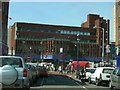
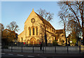
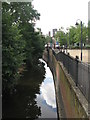
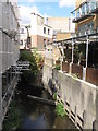
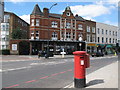
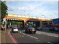
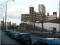
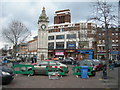
Photos of SE13 6LG


Area Information
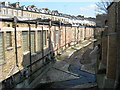
Living in SE13 6LG means residing within a compact residential cluster covering just 1,385 square metres. This postcode area contains 2,205 people, creating a densely populated neighbourhood where daily life moves at a specific pace. You are part of a community with a median age of 47, suggesting a population skewed towards middle-aged residents rather than young professionals or retirees. The accommodation type is predominantly flats, shaping the character of the streets you walk each day. You move through a space defined by its proximity to major transport hubs. Rail stations in Ladywell, Lewisham, and Hither Green are within practical reach, alongside five metro lines including Elverson Road and Cutty Sark for Maritime Greenwich. Ferry connections near Greenwich Pier and Greenwich Surrey Quays Pier offer further mobility across the capital. Despite the urban density, the area scores zero risk for flooding and has no protected planning constraints like Ramsar wetlands or Areas of Outstanding Natural Beauty. Daily life here revolves around practical convenience. Five retail outlets serve your immediate needs, including Iceland Lewisham 2, M&S Lewisham, and Lidl Lewisham. You gain easy access to London City Airport, positioned just one venue away from this postcode sector. This location suits those who prioritise transit links and commercial access over wide public green spaces, offering a slice of London life that is придётся and highly connected.
- Area Type
- Postcode
- Area Size
- 1385 m²
- Population
- 2205
- Population Density
- 6771 people/km²
The property market in SE13 6LG is defined by high-density living within a small physical footprint. Flats represent the predominant accommodation type, meaning you are looking for units that maximise space in an area covering merely 1,385 square metres. This structural reality means detached houses are absent from this specific postcode cluster, and multi-unit buildings are the norm. House ownership sits at 39 per cent, which signals a mixed market where investment and private rental options compete strongly. You are less likely to find a traditional owner-occupied street of bungalows or houses. Instead, the market presents a range of apartments catering to those who can find a flat here among the 2,205 residents. The high population density of 1,591,714 people per square kilometre reinforces the urban, compact nature of the homes. This area suits buyers seeking central London access without the cost of larger outer boroughs. The prevalence of flats means you will negotiate based on floor area and building amenities rather than garden space. The 39 per cent ownership rate suggests a dynamic market where tenants seek stability and investors seek yield. You must consider the implications of living in a predominantly flat estate, where noise transmission and shared corridors are inherent features of this specific postcode sector.
House Prices in SE13 6LG
Showing 1 properties
| Address | Type | Beds | Baths | Last Sale Price | Last Sale Date | |
|---|---|---|---|---|---|---|
| Public Toilet At, Lewisham Library, 199-201 Lewisham High Street, London, SE13 6LG | commercial | - | - | - | - |
Energy Efficiency in SE13 6LG
Your lifestyle in SE13 6LG is characterised by immediate access to essential retail, rail networks, and water transport. Five retail destinations operate within practical reach, including Iceland Lewisham 2, M&S Lewisham, and Lidl Lewisham. These shops handle your weekly food shopping, household essentials, and general provisions without requiring a long journey. Rail access is extensive, with five stations near you offering rail links to London City Airport, Deptford Bridge, and Hither Green. You travel to hubs like Lewisham Railway Station and Ladywell with convenience built into the layout. The metro network adds five more layers of connectivity via points such as Elverson Road and Cutty Sark for Maritime Greenwich. This saturation of options ensures you can reach哪里 you need to go quickly. Ferry services further expand your horizons, with five points of departure including Greenwich Pier and Masthouse Terrace Pier. You can commute across the river or visit the peninsula with ease. London City Airport sits just one venue away, making short international trips accessible. While the area lacks designated parks in this dataset, the transport network substitutes with motion and change of scene. Your week begins and ends with shops, trains, and ferries form the rhythm of daily life.
Amenities
Schools
Families considering living in SE13 6LG have access to one primary education option directly listed for the area. St Saviour's Catholic Primary School offers primary education with an Ofsted rating of good. This specific rating indicates the school meets the required standards for educational quality and care. As this data lists only a single primary institution, you will need to check catchment areas and local authority maps for secondary options. The presence of a 'good' rated primary school suggests a baseline of reliable early education for children growing up in the 2,205 households here. The school's Catholic character provides a specific religious curriculum, which may appeal to parents seeking that environment. For those moving here, this single data point means you have one confirmed primary choice nearby. You should research travel times to other schools in SE13 or neighbouring Lewisham boroughs for secondary placements, as this dataset does not provide secondary entries. The good Ofsted rating of St Saviour's Catholic Primary School offers reassurance that the local educational infrastructure meets government standards. This resource serves the needs of children aged four to eleven within the immediate vicinity of the postcode.
| Rank | School | Type | Entry gender | Ages |
|---|
Explore more schools in this area
Go to Schools tabDemographics
The community in SE13 6LG reflects a mature demographic profile centred on adults aged between 30 and 64 years. The median age of 47 confirms that families and established professionals form the backbone of this neighbourhood. Consequently, you will find a residential environment designed for consistency rather than rapid changeovers typical of student zones or retirement villages. The predominant ethnic group identifies as White, providing a clear demographic identity for the local populace. Housing ownership stands at 39 per cent, indicating that a significant portion of the population rents or rents to buy rather than owning outright. This figure leaves 61 per cent of households in rental accommodation, shaping the transient or investment nature of the market. Flats dominate the accommodation type across this postcodes, aligning with the gentle landmass and high density of 1,591,714 people per square kilometre. Such a high population density relative to the square metreage means you share services and streets closely with your neighbours. Your neighbours are largely in the 30 to 64 age bracket, suggesting a stable household structure. The mix of ownership implies a robust letting market alongside a smaller cohort of owner-occupiers. You are not in an area defined by youth culture or elderly retirement, but by a broad slice of working adulthood. The specific ethnic composition contributes to a distinct cultural character, while the flat-heavy stock defines the architectural and social rhythm of daily life.
Household Size
Accommodation Type
Tenure
Ethnic Group
Religion
Household Composition
Age
Household Deprivation
NS-SEC
Explore more demographic insights in this area
Go to Demographics tabPlanning
Planning Constraints
- Flood RiskPremium
- Ramsar Wetland SitesPremium
- Area of Outstanding Natural BeautyPremium
- Protected Nature ReservePremium
- Protected WoodlandPremium