Area Overview for SE13 6ED
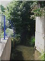
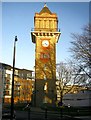
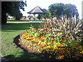
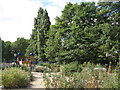
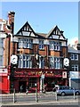
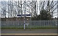
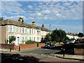
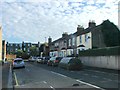
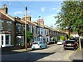
Photos of SE13 6ED

Area Information
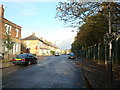
Living in SE13 6ED offers a distinct experience within south-east London, situated in the London Borough of Lewisham. This specific postcode covers a small residential cluster spanning 7229 square metres, containing a population of 1791 people. The area's character is deeply rooted in history; Hither Green transformed from a rural hamlet called Romborough into a suburban district following the opening of Hither Green Station in 1895. Much of the housing was developed subsequently on what became known as the Corbett Estate, reflecting late Victorian and Edwardian architecture. The original settlement was destroyed by the Black Death, yet the area re-emerged as a significant residential zone. Today, the district is split by the railway line into an east side focused on Staplehurst Road and a west side centred on Hither Green Lane and Springbank Road. Residents live in an area where the Prime Meridian crosses through the pedestrian tunnel at Hither Green Station. Most of the district lies in the western hemisphere, making this postcode geographically unique while offering established suburban living. The concentration of homes creates a tight-knit neighbourhood feel, appealing to those seeking older residential architecture rather than modern development.
- Area Type
- Postcode
- Area Size
- 7229 m²
- Population
- 1791
- Population Density
- 13466 people/km²
The property market for SE13 6ED is characterised by a strong preference for traditional housing. Houses dominate the accommodation types, offering open floor plans and gardens that appeal to families. Ownership levels reinforce this stability, with 51% of the population listed as homeowners. This majority ownership rate suggests that the local estate is largely owner-occupied rather than rental-driven. For buyers looking at this small area, the housing stock reflects its history; many properties date back to the late Victorian and Edwardian eras when developers like Archibald Cameron Corbett built homes on the Corbett Estate from 1896 onwards. These late 19th and early 20th century domestic structures, particularly on the Corbett Estate, define the architectural character of the neighbourhood. While the area lacks public houses due to the developer's Quaker origins, the residential nature remains intense within its compact boundaries. The focus on houses means prospective buyers should expect detached or semi-detached properties rather than flats. This concentration of home ownership and house types creates a market where property values are likely influenced by the quality of these period homes and their proximity to local amenities.
House Prices in SE13 6ED
Showing 64 properties
| Address | Type | Beds | Baths | Last Sale Price | Last Sale Date | |
|---|---|---|---|---|---|---|
| 43 Beacon Road, Hither Green, London, SE13 6ED | Terraced | 1 | - | £441,025 | Apr 2024 | |
| 67 Beacon Road, Hither Green, London, SE13 6ED | house | - | - | £648,000 | Mar 2022 | |
| 61 Beacon Road, Hither Green, London, SE13 6ED | house | - | - | £795,000 | Nov 2020 | |
| 59 Beacon Road, Hither Green, London, SE13 6ED | Terraced | 5 | - | £725,000 | Apr 2018 | |
| 55 Beacon Road, Hither Green, London, SE13 6ED | house | - | - | £750,000 | Sep 2016 | |
| 47 Beacon Road, Hither Green, London, SE13 6ED | Terraced | - | - | £246,000 | Feb 2007 | |
| 65 Beacon Road, Hither Green, London, SE13 6ED | Terraced | - | - | £92,000 | Nov 1998 | |
| 45 Beacon Road, Hither Green, London, SE13 6ED | Terraced | - | - | £70,000 | Dec 1997 | |
| 41 Beacon Road, Hither Green, London, SE13 6ED | house | - | - | £70,500 | Mar 1997 | |
| 63 Beacon Road, Hither Green, London, SE13 6ED | house | - | - | £63,000 | Mar 1996 |
Energy Efficiency in SE13 6ED
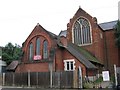
Life in SE13 6ED offers practical access to essential amenities within reach of daily commutes. Residents can shop at five nearby retail outlets, including Sainsburys Hither, Co-op Hither, and Tesco Hither. For those preferring rail travel, five stations such as Hither Green and Ladywell serve the community. Leisure options extend to five metro and ferry terminals, including Cutty Sark for Maritime Greenwich and Greenwich Pier. Additionally, London City Airport provides international connectivity. The area's character includes Mountsfield Park, which opened in August 1905 and now spans 28 acres. This public space, developed on former grounds including Charlton Athletic's football pitch, offers green space for residents. St Andrew's Church stands as another notable feature, built on land donated by Archibald Cameron Corbett. The absence of public houses reflects the developer's temperance convictions, shaping the evening ambiance compared to other parts of London. Shopping and logistics are handled through the named supermarkets located on Hither Green. Parks like Mountsfield Park and Manor House Gardens provide outdoor areas for relaxation. This blend of transport hubs, retail chains, and historic green spaces defines the convenient suburban experience here.
Amenities
Schools
Families considering SE13 6ED have access to educational facilities nearby, with Brindishe Green School listed as a key option. This institution is a primary school holding a 'good' Ofsted rating. The presence of this single named school suggests a localized educational setting for younger children. A primary school focus indicates that the immediate vicinity may cater more to young families with children still in early education stages. For residents requiring secondary education, options outside the immediate primary catchment would be necessary as no secondary schools are listed in the provided data. The 'good' rating from Ofsted provides reassurance regarding the educational standard available directly next to the postcode. Living in SE13 6ED means enrolling children in local neighbourhood schools like Brindishe Green School, which understand the specific catchment area dynamics. Parents should verify catchment boundaries for all schools at the time of purchase. The mix is currently primary-focused, meaning families with older children must look beyond this specific cluster for high school options. The school designation and rating remain factual anchors for households evaluating the neighbourhood for their children's education needs.
| Rank | School | Type | Entry gender | Ages |
|---|
Explore more schools in this area
Go to Schools tabDemographics
The community in SE13 6ED is defined by an older demographic profile. The median age stands at 47 years, with adults aged between 30 and 64 years representing the most common age range. This indicates a population primarily composed of families and established households rather than young professionals or retirees. Over half of the residents, specifically 51%, own their homes outright. This majority ownership rate suggests a stable, settled community where long-term planning is common. Accommodation types in this postcode consist almost entirely of houses, distinguishing it from urban flats or apartment blocks common elsewhere in London. The predominant ethnic group in the area is White, reflecting the historical development patterns evident since the late 19th century. With 1791 people residing in this 7229 square metre area, the population density is high, creating an environment where neighbours are likely to know one another. The housing stock is not mixed; it is focused on family-oriented structures developed during the expansion of the area after 1896.
Household Size
Accommodation Type
Tenure
Ethnic Group
Religion
Household Composition
Age
Household Deprivation
NS-SEC
Explore more demographic insights in this area
Go to Demographics tabPlanning
Planning Constraints
- Flood RiskPremium
- Ramsar Wetland SitesPremium
- Area of Outstanding Natural BeautyPremium
- Protected Nature ReservePremium
- Protected WoodlandPremium