Area Overview for SE13 6DR
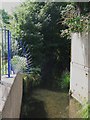
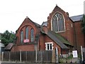
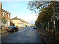
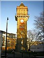
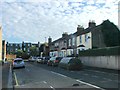
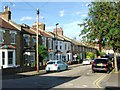
Photos of SE13 6DR


Area Information
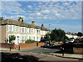
SE13 6DR sits within Hither Green, a distinct district in south-east London covered by almost two square kilometres of residential land. This specific postcode cluster contains 1,910 people living in close proximity, creating a tightly knit environment. The area is historically significant as the location where the Prime Meridian crosses a pedestrian tunnel at Hither Green Station. Most of the district lies in the western hemisphere, a fact that often surprises visitors but defines the local geography. Originally a rural hamlet destroyed by the Black Death, the area transformed into a suburban district by the late 19th century. The residential landscape on this 1.1-hectare plot reflects that Victorian heritage, dominated by late 19th and early 20th-century architecture. You will find houses developed by Archibald Cameron Corbett starting in 1896, particularly on the Corbett Estate. These properties feature Scottish road names that echo Corbett's heritage. The absence of public houses remains a notable characteristic, a legacy of Corbett's strict temperance convictions as a Quaker developer. Daily life here balances this quiet residential focus with immediate access to major transport hubs. The area offers the convenience of being near Lewisham and Deptford while retaining a specific historical identity that distinguishes it from neighbouring sparkling districts.
- Area Type
- Postcode
- Area Size
- 1.1 hectares
- Population
- 1910
- Population Density
- 13255 people/km²
The property market in SE13 6DR is characterised by a predominantly rental sector rather than owner-occupation. Data shows that 33% of households own their homes, leaving the majority, approximately two-thirds, as renters. This high proportion of non-owners aligns with the accommodation type, which is flats. Flats are the standard residential form in this postcode, suggesting a market built for smaller households or individuals rather than large family estates. If you are looking at homes in SE13 6DR, you will primarily encounter flat properties within Victorian and Edwardian buildings. The Corbett Estate provides a backdrop of Victorian and Edwardian domestic architecture developed from 1896 onwards. This historical stock often features terraced layouts suited to the high population density of 166,472 people per square kilometre. The area accommodates 1,910 people within just 1.1 hectares, meaning space is at a premium. Buyers seeking detached houses found elsewhere in Lewisham will not find them here. Instead, the market focuses on efficient living in multi-unit blocks. The low ownership rate of 33% indicates that purchasing flats in SE13 6DR often means entering a competitive rental yield market or securing a shared ownership scheme rather than buying a traditional freehold home.
House Prices in SE13 6DR
Showing 100 properties
| Address | Type | Beds | Baths | Last Sale Price | Last Sale Date | |
|---|---|---|---|---|---|---|
| 173 Courthill Road, London, SE13 6DR | Flat | - | 1 | £220,000 | Jul 2023 | |
| 130 Courthill Road, London, SE13 6DR | Flat | - | - | £630,000 | Apr 2023 | |
| 142C Courthill Road, London, SE13 6DR | Flat | 2 | 1 | £347,500 | Aug 2022 | |
| 177 Courthill Road, London, SE13 6DR | Flat | - | - | £246,000 | May 2015 | |
| 135 Courthill Road, London, SE13 6DR | house | 6 | - | £638,000 | Nov 2014 | |
| 163 Courthill Road, London, SE13 6DR | Flat | - | - | £130,000 | Oct 2011 | |
| 155 Courthill Road, London, SE13 6DR | Flat | - | - | £132,000 | Aug 2004 | |
| 134A Courthill Road, London, SE13 6DR | Flat | - | - | £82,000 | Apr 2001 | |
| 136A Courthill Road, London, SE13 6DR | Flat | - | - | £66,000 | Apr 2000 | |
| 154 Courthill Road, London, SE13 6DR | Terraced | - | - | £188,500 | Jan 2000 |
Energy Efficiency in SE13 6DR
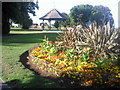
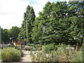
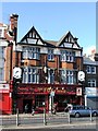
Daily life in SE13 6DR blends residential quiet with immediate access to major amenities. You have five retail options nearby, including the Co-op Hither, Sainsburys Hither, and Sainsburys Lewisham. These shops provide everyday necessities without requiring long journeys. Your transport options are equally robust, with five rail access points including Hither Green and Ladywell stations, plus five metro lines serving Elverson Road and Deptford Bridge. Further afield, five ferry services operate from Greenwich Pier and Greenland Surrey Quays Pier. Parks and leisure are well represented, with Mountsfield Park located at 28 acres. This park opened in August 1905 on the former Mountsfield house grounds and notably includes Charlton Athletic's former football ground acquired in 1923. You can also use Manor House Gardens and Manor Park to the east. St Andrew's Church stands as a historic landmark, built on land donated by Corbett and dedicated to Scotland's patron saint. The area also features Hither Green Hospital, which opened in 1897 and suffered bomb damage during the Second World War. The lack of public houses on local streets reflects the area's heritage, offering a calmer environment than many other London districts.
Amenities
Schools
| Rank | School | Type | Entry gender | Ages |
|---|
Explore more schools in this area
Go to Schools tabDemographics
The community profile of SE13 6DR is defined by an established population where 47 is the median age. Adults between 30 and 64 years form the most common age range, indicating a settled rather than transient neighbourhood. Only 33% of residents own their homes, which suggests a significant rental element within this cluster. The prevailing housing stock consists of flats, catering largely to those who do not own property. Ethnically, the predominant group is White. While the median age of 47 points to mature residents, the high percentage of flats implies many younger adults and families live in the area without owning their homes. The population density is exceptionally high at 166,472 people per square kilometre. This figure reflects the constraint of the 1.1-hectare area containing nearly 2,000 people. Such density means you are living in a bustling micro-community where neighbours are close by. The demographic mix creates a dynamic environment where long-term residents share space with tenants in modern flats, blending historical stability with the flexibility of the rental market.
Household Size
Accommodation Type
Tenure
Ethnic Group
Religion
Household Composition
Age
Household Deprivation
NS-SEC
Explore more demographic insights in this area
Go to Demographics tabPlanning
Planning Constraints
- Flood RiskPremium
- Ramsar Wetland SitesPremium
- Area of Outstanding Natural BeautyPremium
- Protected Nature ReservePremium
- Protected WoodlandPremium