Area Overview for SE13 6AT
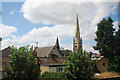
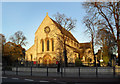
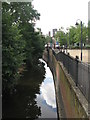
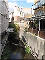
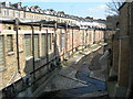
Photos of SE13 6AT


Area Information
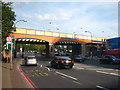
Living in SE13 6AT means residing within a specific residential cluster in England that measures just 2,354 square metres. This is a highly concentrated environment where over 936,600 people per square kilometre share the space, creating an intensely urban experience. The postcode area houses 2,205 residents, ensuring that the immediate surroundings are always lively and active. Daily life here is defined by proximity, with householders situated moments from major transport hubs like Lewisham Railway Station and the Cutty Sark for Maritime Greenwich station. You will find immediate access to Greenius Pier and Masthouse Terrace Pier alongside mainland rail services. The area functions as a tight-knit neighbourhood where convenience is paramount. You can reach London City Airport, Lidl Lewisham, and M&S Lewisham without needing extensive travel planning. It is a location for those who prioritise accessibility over space. The density ensures that services are never more than a short walk away, though residents should accept that they are living in a very packed environment.
- Area Type
- Postcode
- Area Size
- 2354 m²
- Population
- 2205
- Population Density
- 6771 people/km²
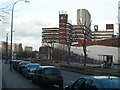
Homes in SE13 6AT are overwhelmingly flats rather than detached or semi-detached houses. This property composition aligns directly with the finding that only 39% of residents own their dwellings. The vast majority of the 2,205 population completes their housing via the private rental sector or tenancy agreements. For buyers viewing the area, the lack of single-family homes offers limited scope for traditional homeownership unless purchasing shares in larger blocks or ground-floor units. You will be entering a competitive market driven by location rather than property size. The accommodation type suggests that space is at a premium, which fits the extreme population density of 936,695 people per square kilometre. Investors may find this postcode attractive due to the concentration of flats near transport links, but first-time buyers seeking standalone houses should look elsewhere. The current market structure dictates that lower entry costs are possible, yet the scarcity of freehold properties remains a defining characteristic of the local housing stock.
House Prices in SE13 6AT
Showing 16 properties
| Address | Type | Beds | Baths | Last Sale Price | Last Sale Date | |
|---|---|---|---|---|---|---|
| 95 Lewisham High Street, London, SE13 6AT | Flat | 4 | 2 | - | - | |
| 127 Lewisham High Street, London, SE13 6AT | Flat | 4 | 2 | - | - | |
| 111A Lewisham High Street, London, SE13 6AT | Flat | - | - | - | - | |
| FLAT A, 22 LEWIS GROVE, Hither Green, London, SE13 6AT | Flat | - | - | - | - | |
| Flat A, 97-99 Lewisham High Street, London, SE13 6AT | Flat | - | - | - | - | |
| Flat D, 97-99 Lewisham High Street, London, SE13 6AT | Flat | - | - | - | - | |
| Flat B, 97-99 Lewisham High Street, London, SE13 6AT | Flat | - | - | - | - | |
| Flat C, 97-99 Lewisham High Street, London, SE13 6AT | Flat | - | - | - | - | |
| Flat A, 97-99 Lewisham High Street, London, SE13 6AT | Flat | - | - | - | - | |
| Flat C, 97-99 Lewisham High Street, London, SE13 6AT | Flat | - | - | - | - |
Energy Efficiency in SE13 6AT
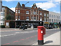
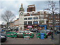
Living in SE13 6AT offers immediate access to a dense network of retail and leisure venues. Retail options include M&S Lewisham, Iceland Lewisham 2, and Lidl Lewisham, all situated within practical reach of the postcode. Residents can easily walk to Greenwich Pier or Masthouse Terrace Pier for river views and water-based activities. The area also benefits from proximity to the Cutty Sark for Maritime Greenwich station, which serves as a cultural and transport landmark. Five railway stations, five metro stops, five ferry points, and one airport nearby ensure that leisure travel is as convenient as daily commuting. You can visit the Kentish Town area or other parts of South-East London via the nearby shrines. The presence of five distinct retail outlets means you rarely need to venture far for groceries or clothing. Daily life centres on this convenient blend of shopping, dining, and transport hubs.
Amenities
Schools
St Saviour's Catholic Primary School stands as the only primary education option explicitly listed for families near this postcode. The school holds a good Ofsted rating, providing a verified standard of education for younger children in the vicinity. This single listing implies a heavy reliance on catchment areas or alternative choices for secondary education, as no comprehensive schools are named in the available records. If you are considering buying for a family, you must verify the nearest maintained schools outside this immediate data set. The presence of just one named institution suggests limited options directly on the doorstep. Families will likely need to commute to schools in adjacent postcodes or utilise academy groups that draw from a wider region. While the specific primary school rated good offers reassurance for early years, the educational landscape for older pupils requires separate research beyond the named entities provided.
| Rank | School | Type | Entry gender | Ages |
|---|
Explore more schools in this area
Go to Schools tabDemographics
The community in SE13 6AT skews quite significantly towards middle adulthood. The median age stands at 47 years, with adults aged between 30 and 64 forming the largest demographic group. Only 39% of residents own their homes, meaning just under two of every five households secure their investment through ownership rather than renting. This high proportion of rental properties suggests a transient population or a market shaped by investment landlords. Flats are the predominant accommodation type in this postcode, reflecting the vertical nature of living in such a dense cluster. The predominant ethnic group within this specific area is White. You should expect to deal with a mature community where stability among older tenants often coexists with the turnover inherent in a rental-heavy street. The age profile indicates few young families with school-age children compared to the large number of working professionals or empty nesters. Secure tax rates and income levels may be inconsistent given the ownership split, but the established age range implies a stable workforce in the immediate vicinity.
Household Size
Accommodation Type
Tenure
Ethnic Group
Religion
Household Composition
Age
Household Deprivation
NS-SEC
Explore more demographic insights in this area
Go to Demographics tabPlanning
Planning Constraints
- Flood RiskPremium
- Ramsar Wetland SitesPremium
- Area of Outstanding Natural BeautyPremium
- Protected Nature ReservePremium
- Protected WoodlandPremium