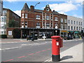
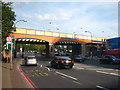
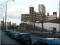
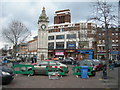
Area Overview for SE13 5HS
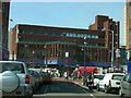
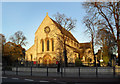
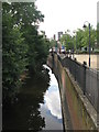
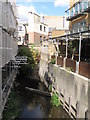
Photos of SE13 5HS


Area Information
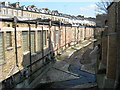
Living in SE13 5HS means residing within a very specific, small residential cluster in South East London. This postcode covers an area of just 8,652 square metres, housing a population of 2,415 people. The density is extremely high at 279,139 people per square kilometre, indicating a tightly packed urban environment typical of the Lewisham borough. Although the postcode itself defines a minute geographical footprint, it sits within a location with significant connectivity to the wider city. Residents benefit from proximity to major transport nodes including Hither Green, Ladywell, and Lewisham railway stations. Transport links also extend to several DLR stops such as Elverson Road and Deptford Bridge, plus ferry options across the River Thames. For some residents, London City Airport is a convenient landmark within reach. The character of this area is defined by its compact size and high population concentration. You are part of a dense neighbourhood where access to shops and stations balances against the lack of open space within the exact boundary of this postcode. Daily life involves navigating a bustling patch of the city where every step can place you near essential services or transit hubs.
- Area Type
- Postcode
- Area Size
- 8652 m²
- Population
- 2415
- Population Density
- 11175 people/km²
The property market in SE13 5HS is characterised by a predominance of flats rather than detached or semi-detached houses. This type of accommodation aligns with the high population density of the postcode area, which manages over 279,000 people per square kilometre. With home ownership standing at 46 per cent, the area presents a balanced market where both buyers and renters operate. You are likely to find a range of rental opportunities alongside properties available for purchase, though stock is limited due to the small size of the postcode boundary. The housing stock reflects the needs of an adult population with a median age of 47. Flats here offer a practical living solution for professionals and small families alike. Given the compact nature of 8,652 square metres, space is at a premium, and interiors must be used efficiently. Buyers seeking houses will need to look beyond this specific SE13 5HS boundary, but owners and renters within the cluster enjoy the convenience of living close to major transport lines and amenities.
House Prices in SE13 5HS
Showing 59 properties
| Address | Type | Beds | Baths | Last Sale Price | Last Sale Date | |
|---|---|---|---|---|---|---|
| 14A Eastdown Park, London, SE13 5HS | Flat | - | - | £19,980 | Feb 2024 | |
| 12A Eastdown Park, London, SE13 5HS | Flat | - | - | £300,000 | Apr 2022 | |
| 22A Eastdown Park, London, SE13 5HS | Flat | - | - | £264,000 | Oct 2021 | |
| 20A Eastdown Park, London, SE13 5HS | Flat | - | - | £295,000 | Mar 2021 | |
| Basement Flat, 8A Eastdown Park, London, SE13 5HS | Flat | 2 | 1 | £367,500 | Jan 2020 | |
| Middle Flat, 8B Eastdown Park, London, SE13 5HS | Flat | 2 | 1 | £395,000 | Feb 2019 | |
| Flat C, 30 Eastdown Park, London, SE13 5HS | Flat | 2 | 1 | - | - | |
| 10B Eastdown Park, London, SE13 5HS | Flat | 1 | 1 | - | - | |
| 10C Eastdown Park, London, SE13 5HS | Flat | 1 | 1 | - | - | |
| 10D Eastdown Park, London, SE13 5HS | Flat | 1 | 1 | - | - |
Energy Efficiency in SE13 5HS
Your lifestyle in SE13 5HS revolves around excellent access to retail and major transport hubs, ensuring daily conveniences are within practical reach. Five retail options stand out, including Sainsburys Lewisham, Lidl Lewisham, and Iceland Lewisham 2. These supermarkets allow you to do your weekly shopping without needing a private vehicle for essential groceries. Transport is equally central, with five railway stations nearby including Hither Green, Ladywell, and Lewisham Railway Station. Commuters gain access to five DLR stops such as Elverson Road and Deptford Bridge, offering diversions from the main rail lines. For leisure trips, five ferry points including Greenwich Pier and Cutty Sark for Maritime Greenwich provide scenic river crossings. The area also features London City Airport for direct international connections. This density of amenities means that almost all shopping and transport needs are served locally. You do not need to travel far to find what you require for work, play, or shopping.
Amenities
Schools
Families living in SE13 5HS have at least one primary education option immediately nearby. Ennersdale Primary School serves as the specific primary school identified for this location. This school offers the first years of formal education for children residing in the household. As a primary institution, it caters to younger students before they move on to secondary education elsewhere. The presence of a named primary school indicates that early learning needs are met without leaving the immediate locality. There are no secondary schools listed in the data for this specific cluster, which means parents must plan for secondary schooling in the broader Lewisham area or across the city. For any homebuyer considering properties with the intention to raise a family, checking the catchment area for Ennersdale Primary School is a logical first step. The school type available here is strictly primary, so expect educational planning to extend further than just the immediate street.
| Rank | School | Type | Entry gender | Ages |
|---|
Explore more schools in this area
Go to Schools tabDemographics
The community in SE13 5HS is predominantly formed by adults, with the most common age range falling between 30 and 64 years old. The median age for residents is 47, suggesting a mature demographic with established households. Home ownership stands at 46 per cent, meaning roughly half of the residents buy their homes rather than renting. The remaining half likely rents from landlords or housing associations, creating a mixed tenure environment. Flats are the principal accommodation type recorded for this area, reflecting the urban density and construction history of the locality. The area is also predominantly White in terms of ethnic composition. With a median age of 47, families with young children are less dominant than in suburbs designed for younger populations, though families do reside here. This age profile indicates a stable community where long-term residents and those seeking stability over transient lifestyles are common. The mix of ownership and rental properties suggests a market where both buyers and tenants compete for limited housing stock.
Household Size
Accommodation Type
Tenure
Ethnic Group
Religion
Household Composition
Age
Household Deprivation
NS-SEC
Explore more demographic insights in this area
Go to Demographics tabPlanning
Planning Constraints
- Flood RiskPremium
- Ramsar Wetland SitesPremium
- Area of Outstanding Natural BeautyPremium
- Protected Nature ReservePremium
- Protected WoodlandPremium