Area Overview for SE13 5DL
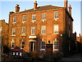
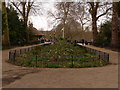
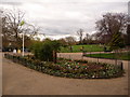
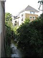
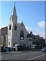
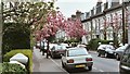
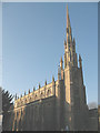
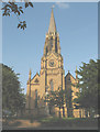
Photos of SE13 5DL
Area Information
Living in SE13 5DL means residing within a very compact residential cluster covering just 1,525 square metres. This small footprint suggests a concentrated environment where neighbours are inevitably close by. The population stands at 1,971, creating a dense living experience typical of specific postcode areas rather than sprawling suburbs. You are situated in an environment defined by sheer proximity, where every street corner connects quickly to another. Daily life here revolves around this tight-knit geometry, making the immediate surroundings feel intimately familiar. The area operates as a distinct pocket within the wider locale, characterised by limited square footage but significant resident numbers. This density shapes how you interact with your community and access local services. There is little in the way of open space between houses, reinforcing a sense of shared neighbourhood identity. When you consider homes in SE13 5DL, remember that you are choosing a location defined by its precise scale and high concentration of people. The geography dictates a lifestyle where convenience relies on the short distances separating you from key destinations.
- Area Type
- Postcode
- Area Size
- 1525 m²
- Population
- 1971
- Population Density
- 6222 people/km²
The property market in SE13 5DL is characterised by a dominance of flats due to the specific accommodation type listed for the area. With a home ownership rate of exactly 50%, this postcode functions as a hybrid environment with significant rental activity alongside owner-occupied properties. You are likely to encounter a stock dominated by multi-storey living rather than detached houses or semi-detached homes. This type of housing suits single professionals, couples, or small families who prioritise location over expansive grounds. The high density of the borough influences your options, steering buyers towards vertical living solutions. When you look for homes in SE13 5DL, you are navigating a market where every square metre is valuable. The balance of ownership implies a stable population with some mobility, as half the residents might be moving occasionally due to tenancy terms. This dynamic affects local networks and the turnover of properties.
House Prices in SE13 5DL
Showing 22 properties
| Address | Type | Beds | Baths | Last Sale Price | Last Sale Date | |
|---|---|---|---|---|---|---|
| 1, Flat, Forbury House, 1 Lee Terrace, London, SE13 5DL | Flat | 2 | 2 | £790,000 | Nov 2025 | |
| Whitehouse Group Ltd, Lee Terrace, London, SE13 5DL | Semi-detached | 4 | 1 | £3,450,000 | Nov 2021 | |
| 7, Flat, Forbury House, 1 Lee Terrace, London, SE13 5DL | Flat | 2 | 2 | - | - | |
| 19, Flat, Forbury House, 1 Lee Terrace, London, SE13 5DL | Flat | 1 | 1 | - | - | |
| 5, Flat, Forbury House, 1 Lee Terrace, London, SE13 5DL | Flat | 1 | 1 | - | - | |
| 11, Flat, Forbury House, 1 Lee Terrace, London, SE13 5DL | Flat | 1 | 1 | - | - | |
| 6, Flat, Forbury House, 1 Lee Terrace, London, SE13 5DL | Flat | 1 | 1 | - | - | |
| 16, Flat, Forbury House, 1 Lee Terrace, London, SE13 5DL | Flat | 2 | 2 | - | - | |
| 4, Flat, Forbury House, 1 Lee Terrace, London, SE13 5DL | Flat | 2 | 2 | - | - | |
| 9, Flat, Forbury House, 1 Lee Terrace, London, SE13 5DL | Flat | 2 | 2 | - | - |
Energy Efficiency in SE13 5DL
Residents of SE13 5DL enjoy immediate access to a diverse range of amenities within practical reach. For groceries and shopping, five retail outlets are nearby, including Lidl Lewisham, Sainsburys Lewisham, and M&S Lee Lewisham BP. These stores provide essential daily supplies without requiring a journey into the city centre. Transport links are extensive, with five railway stations close by such as Lewisham Railway Station, Hither Green, and Ladywell. Additionally, five metro stops including Elverson Road, Deptford Bridge, and Cutty Sark for Maritime Greenwich allow swift integration across London. Ferry connections are also available via Greenwhich Pier, Masthouse Terrace Pier, and Greenland Surrey Quays Pier. One airport, London City Airport, sits within reach for business travellers. This density of transport hubs means you have multiple ways to leave or enter the area depending on your destination. You can walk short distances to reach most of these facilities given the small size of the residential cluster.
Amenities
Schools
Parents considering living in SE13 5DL have access to a defined list of educational institutions nearby. Primary education options include Our Lady of Lourdes Catholic Primary School and St Theresa's RC School. If your children reach sixth form, Christ The King Sixth Form College provides further education pathways in the vicinity. For those seeking a good Ofsted rating, St Matthew Academy carries a 'good' designation in the available records. You also find Hopewell School (Bartram) nearby, which serves as a special school. This mix of primary, secondary, sixth form, and special provision suggests a comprehensive educational catchment area. Families with young children will find multiple primary choices without needing to travel far. The presence of a sixth form college indicates that teenagers in this neighbourhood can access higher education locally. These schools form the backbone of the local education landscape for residents of SE13 5DL.
| Rank | School | Type | Entry gender | Ages |
|---|
Explore more schools in this area
Go to Schools tabDemographics
The community in SE13 5DL reflects a mature demographic profile with a median age of 47 years. The most common age range is adults aged between 30 and 64 years, indicating that the majority of residents are in their working or early retirement years. Exactly 50% of households own their homes, meaning half of the residents do not have a mortgage or rent. This split suggests a balanced mix of owner-occupiers and tenants within your immediate vicinity. Regarding social diversity, the predominant ethnic group is White, which forms the primary demographic makeup of the area. The majority of accommodation consists of flats, which aligns with the high population density of 129,218 people per square kilometre. This figure places SE13 5DL among the most densely populated residential zones in the dataset. Such density often correlates with urban living standards. You can expect a community where space is premium and living arrangements are efficient by design.
Household Size
Accommodation Type
Tenure
Ethnic Group
Religion
Household Composition
Age
Household Deprivation
NS-SEC
Explore more demographic insights in this area
Go to Demographics tabPlanning
Planning Constraints
- Flood RiskPremium
- Ramsar Wetland SitesPremium
- Area of Outstanding Natural BeautyPremium
- Protected Nature ReservePremium
- Protected WoodlandPremium