Area Overview for SE13 5DD
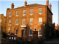
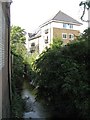
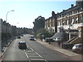
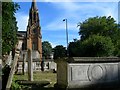
Photos of SE13 5DD


Area Information
Living in SE13 5DD offers a residential experience defined by its high-density clustering within a small defined boundary. This postcode covers merely 5708 square metres, yet it supports a population of 1494 people. You will find this neighbourhood characterised by close proximity to neighbours due to the compact size of the area. The demographic profile indicates a mature community with a median age of 47 years. Most residents fall within the adult bracket between 30 and 64 years old. This concentration of adults suggests a stable environment where long-term residents dominate the streetscape. The accommodation type is predominantly flat, which aligns with the limited physical space available in this specific cluster. Daily life here involves navigating a tightly packed residential zone with access to wider London amenities via local transport links. You are essentially living in a highly concentrated urban pocket that forms part of the greater Lewisham and Greenwich hinterland. The sheer population density of 261740 people per square kilometre highlights the intensity of the urban fabric you would be joining. This is a space where privacy meets convenience, offering a slice of city living without the sprawling footprint of other districts.
- Area Type
- Postcode
- Area Size
- 5708 m²
- Population
- 1494
- Population Density
- 8825 people/km²
The property market in SE13 5DD is shaped by the physical constraints of the land and the resulting housing stock. A defining feature is that flats are the primary accommodation type available to buyers and renters. This concentration of flats aligns with the postcode's tiny footprint of 5708 square metres. Home ownership stands at 47 per cent, which indicates a mixed market where nearly half the population owns their property while the other half lives in rented accommodation. You are looking at a small residential cluster where multiple dwellings sit within a very compact area. The presence of 1494 residents in flats suggests a high turnover of leases and sales depending on market conditions. This area does not cater to large detached homes but rather offers a high-urban-density living experience. For those seeking detached properties, you will need to look beyond this specific postcode. The market here is driven by those who value location over ground space. The flat ownership model is standard for this section of London, meaning you should expect vertical living with shared building infrastructure.
House Prices in SE13 5DD
Showing 40 properties
| Address | Type | Beds | Baths | Last Sale Price | Last Sale Date | |
|---|---|---|---|---|---|---|
| 248A Dacre Park, London, SE13 5DD | Maisonette | 2 | 1 | £550,000 | Sep 2025 | |
| 242A Dacre Park, London, SE13 5DD | Flat | - | - | £498,000 | Sep 2024 | |
| 266 Dacre Park, London, SE13 5DD | Semi-detached | 5 | 2 | £1,825,000 | Jun 2024 | |
| 250 DACRE PARK, London, SE13 5DD | Flat | - | - | £612,500 | Jun 2024 | |
| 262 Dacre Park, London, SE13 5DD | Semi-detached | 4 | 1 | £1,300,000 | Apr 2024 | |
| 238A Dacre Park, London, SE13 5DD | Flat | - | - | £550,000 | Nov 2023 | |
| 220 Dacre Park, London, SE13 5DD | Maisonette | 2 | 1 | £365,000 | Oct 2022 | |
| 268 Dacre Park, London, SE13 5DD | house | - | - | £1,778,000 | Aug 2022 | |
| 224 Dacre Park, London, SE13 5DD | Flat | - | - | £315,000 | Apr 2021 | |
| 240A Dacre Park, London, SE13 5DD | Flat | - | - | £690,000 | Feb 2021 |
Energy Efficiency in SE13 5DD
Your lifestyle in SE13 5DD revolves around excellent access to a wide range of transport and retail hubs. Within practical reach, you have five railway stations including Hither Green, Lewisham Railway Station, and Lee. For tube travel, five metro stations serve the area, such as Elverson Road, Deptford Bridge, and Cutty Sark for Maritime Greenwich. If you prefer the water, five ferry piers offer passages to Greenwich and beyond, including Greenwich Pier and Royal Wharf Pier. London City Airport is just one station away, providing quick access to business destinations. At the same time, five retail outlets ensure your daily shopping needs are met by brands like M&S Lee Lewisham BP, Cook Blackheath, and Morrisons Daily. This mix of rail, metro, ferry, and air travel creates a versatile lifestyle where you can choose how you reach your destination. The retail options provide convenience for supermarket runs and general goods. You can walk to a grocery store or jump on a train to central London with minimal effort.
Amenities
Schools
Families living near SE13 5DD have access to specific educational facilities within the local catchment. The nearest school listed for the area is St Joseph's Academy. This institution operates as a primary school, catering to young children and their immediate educational needs. With only one primary school explicitly noted in the vicinity, options for younger children are concentrated in this single location. You do not have data on secondary schools immediately adjacent to this specific postcode, so families often rely on St Joseph's Academy for earlier years before transitioning to mainstream secondary provision elsewhere. The presence of a named primary academy suggests a standard state-funded education provider is available close to your home. There is no data provided regarding the Ofsted rating or enrollment capacity of St Joseph's Academy. Families should verify current ratings directly with the school or the Department for Education. The proximity of at least one primary institution allows residents to send their young children to school without a long commute.
| Rank | School | Type | Entry gender | Ages |
|---|
Explore more schools in this area
Go to Schools tabDemographics
The community in SE13 5DD presents a clear demographic snapshot of a mature, largely settled population. With a median age of 47 years, the area is home to established households rather than transient young professionals or retirees. The vast majority of residents belong to the adult age range of 30 to 64 years, indicating a workforce-active population settled into the locality. Home ownership stands at 47 per cent, suggesting a significant portion of the 1494 residents possess a stake in their homes. Nearly half of the population rents or lives in other ownership types. The predominant ethnic group is White, reflecting the traditional character of much of South East London. Accommodation is almost exclusively in the form of flats, dictated by the 5708 square metre footprint of the postcode. This high-density living arrangement supports a neighbourhood where communal spaces are likely vital. While specific deprivation metrics are not included, the demographic data paints a picture of an area with a stable core. You are looking at a community where families and older professionals share the neighbourhood responsibilities. The population density of 261740 people per square kilometre means shared facilities are under constant use.
Household Size
Accommodation Type
Tenure
Ethnic Group
Religion
Household Composition
Age
Household Deprivation
NS-SEC
Explore more demographic insights in this area
Go to Demographics tabPlanning
Planning Constraints
- Flood RiskPremium
- Ramsar Wetland SitesPremium
- Area of Outstanding Natural BeautyPremium
- Protected Nature ReservePremium
- Protected WoodlandPremium