Area Overview for SE13 5AW
Photos of SE13 5AW
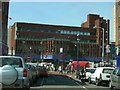

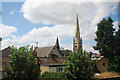
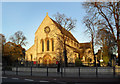
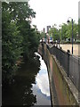
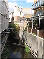
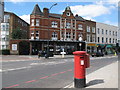

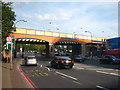
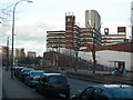
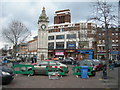
100 photos from this area
Area Information
Key information about the SE13 5AW including its size, population, and administrative classification.
- Area Type
- Postcode
- Area Size
- 8796 m²
- Population
- 1680
- Population Density
- 10721 people/km²
House Prices in SE13 5AW
50
Properties
£538,821
Average Sold Price
£160,000
Lowest Price
£920,000
Highest Price
Showing 50 properties
| Address | Type | Beds | Baths | Last Sale Price | Last Sale Date | |
|---|---|---|---|---|---|---|
| 22 Boyne Road, London, SE13 5AW | Terraced | 5 | 2 | £920,000 | Mar 2025 | |
| 80 Boyne Road, London, SE13 5AW | house | - | - | £905,000 | Aug 2024 | |
| 38 Boyne Road, London, SE13 5AW | Detached | 4 | 1 | £730,000 | Feb 2024 | |
| 2 Boyne Road, London, SE13 5AW | Flat | 1 | 1 | £773,500 | Sep 2022 | |
| 24 Boyne Road, London, SE13 5AW | house | - | - | £765,800 | Sep 2021 | |
| 60 Boyne Road, London, SE13 5AW | house | - | - | £875,000 | Sep 2017 | |
| 12 Boyne Road, London, SE13 5AW | Terraced | 4 | - | £637,500 | Aug 2015 | |
| 52 Boyne Road, London, SE13 5AW | Semi-detached | 5 | - | £737,000 | Feb 2015 | |
| 78 Boyne Road, London, SE13 5AW | Semi-detached | 4 | 2 | £745,000 | Jan 2015 | |
| 14 Boyne Road, London, SE13 5AW | Terraced | 4 | 2 | £705,000 | May 2014 |
Page 1 of 5
Energy Efficiency in SE13 5AW
Amenities
Schools
| Rank | School | Type | Entry gender | Ages |
|---|
Explore more schools in this area
Go to Schools tabDemographics
Household Size
Family (3-5 people)
most common
Accommodation Type
Flats
most common
Tenure
37
majority
Ethnic Group
White
most common
Religion
N/A
most common
Household Composition
N/A
most common
Age
47
median
Adults (30-64 years)
most common
Household Deprivation
N/A
with no deprivation
NS-SEC
44
in Lower managerial occupations
Explore more demographic insights in this area
Go to Demographics tabPlanning
Planning Constraints
- Flood RiskPremium
- Ramsar Wetland SitesPremium
- Area of Outstanding Natural BeautyPremium
- Protected Nature ReservePremium
- Protected WoodlandPremium