Area Overview for SE12 9TJ
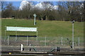
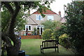
Photos of SE12 9TJ


Area Information
Living in SE12 9TJ means residing within a very specific residential cluster that covers just 4,647 square metres. This small footprint supports a population of 1,646 people, creating an environment where local familiarity is high. The area sits in England, characterised by a high density of 354,172 people per square kilometre. Such concentration often means streets are lively and neighbours are close by. Daily life here revolves around a tight-knit community situated centrally within South East London. The postcode is not a broad neighbourhood but a precise slice of property, likely containing a mix of modern and established dwellings. Your routine in SE12 9TJ will be defined by proximity. You are moments away from significant transport hubs and essential shops, yet you occupy a distinct pocket of the broader Borough of Bromley or Lewisham boundary. The small area size suggests a neighbourhood where every street name is significant. Residents enjoy the benefits of an urban setting without the sprawl of larger districts. The high population density contributes to a vibrant rhythm throughout the day and night. When you consider this location, you are looking at a place where access to services is immediate. The physical compactness makes it easy to navigate on foot or by bicycle. This is a community where you pay a premium for location convenience over expansive grounds.
- Area Type
- Postcode
- Area Size
- 4647 m²
- Population
- 1646
- Population Density
- 7135 people/km²
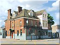
The property stock in SE12 9TJ is characterised by flats rather than detached homes. This accommodation type dominates the landscape due to the small area size of 4,647 square metres. The housing market operates in a mixed environment where owner-occupiers make up 41% of the populace. This figure is slightly below a nationwide average, suggesting a significant rental sector is also active. Potential buyers must navigate whether they are purchasing a leasehold flat or a shared ownership unit common in dense clusters. Living in SE12 9TJ often involves buying a flat within a multi-storey building or a converted structure. The high population density of 354,172 people per square kilometre drives the demand for vertical living. You will find a variety of leasehold agreements, potentially with ground rents and service charges inherent to flat living. The market is competitive because the land is so scarce within this postcode boundary. Buyers should inspect the building fabric and management statements carefully. The 41% ownership rate indicates a area used by investors and expats as well as long-term locals. Homes in SE12 9TJ offer immediate access to transport links, which maintains strong property values. The small area size limits the number of available homes, making each property highly specific. Your search here will require looking at nearby tram stops and train stations to understand the full value proposition of a flat in this dense cluster.
House Prices in SE12 9TJ
Showing 18 properties
| Address | Type | Beds | Baths | Last Sale Price | Last Sale Date | |
|---|---|---|---|---|---|---|
| 11 Chinbrook Crescent, Grove Park, London, SE12 9TJ | Flat | - | - | £277,500 | Apr 2024 | |
| 14 Chinbrook Crescent, Grove Park, London, SE12 9TJ | Flat | - | - | £295,000 | Jul 2023 | |
| 2 Chinbrook Crescent, Grove Park, London, SE12 9TJ | Flat | - | - | £227,000 | Aug 2019 | |
| 9 Chinbrook Crescent, Grove Park, London, SE12 9TJ | Flat | - | - | £235,000 | Jun 2019 | |
| 5 Chinbrook Crescent, Grove Park, London, SE12 9TJ | Flat | - | - | £175,000 | Feb 2014 | |
| 13 Chinbrook Crescent, Grove Park, London, SE12 9TJ | Flat | 2 | 1 | £147,000 | Jan 2013 | |
| 7 Chinbrook Crescent, Grove Park, London, SE12 9TJ | Flat | 2 | 1 | £156,000 | Sep 2010 | |
| 12 Chinbrook Crescent, Grove Park, London, SE12 9TJ | Flat | 2 | 1 | £172,000 | Sep 2008 | |
| 15 Chinbrook Crescent, Grove Park, London, SE12 9TJ | Flat | - | - | £155,000 | Jan 2007 | |
| 10 Chinbrook Crescent, Grove Park, London, SE12 9TJ | Flat | - | - | £150,000 | Nov 2006 |
Energy Efficiency in SE12 9TJ
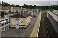
Your daily routine in SE12 9TJ benefits from a convenient radius of amenities. Five retail options fall within practical reach. You can shop at Sainsburys Lewisham Grove, Tesco Grove, or the Co-op on Downham. These supermarkets provide fresh groceries and daily essentials without a long drive. Five metro trams feed into your life, linking the area to the River Thames crossings and Stepney. If you want to enjoy the water, you must travel further to Greenwich Pier, Masthouse Terrace Pier, or Barrier Gardens Pier for boat trips. Rest and socialising happen nearby too. Five rail stations anchor the transport network, with Grove Park Station and Sundridge Park Station being key hubs. London City Airport is just one away, offering quick departures for business or leisure travel. You can walk to entertainment venues or dine in Lewisham, a short distance from the postcode. The arrangement of amenities creates a cycle of convenience. You buy your morning coffee at a local shop and catch your evening tram from the same block. The presence of multiple ferry piers adds a unique leisure element. Dining options cluster around the main thoroughfares connecting the tram stops. Parks and green spaces exist nearby though the data focuses on commercial services. Living in SE12 9TJ means you step outside your door and have immediate access to work, food, or travel. The variety of transport modes ensures you can choose the route that suits your mood.
Amenities
Schools
| Rank | School | Type | Entry gender | Ages |
|---|
Explore more schools in this area
Go to Schools tabDemographics
The community profile in SE12 9TJ reflects a mature and settled population. The median age stands at 47 years, indicating that families and empty nesters form the backbone of the residents. The most common age group comprises adults between the ages of 30 and 64 years. This demographic skew suggests a demand for family-sized properties or homes suitable for growing households. Home ownership accounts for 41% of the residents, while the remaining 59% likely reside in rental properties. This split points to a mixed market where long-term residents join with those seeking flexible housing options. Accommodation types in this postcode are predominantly flats. This financial approach to living aligns with the high population density of 354,172 people per square kilometre. Vertical living is the norm here rather than detached houses. The predominant ethnic group identifies as White, reflecting the broader London demographic trends. The age structure and ownership levels create a stable environment. A larger proportion of owners usually correlates with neighbourhood investment and stability. The presence of adults aged 30 to 64 suggests active community engagement. Schools near SE12 9TJ cater primarily to children of this established resident base. You should expect a quiet but engaged neighbourhood where life settles into a predictable pattern. The high density means you interact with many households across a limited square kilometre.
Household Size
Accommodation Type
Tenure
Ethnic Group
Religion
Household Composition
Age
Household Deprivation
NS-SEC
Explore more demographic insights in this area
Go to Demographics tabPlanning
Planning Constraints
- Flood RiskPremium
- Ramsar Wetland SitesPremium
- Area of Outstanding Natural BeautyPremium
- Protected Nature ReservePremium
- Protected WoodlandPremium