Area Overview for SE12 9QW
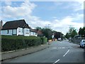
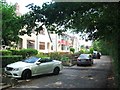
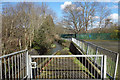
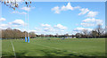
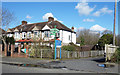
Photos of SE12 9QW

Area Information
SE12 9QW defines a specific postcode area covering a small residential cluster within greater London. The location encompasses a total area of 4895 square metres and serves a population of 1646 people. Living in SE12 9QW means residing in a compact environment where density significantly impacts the immediate surroundings. With a population density exceeding 336,000 people per square kilometre, you inhabit one of the most concentrated urban zones in the region. This extreme density characterises the daily experience for all 1646 residents, creating a tightly knit local economy. The area functions as a defined residential pocket rather than a sprawling neighbourhood. Prospective buyers should understand that SE12 9QW offers a distinct urban settlement model. The physical space is limited by design, resulting in a community where neighbours live in close proximity. You will find that homes in SE12 9QW exist within a confined footprint compared to suburban alternatives. The sheer number of inhabitants relative to the land size creates a vibrant, albeit compact, living arrangement. This postcode area stands out for its singular focus on residential density within a specific geographical boundary.
- Area Type
- Postcode
- Area Size
- 4895 m²
- Population
- 1646
- Population Density
- 7135 people/km²
The property market in SE12 9QW is defined by a specific accommodation type: flats. You will not find detached houses or semi-detached homes within this 4895 square metre postcode area. This housing form aligns with the high density of 336,252 people per square kilometre. Market data shows a home ownership rate of 41%, meaning you join a significant cohort of owners if you purchase here. However, the majority of the 1646 population rents their accommodation. This blend of ownership and renting characterises a mature urban market where flats dominate the streetscape. Living in SE12 9QW requires accepting that terraced housing or large family estates are absent from this specific cluster. The housing stock prioritises vertical living over expansive grounds. Buyers looking at homes in SE12 9QW should focus on apartment living as the only option available. The 41% ownership figure indicates a stable base of invested residents alongside a substantial tenant population. This market dynamic ensures constant turnover but also a steady presence of long-term owners. You cannot find traditional suburban properties within this defined postcode boundary. The exclusive focus on flats limits architectural variety but maximises efficiency for the dense population. Understanding this property type concentration is essential before viewing flats in SE12 9QW.
House Prices in SE12 9QW
Showing 37 properties
Energy Efficiency in SE12 9QW
Residents of SE12 9QW enjoy immediate access to five railway stations including Grove Park Station, Mottingham Station, and Elmstead Woods. Retail provisions include Sainsburys Lewisham Grove, Tesco Grove, and Lidl LON within practical reach. You have five metro stops nearby such as Elverson Road, Beckenham Road Tram Stop, and Deptford Bridge. Ferry options connect you to Greenwich Pier, Barrier Gardens Pier, and Masthouse Terrace Pier for river access. Alexandra Palace and Heathrow Airport do not appear in the vicinity of this specific cluster. London City Airport lies one airport stop away, linking you to eastern business districts quickly. You will find your daily shopping needs met by the three major supermarket chains located near the postcode. These retail hubs allow you to buy groceries and household essentials without long commutes. The presence of multiple transport modes means you can choose trains, trams, buses, or boats for your journey. Diversity in transport reduces travel stress when navigating SE12 9QW. You do not rely on a single line for your morning or evening commute. The combination of five rail stations and four metro stops provides unparalleled flexibility for travel. Living in SE12 9QW offers convenience through this diverse network of public transport services.
Amenities
Schools
| Rank | School | Type | Entry gender | Ages |
|---|
Explore more schools in this area
Go to Schools tabDemographics
The community in SE12 9QW reflects a mature population profile with a median age of 47 years. Adults between 30 and 64 years represent the most common age range within this cluster. You will encounter a population where stability often characterises the household composition. Home ownership reaches a level of 41% among residents, indicating a mixed tenure market with a significant rental component. Flats constitute the primary accommodation type found throughout the postcode area. This housing stock suits the needs of the predominantly adult workforce and families seeking contemporary living spaces. The predominant ethnic group in SE12 9QW is White, shaping the cultural fabric of local interactions. Deprivation levels in SE12 9QW do not feature in the provided statistics, so you cannot assess disadvantage metrics for this specific cluster. Instead, focus on the demographic stability indicated by the median age of 47. The area hosts the highest concentration of adults of working age, which supports local businesses. You should expect a neighbourhood where long-term residents and established families form the social core. The 41% ownership rate suggests a balanced market where both buyers and renters share the space. This demographic structure defines the rhythm of life in SE12 9QW.
Household Size
Accommodation Type
Tenure
Ethnic Group
Religion
Household Composition
Age
Household Deprivation
NS-SEC
Explore more demographic insights in this area
Go to Demographics tabPlanning
Planning Constraints
- Flood RiskPremium
- Ramsar Wetland SitesPremium
- Area of Outstanding Natural BeautyPremium
- Protected Nature ReservePremium
- Protected WoodlandPremium