Area Overview for SE12 9QD
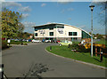
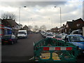
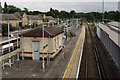
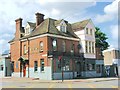
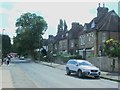
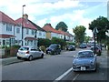
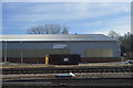
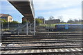
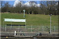
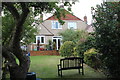
Photos of SE12 9QD


Area Information
Living in SE12 9QD means settling into a small residential cluster defined by precise boundaries rather than grand estates. This postcode covers exactly 2,234 square metres, hosting a population of 1,643 residents. The area is compact, offering an intimate environment where neighbours are likely to know one another, yet it retains the practical utility of Greater London. You will find a community that has matured, with the demographic centre of gravity sitting squarely in the adult years. The space is efficient, utilising land with a very high population density of 735,593 people per square kilometre. This tight packing suggests a neighbourhood where communal spaces are valued and the built environment is immediately accessible to daily needs. Unlike sprawling suburbs, SE12 9QD presents a concentrated slice of life where distances to transport links and shops are minimal. The area functions as a self-contained unit within the London postal system, providing a specific address for those seeking a defined corner of the south-east.
- Area Type
- Postcode
- Area Size
- 2234 m²
- Population
- 1643
- Population Density
- 7232 people/km²
The property market in SE12 9QD is distinctly characterised by private ownership rather than a high-volume rental sector. With 52% of households owning their homes, this postcode leans heavily towards the owner-occupied market. This dynamic typically implies longer-term residents and less frequent churn compared to areas dominated by private landlords. The predominant accommodation type is houses, meaning you will find more semi-detached, detached, or terraced properties rather than purpose-built high-rise flats. This housing stock generally offers more privacy and traditional gardens, appealing to families or individuals seeking a quieter domestic sphere. For buyers looking at SE12 9QD, the market feels established and local. There is less pressure to compete with massive chains of tenants which can drive short-term volatility in neighbourhood dynamics. The small area size of 2,234 square metres suggests a limited inventory, so selection is naturally constrained to what is currently on the market within this specific cluster.
House Prices in SE12 9QD
Showing 6 properties
| Address | Type | Beds | Baths | Last Sale Price | Last Sale Date | |
|---|---|---|---|---|---|---|
| 5 Thomas Dinwiddy Road, Grove Park, London, SE12 9QD | Terraced | 3 | 2 | £460,000 | Jul 2023 | |
| 7 Thomas Dinwiddy Road, Grove Park, London, SE12 9QD | Semi-detached | 3 | - | £347,500 | Mar 2015 | |
| 9 Thomas Dinwiddy Road, Grove Park, London, SE12 9QD | Semi-detached | 2 | 1 | £217,000 | Aug 2013 | |
| 11 Thomas Dinwiddy Road, Grove Park, London, SE12 9QD | Semi-detached | - | - | £34,000 | Feb 1995 | |
| 3 Thomas Dinwiddy Road, Grove Park, London, SE12 9QD | Terraced | 3 | 2 | - | - | |
| 1 Thomas Dinwiddy Road, Grove Park, London, SE12 9QD | Semi-detached | 2 | 1 | - | - |
Energy Efficiency in SE12 9QD
Your daily life in SE12 9QD is supported by a wide array of amenities accessible within a short journey. For shopping needs, you will find five major retailers nearby, including Tesco Grove, Sainsburys Lewisham Grove, and Lidl LON, placing essential goods and comparison shopping within easy reach. Leisure travel could see you taking a weekend break via five nearby ferry terminals such as Greenwich Pier or Barrier Gardens Pier, offering views of the Thames and access to the historic East London peninsulas. Five DLR stops including Elverson Road and Deptford Bridge place you in the heart of the Fairfield and Greenwich peninsula's commercial and cultural scene. Five railway stations like Lee and Mottingham Station ensure you can reach London Bridge or Victoria quickly. For business matters, London City Airport sits within practical reach, though this is primarily for visitors rather than general commuting. The combination of retail giants and diverse transport options means you can satisfy most weekly needs without leaving the immediate vicinity of SE12 9QD.
Amenities
Schools
| Rank | School | Type | Entry gender | Ages |
|---|
Explore more schools in this area
Go to Schools tabDemographics
The community in SE12 9QD is remarkably settled, with a median age of 47 years. Adults aged between 30 and 64 years form the most common age range, indicating a population of established families or professionals who have chosen to stay. Almost half of the residents, representing 52% of the total, are owner-occupiers. This statistic reflects a deep-rooted attachment to the locality and stability within the housing market. The accommodation type is overwhelmingly houses, suggesting a preference for private overground living rather than blocks of flats. Demographically, the area is predominantly White, creating a relatively homogenous social fabric compared to wider London averages. With such a significant proportion of adults in the workforce ages, the local economy likely supports established career paths. The high home ownership rate often correlates with lower tenant turnover, leading to neighbours with longer tenures. This stability is a defining character trait of SE12 9QD, offering a consistent environment for children and pets alike.
Household Size
Accommodation Type
Tenure
Ethnic Group
Religion
Household Composition
Age
Household Deprivation
NS-SEC
Explore more demographic insights in this area
Go to Demographics tabPlanning
Planning Constraints
- Flood RiskPremium
- Ramsar Wetland SitesPremium
- Area of Outstanding Natural BeautyPremium
- Protected Nature ReservePremium
- Protected WoodlandPremium