Area Overview for SE12 9PX
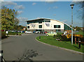
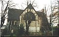
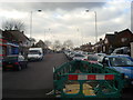
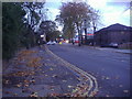
Photos of SE12 9PX
Area Information
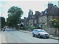
SE12 9PX represents a small, specific residential cluster situated in South East London. This postcode covers a tiny footprint of just 885 square metres, housing a population of 1,643 people. Despite its minuscule size, it functions as a cohesive neighbourhood rather than an isolated plot. Living in SE12 9PX means you are part of a tight-knit environment where your immediate surroundings are defined by proximity to key transport hubs and local retail nodes. The area sits between Grove Park and Mottingham, benefiting from close access to the DLR and local rail stations. You will find Glebe Road and the vicinity of the Green operate as natural arteries connecting you to the wider Lewisham and Bromley suburbs. The density here is significant, creating a vibrant but confined space where daily life revolves around local streets and green spaces. For those considering homes in SE12 9PX, the scale offers a sense of community that larger districts often lack. Your daily commute from this specific location benefits from excellent digital infrastructure and nearby transport links. The area avoids major planning constraints like protected woodlands or wetlands, allowing for straightforward development and maintenance of the built environment. You move through a zone where the architecture reflects its residential purpose, devoid of heavy industrial or protected natural land pressures. Whether you are walking to a station or simply strolling down the street, you navigate a compact yet functional urban space designed for habitation.
- Area Type
- Postcode
- Area Size
- 885 m²
- Population
- 1643
- Population Density
- 7232 people/km²
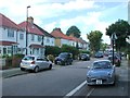
### Property Landscape in SE12 9PX The housing market in SE12 9PX is defined by its small scale and specific property types. With a population density reaching 1,855,933 people per square kilometre, this area is incredibly saturated for its land size. The accommodation type is predominantly houses, suggesting a lack of purpose-built rental blocks or large apartment complexes within this specific postcode. Approximately 52 per cent of residents are homeowners, which signals that the area is largely owner-occupied rather than a high-turnover rental zone. You are more likely to buy an existing house here than construct a new build. The compact footprint of 885 square metres means you cannot find sprawling estates, only a dense cluster of residential properties. This concentration often results in higher competition for specific lots. The housing stock consists mainly of traditional houses, catering to buyers who prefer ground-level access and garden space over high-rise living. The median age of 47 further supports the demand for family-sized or executive homes rather than micro-studios. When looking at homes in SE12 9PX, you find a market driven by established families and retirees seeking ownership. The high population density relative to the small area size indicates efficient land use, likely through terraced or semi-detached configurations. This market segment tends to be stable, with fewer volatile fluctuations typical of speculative investment areas.
House Prices in SE12 9PX
Showing 6 properties
| Address | Type | Beds | Baths | Last Sale Price | Last Sale Date | |
|---|---|---|---|---|---|---|
| Flat 4, Beecher Court, Balder Rise, Grove Park, London, SE12 9PX | Flat | 2 | 1 | - | - | |
| Flat 6, Beecher Court, Balder Rise, Grove Park, London, SE12 9PX | Flat | - | - | - | - | |
| Flat 5, Beecher Court, Balder Rise, Grove Park, London, SE12 9PX | Flat | - | - | - | - | |
| Flat 2, Beecher Court, Balder Rise, Grove Park, London, SE12 9PX | Flat | - | - | - | - | |
| Flat 3, Beecher Court, Balder Rise, Grove Park, London, SE12 9PX | Flat | - | - | - | - | |
| Flat 1, Beecher Court, Balder Rise, Grove Park, London, SE12 9PX | Flat | 2 | 1 | - | - |
Energy Efficiency in SE12 9PX
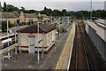
Living in SE12 9PX places you within minutes of major shopping and leisure centres. You have access to five nearby retail locations, including Tesco Grove, Sainsburys Lewisham Grove, and Budgens Catford. These supermarkets handle your weekly grocery shopping and everyday essentials with ease. The proximity to these stores means you do not need to venture far into Lewisham or Grove Park for basic provisions. Your lifestyle also benefits from extensive rail and DLR networks linking you to five notable transport hubs nearby. If you prefer the water, five ferry terminals including Greenwich Pier and Barrier Gardens Pier are within practical reach. The area lies on the same side of the river as London City Airport, providing quick access to air travel. You can reach five metro stops quickly, ensuring connectivity across South East London. The presence of these amenities creates a convenient life where errands take less than thirty minutes. Dining and leisure options are abundant within a short walk or cycle ride. The character of the area is defined by this convenience, allowing you to balance quiet neighbourhood living with active retail engagement.
Amenities
Schools
| Rank | School | Type | Entry gender | Ages |
|---|
Explore more schools in this area
Go to Schools tabDemographics
The community within SE12 9PX is characterised by a mature demographic profile. The median age stands at 47 years, with the most common age range falling squarely between 30 and 64 years. Households in this postcode are predominantly occupied by adults who typically fall into this mid-life bracket. Approximately 52 per cent of residents own their homes, indicating a solid base of owner-occupiers rather than a transient rental population. This level of ownership suggests stability within the local neighbourhood. The accommodation type is almost exclusively houses, meaning you will primarily encounter detached or semi-detached structures rather than high-density flats. This housing stock appeals to families or individuals seeking a traditional suburban living experience. The predominant ethnic group identifies as White, reflecting the established character of the local settlement. With a population density that indicates crowded living conditions relative to the small land area of 0.885 square kilometres, residents share a high degree of closeness. You live among neighbours who likely value the established nature of the street scene. The age distribution implies a quiet evening atmosphere, as the primary occupants are beyond the typical school-age children demographic. Shopping trips and social visits often involve people with disposable income and established lifestyles. The low crime risk score relative to some other areas acknowledges that standard precautions remain essential, but the environment generally supports long-term living.
Household Size
Accommodation Type
Tenure
Ethnic Group
Religion
Household Composition
Age
Household Deprivation
NS-SEC
Explore more demographic insights in this area
Go to Demographics tabPlanning
Planning Constraints
- Flood RiskPremium
- Ramsar Wetland SitesPremium
- Area of Outstanding Natural BeautyPremium
- Protected Nature ReservePremium
- Protected WoodlandPremium