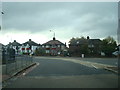
Area Overview for SE12 9HZ
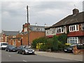
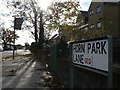
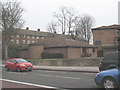
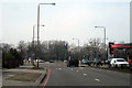
Photos of SE12 9HZ


Area Information
The postcode SE12 9HZ defines a specific residential cluster covering 1878 square metres. This compact area supports a population of 1644 people, creating a tight-knit environment where neighbours are likely to know one another. Living in SE12 9HZ means residing within a zone of significant density, with 875,241 people occupying this postcode area per square kilometre. The responsiveness to living in this location is driven by its proximity to major transport hubs and retail outlets. You will find yourself close to Lee, Hither Green, and Kidbrooke railway stations, alongside options like Elverson Road and Cutty Sark for Maritime Maritime Greenwich. The area also benefits from direct access to London City Airport and multiple Thames ferries. Daily life here revolves around convenience and connectivity, with large supermarkets such as Co-op Burnt, Tesco Clifton, and Sainsburys Lee all within practical reach. Homes in SE12 9HZ are situated in a highly connected part of southeast London, offering immediate access to both local grocery stores and national rail lines without needing extensive travel.
- Area Type
- Postcode
- Area Size
- 1878 m²
- Population
- 1644
- Population Density
- 8266 people/km²
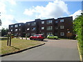
The property market in SE12 9HZ is characterised by a distinct split between ownership and renting. With a home ownership rate of 50%, the area presents an equal opportunity for those purchasing a property and those seeking to rent rather than buy. The predominant accommodation type consists of houses, which influences buyer expectations regarding garden space, parking, and internal layout. This housing style contrasts with the compact flats often found in central London, offering a different living experience for buyers looking at homes in SE12 9HZ. A property here is likely to be a standalone or semi-detached structure rather than a unit within a larger block of flats. This preference for houses aligns with the median age of 47, suggesting a demand for family-grade amenities. You should consider the implications of this housing stock when evaluating the cost of living and the potential for modification. The market reflects a desire for traditional domestic space within a dense urban postcode, catering to established households who may or may not plan to stay indefinitely.
House Prices in SE12 9HZ
Showing 3 properties
| Address | Type | Beds | Baths | Last Sale Price | Last Sale Date | |
|---|---|---|---|---|---|---|
| 130 Pitfold Road, London, SE12 9HZ | Semi-detached | 3 | 2 | £280,000 | Apr 2009 | |
| 132 Pitfold Road, London, SE12 9HZ | Terraced | - | - | £190,000 | Sep 2001 | |
| 128 Pitfold Road, London, SE12 9HZ | Semi-detached | - | - | - | - |
Energy Efficiency in SE12 9HZ
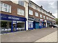
Residents of SE12 9HZ enjoy immediate access to a wide range of practical amenities. There are five retail options nearby, including Co-op Burnt, Tesco Clifton, and Sainsburys Lee. This ensures you can purchase groceries and essentials without travelling far. Transport choices are extensive, with five rail stations, five metro lines, and five ferry piers all within practical reach. Notable ferry stops include Greenwich Pier, Masthouse Terrace Pier, and Barrier Gardens Pier, offering scenic river crossings. London City Airport is also just one unit away in terms of nearby facilities, simplifying air travel needs. The combination of supermarkets and public transport creates a self-sufficient environment where daily errands require minimal effort. You can walk to fill your weekly shop or catch a train for the city with equal ease. Dining and leisure facilities are effectively integrated into these transport corridors. The density of services within such a small 1878 square metre cluster demonstrates how SE12 9HZ functions as a micro-community with world-class connectivity and local convenience.
Amenities
Schools
| Rank | School | Type | Entry gender | Ages |
|---|
Explore more schools in this area
Go to Schools tabDemographics
The community in SE12 9HZ reflects a mature settlement with a median age of 47 years. The most common age range for residents falls between 30 and 64 years, indicating a population dominated by working adults and established families. This age profile suggests a stable environment where long-term residents are likely to outstay temporary occupiers. Housing preferences align with this demographic, as the predominant accommodation type comprises houses rather than high-rise apartments. Just over half of householders in this postcode area own their homes, with a home ownership rate of exactly 50%. This balance suggests a healthy mix of owner-occupiers and landlords within the local community. The predominant ethnic group is White, shaping the cultural fabric of this specific residential cluster. You can expect a neighbourhood where household compositions tend towards stability and traditional family life, supported by a housing stock designed for homes rather than dense flats. The demographic stability offers a reassuring sense of consistency for those moving into this part of London.
Household Size
Accommodation Type
Tenure
Ethnic Group
Religion
Household Composition
Age
Household Deprivation
NS-SEC
Explore more demographic insights in this area
Go to Demographics tabPlanning
Planning Constraints
- Flood RiskPremium
- Ramsar Wetland SitesPremium
- Area of Outstanding Natural BeautyPremium
- Protected Nature ReservePremium
- Protected WoodlandPremium