Area Overview for SE12 9BD
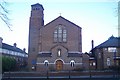
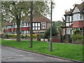
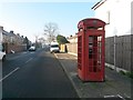
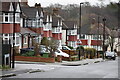
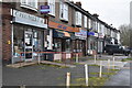
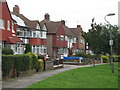
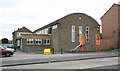
Photos of SE12 9BD

Area Information
Living in SE12 9BD offers a distinctly residential experience within a tight-knit neighbourhood in south-east London. This small postcode cluster covers an area of just 3,632 square metres, creating a dense living environment where the population is concentrated. You will find 1,559 residents calling this specific post code home, resulting in a very high density of 429,193 people per square kilometre while the data indicates a specific residential cluster. The character of the area is shaped by this compact footprint, ensuring that daily amenities are within immediate reach without the sprawling sprawl of larger districts. Prospective buyers should understand that they are entering a focused zone where community interaction is likely more prevalent due to the sheer proximity of neighbours. The demographic makeup suggests a mature community, as the median age is 47 years old. This detail reveals that the street layout and local services are oriented towards an older, established populace rather than young families or students. You are purchasing a slice of a larger urban fabric, yet the scale of SE12 9BD permits a sense of contained neighbourhood living. The area functions as a practical base for those who value proximity to transport links while residing in a defined, manageable locality.
- Area Type
- Postcode
- Area Size
- 3632 m²
- Population
- 1559
- Population Density
- 4655 people/km²
The housing stock in SE12 9BD is characterised primarily by houses, distinguishing it from the tower blocks found in adjacent urban centres. Currently, 49% of households are owner-occupied, indicating a significant presence of owner-occupiers within this small cluster. This level of ownership creates a market where residents have a vested interest in maintaining property values and local aesthetics. The remaining half of the households likely form part of a private or social rental sector, which is common in areas with such a high population density of 429,193 people per square kilometre. For buyers seeking a home, the predominance of houses offers a different feel than the typical London apartment sector. You are looking for stock that serves a mature demographic, as the median age of residents is 47. The area size of 3,632 square metres means there is limited inventory outside of this specific postcode, so choices are narrow. To find suitable homes, you must be prepared to act quickly or consider the immediate surroundings where similar house types may exist. The market here rewards those who understand the specific constraints and opportunities of a small, house-led residential catchment area.
House Prices in SE12 9BD
Showing 12 properties
| Address | Type | Beds | Baths | Last Sale Price | Last Sale Date | |
|---|---|---|---|---|---|---|
| 2 Alnwick Road, Eltham, SE12 9BD | house | 4 | 2 | £555,000 | Oct 2025 | |
| 6 Alnwick Road, Eltham, SE12 9BD | house | - | - | £450,000 | Jun 2022 | |
| 10 Alnwick Road, Eltham, SE12 9BD | house | - | - | £375,000 | May 2016 | |
| 8 Alnwick Road, Eltham, SE12 9BD | Terraced | - | - | £215,000 | Dec 2007 | |
| 14 Alnwick Road, Eltham, SE12 9BD | Semi-detached | 3 | 1 | £185,000 | Nov 2003 | |
| 22 Alnwick Road, Eltham, SE12 9BD | house | - | - | - | - | |
| 18 Alnwick Road, Eltham, SE12 9BD | house | - | - | - | - | |
| 20 Alnwick Road, Eltham, SE12 9BD | house | - | - | - | - | |
| 24 Alnwick Road, Eltham, SE12 9BD | Semi-detached | - | - | - | - | |
| 12 Alnwick Road, Eltham, SE12 9BD | house | - | - | - | - |
Energy Efficiency in SE12 9BD
Your daily life in SE12 9BD centres on a surprising abundance of transport and retail options that are practically reached from your doorstep. Despite being a small area, you have access to five nearby shopping locations, including Tesco Clifton, Co-op Burnt, and Tesco Elvam. These supermarkets are all within a practical walk or short drive, ensuring that weekly shop trips are convenient. Transport connectivity is equally extensive, with five rail stations including Lee, Kidbrooke, and Hither Green offering regular trains to central London or the suburbs. You also benefit from five metro stations such as Elverson Road and Deptford Bridge, providing another layer of flexibility. If travelling to Greenwich or Canary Wharf, five ferry options like Greenwich Pier and Masthouse Terrace Pier are available for scenic commutes. London City Airport is just one away, making business travel efficient. This mix of rail, metro, and ferry services creates a highly accessible lifestyle where you are never far from a hub for work or leisure. The variety ensures that you can choose the transport method that suits your mood or schedule.
Amenities
Schools
| Rank | School | Type | Entry gender | Ages |
|---|
Explore more schools in this area
Go to Schools tabDemographics
The community profile of SE12 9BD reflects a settled, mature household with a median age of 47 years. The most common age range among residents falls between 30 and 64 years old, indicating a population driven by working adults and those entering retirement. This age distribution often correlates with higher stability in tenancy and local engagement. Approximately 49% of households own their homes, meaning nearly half of the residents are self-employed owners. This figure places the area slightly below the national average for owner-occupation, suggesting a balanced mix of tenancies and ownership. The predominant ethnic group in the postcode is White, which aligns with the broader demographic trends of south-east London. The primary accommodation type here consists of houses, distinguishing this cluster from areas dominated by high-rise flats or purpose-built rental blocks. With a population density of 429,193 people per square kilometre despite the small 3,632 square metre area, the living arrangement is intensely private yet communal. Residents enjoy the traits of a house-dominated street while sharing the resources of a dense urban environment. This specific blend of house ownership and mature age suggests a neighbourhood focused on long-term stability.
Household Size
Accommodation Type
Tenure
Ethnic Group
Religion
Household Composition
Age
Household Deprivation
NS-SEC
Explore more demographic insights in this area
Go to Demographics tabPlanning
Planning Constraints
- Flood RiskPremium
- Ramsar Wetland SitesPremium
- Area of Outstanding Natural BeautyPremium
- Protected Nature ReservePremium
- Protected WoodlandPremium