Area Overview for SE12 8RU
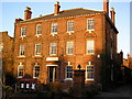
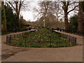
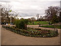
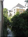
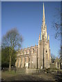
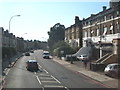
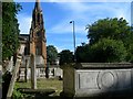
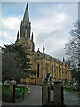
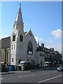
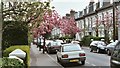
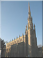
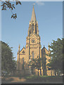
Photos of SE12 8RU
Area Information
SE12 8RU is a specific residential postcode covering an area of just 1.6 hectares. This compact cluster contains a total population of 1,558 people. By UK standards, the location has a very high population density, recorded as 95,036 people per square kilometre. The setting functions as a dense residential zone where daily life moves quickly within defined boundaries. Living in SE12 8RU means accessing a neighbourhood defined by its tight-knit scale and immediate proximity to wider transport hubs. You are situated in a part of London where the focus remains on housing and accessibility. The area sits at a specific intersection, connecting residents to larger districts through rail, metro, and ferry links. Daily routines are shaped by the proximity of shops and services without the sprawl of suburban estates. This postcode represents a practical choice for those who prioritise location over large gardens or standalone space. The high density ensures that essential amenities remain within walking or short transit distance. You find a community that is distinct from the surrounding boroughs due to its concentrated nature.
- Area Type
- Postcode
- Area Size
- 1.6 hectares
- Population
- 1558
- Population Density
- 6750 people/km²
The property market in SE12 8RU is dominated by flats rather than detached houses. This accommodation type defines the physical character of the 1.6-hectare residential cluster. With 58% home ownership, the area leans heavily towards owner-occupied stock despite the high density. You will find fewer buy-to-let properties compared to student-heavy zones or commuter hubs. Homes in SE12 8RU are situated in buildings designed for efficient use of limited space. This structure means you are less likely to find expansive gardens or large internal volumes. The predominant ethnic group data reflects the composition of the people maintaining these homes. The high population density of 95,036 people per square kilometre confirms the intense use of every building here. Buyers seeking terraced houses or bungalows will find limited options within this specific postcode. Instead, you must adapt to life in an apartment block. The mature age demographic of 47 suggests demand comes from those upgrading from smaller rentals or looking to downsize. Pricing reflects the scarcity of land and the premium on urban convenience. You purchase a share of a building rather than a plot of land.
House Prices in SE12 8RU
Showing 100 properties
| Address | Type | Beds | Baths | Last Sale Price | Last Sale Date | |
|---|---|---|---|---|---|---|
| 329-341 Lee High Road, London, SE12 8RU | Unknown | - | - | £2,629,000 | Oct 2019 | |
| Flat 1, 343 Lee High Road, London, SE12 8RU | Flat | - | - | £110,000 | Sep 2005 | |
| 313 Lee High Road, London, SE12 8RU | Terraced | - | - | £199,995 | Feb 2000 | |
| Flat 2, 267 Lee High Road, London, SE12 8RU | Flat | 2 | 1 | - | - | |
| Flat 5, 267 Lee High Road, London, SE12 8RU | Flat | 2 | 1 | - | - | |
| Flat A, 309 Lee High Road, London, SE12 8RU | Flat | 1 | 1 | - | - | |
| Flat 1, 309A Lee High Road, London, SE12 8RU | Maisonette | 3 | 1 | - | - | |
| Basement Flat, 277 Lee High Road, London, SE12 8RU | Flat | 2 | 1 | - | - | |
| Flat 2, 315 Lee High Road, London, SE12 8RU | Flat | - | 1 | - | - | |
| Flat 3, 267 Lee High Road, London, SE12 8RU | Flat | 2 | 2 | - | - |
Energy Efficiency in SE12 8RU
Residents of SE12 8RU enjoy immediate access to a wide range of amenities within practical reach. Retail options include five shopping locations, featuring Sainsburys Lee, M&S Lee Lewisham BP, and Sainsburys Hither. You can stock up on groceries or grab essentials without travelling far. Transport links are extensive, comprising five rail stations named Lee, Hither Green, and Kidbrooke. A further five metro stops serve the area, including Elverson Road, Deptford Bridge, and Cutty Sark for Maritime Greenwich. This diversity in transport means you can choose the best route to London or Kent. Ferry access includes Greenwich Pier, Masthouse Terrace Pier, and Royal Wharf Pier, offering scenic travel to the city. There is also one airport, London City Airport, nearby for short-haul flights. Lifestyle in SE12 8RU revolves around convenience and varied transit choices. Proximity to these specific venues saves significant time in your daily commute. You spend less on fuel and less time on trains. The concentration of retail and transport creates a dynamic environment where errands blend seamlessly with leisure trips.
Amenities
Schools
| Rank | School | Type | Entry gender | Ages |
|---|
Explore more schools in this area
Go to Schools tabDemographics
The community in SE12 8RU displays a clear preference for established living. The median age stands at 47 years, indicating a mature resident base. Most commonly, the population falls within the adult range of 30 to 64 years. This age profile suggests families and professionals rather than young students or retirees. Home ownership is strong here, with 58% of residents owning their properties outright or with a mortgage. The remaining houses operate within the tenure market. Accommodation types are predominantly flats, reflecting the vertical nature of the built environment. The predominant ethnic group is White, which characterises the cultural makeup of the neighbourhood. Living in SE12 8RU involves joining a demographic that values stability and long-term residency. The high home ownership rate points to residents who have settled into the area for the duration. You are looking at a community where neighbours have likely lived nearby for many years. This stability often correlates with quiet streets and established local relationships. The flat-led stock means everyone shares common walls and entrances, which can influence social interaction.
Household Size
Accommodation Type
Tenure
Ethnic Group
Religion
Household Composition
Age
Household Deprivation
NS-SEC
Explore more demographic insights in this area
Go to Demographics tabPlanning
Planning Constraints
- Flood RiskPremium
- Ramsar Wetland SitesPremium
- Area of Outstanding Natural BeautyPremium
- Protected Nature ReservePremium
- Protected WoodlandPremium