Area Overview for SE12 8ES
Photos of SE12 8ES


Area Information
Living in SE12 8ES offers a compact residential experience within a densely populated stretch of southeast London. This specific postcode covers a small residential cluster spanning only 1.5 hectares, creating an intimate neighbourhood environment. The area hosts a population of 1,569 people, resulting in a very high population density of 107,527 people per square kilometre. This concentration means that daily life unfolds in a close-knit setting where residents inevitably interact frequently. You are situated in a location that balances urban convenience with a remarkably small footprint. The immediate surroundings reflect a shared living experience where privacy and communal presence often coexist within close quarters. Prospective buyers considering this postcode should expect a lived-in atmosphere defined by its limited physical space relative to its number of inhabitants. The area functions as a distinct pocket within the wider Lewisham landscape, offering a concentrated slice of city living without the sprawl of larger boroughs. Understanding this scale is essential for grasping the pulse of SE12 8ES.
- Area Type
- Postcode
- Area Size
- 1.5 hectares
- Population
- 1569
- Population Density
- 3882 people/km²
The property market in SE12 8ES is characterised by a landscape dominated by flats, as indicated by the prevailing accommodation type data. With 60% of residents owning their homes, this is firmly an owner-occupied area rather than a student or transient rental hub. This high ownership figure points to a standing market where professionals and families seek long-term stability. Buyers looking at homes in SE12 8ES should anticipate properties that appeal to established adults looking to consolidate their assets in a high-density zone. The specific nature of the housing stock as flats means you are likely evaluating units designed for vertical living within constrained land parcels. Given the tiny area size of 1.5 hectares, inventory levels are naturally low, and competition for available stock can be fierce. The market reflects a pragmatic approach to urban living where space is prioritised through upward construction rather than horizontal expansion. Families and couples form the core demographic driving demand, seeking the convenience of flat living without sacrificing a foothold in the city. This dynamic creates a robust but competitive environment for those wishing to purchase a property in this specific postcode.
House Prices in SE12 8ES
Showing 26 properties
| Address | Type | Beds | Baths | Last Sale Price | Last Sale Date | |
|---|---|---|---|---|---|---|
| 33 Eltham Road, Eltham, SE12 8ES | Terraced | 2 | 1 | £295,000 | Mar 2015 | |
| 33A Eltham Road, Eltham, SE12 8ES | Terraced | 2 | 1 | £62,500 | Sep 2000 | |
| 27 Eltham Road, Eltham, SE12 8ES | Terraced | 2 | - | £36,000 | Feb 1998 | |
| Flat 1, 19 Eltham Road, Eltham, SE12 8ES | Flat | 1 | 1 | - | - | |
| 29 Eltham Road, Eltham, SE12 8ES | Terraced | 2 | - | - | - | |
| 1A St Peters Court, Eltham, SE12 8ES | Flat | - | - | - | - | |
| 7 Eltham Road, Eltham, SE12 8ES | Detached | - | - | - | - | |
| 1B Eltham Road, Eltham, SE12 8ES | Maisonette | - | - | - | - | |
| Flat 2, 19 Eltham Road, Eltham, SE12 8ES | Flat | - | - | - | - | |
| Flat 4, 19 Eltham Road, Eltham, SE12 8ES | Flat | 2 | 1 | - | - |
Energy Efficiency in SE12 8ES
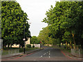
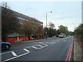
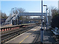
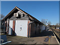
Life in SE12 8ES is defined by convenient access to a wide array of amenities located within practical reach of every doorstep. Retail needs are met by five nearby stores, including Sainsburys Lee, M&S Lee, and the Co-op in Burnt Oak. These options ensure you can handle grocery shopping and daily retail tasks without leaving the immediate vicinity. Transport links are exceptionally strong, offering five rail stations such as Lee, Kidbrooke, and Hither Green. Public transport users benefit from connections via metro hubs like Elverson Road, Deptford Bridge, and Cutty Sark for Maritime Greenwich. Ferry services at Greenwich Pier, Masthouse Terrace Pier, and Royal Wharf Pier provide further routes to central London and the Isle of Dogs. Although airport access is limited to one option, London City Airport offers a direct gateway for business travellers. This concentration of five ferry points, five rail stations, and five metro stops creates a seamless web of mobility. You can navigate the city efficiently, relying on multiple modes of transport to reach destinations quickly. The lifestyle here prioritises connectivity over luxury, offering functional access to the greater London infrastructure.
Amenities
Schools
For families residing in SE12 8ES, the local education landscape is anchored by one specific institution within practical reach. The International Academy of Greenwich operates as an academy and serves as the primary nearby school option listed for this area. As an academy, this institution offers autonomy in its educational approach while adhering to national standards, fitting the profile of a modern secondary or specialist school. The current data does not specify the Ofsted rating for this school, so prospective parents must verify the latest inspection status through official sources before making decisions. The presence of this single named academy suggests that schooling options in the immediate vicinity are concentrated, meaning you will likely need to rely on this specific provider for local education while considering wider catchment areas for additional subjects or years. This focus on a single academy type shapes the family demographic, attracting households with children who fit the academy's specific curriculum or age requirements. While the choice of school type is clear, the range of secondary and primary options remains narrow for this specific postcode location.
| Rank | School | Type | Entry gender | Ages |
|---|
Explore more schools in this area
Go to Schools tabDemographics
The community in SE12 8ES reflects the broader trends of suburbanLondon with a predominantly adult demographic. The median age stands at 47 years, aligning with mostCommonAgeRange of residents between 30 and 64 years. This indicates a area largely inhabited by working families and established professionals rather than young singles or retirees. Sixty per cent of households own their homes, revealing a strong sense of stability among the residents. The remaining forty per cent reside in rented accommodation, suggesting a mix of ownership and tenancy typical of mature London suburbs. Flats serve as the primary accommodation type within this postcode, catering well to the dense living preferences of many locals. The predominant ethnic group in SE12 8ES is White, though the area maintains an inclusive feel common to modern London neighbourhoods. Deprivation measures are not included in the available records for this specific cluster, but the high home ownership rate suggests a settled, financially secure population. You can expect to meet neighbours who have put down roots in this specific 1.5-hectare zone for significant periods.
Household Size
Accommodation Type
Tenure
Ethnic Group
Religion
Household Composition
Age
Household Deprivation
NS-SEC
Explore more demographic insights in this area
Go to Demographics tabPlanning
Planning Constraints
- Flood RiskPremium
- Ramsar Wetland SitesPremium
- Area of Outstanding Natural BeautyPremium
- Protected Nature ReservePremium
- Protected WoodlandPremium