Area Overview for SE12 0SY
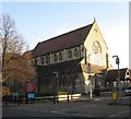
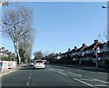
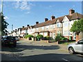
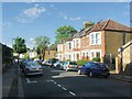
Photos of SE12 0SY


Area Information
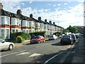
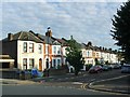
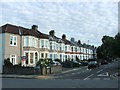
Living in SE12 0SY means residing within a tightly clustered residential zone covering just 1.4 hectares. This small footprint creates an intimate neighbourhood where residents share a distinct sense of locality. The population stands at 1,496 people, resulting in a very high density of 108,181 people per square kilometre. Such concentration is characteristic of a post code area defined by specific streets rather than a broad district. Daily life here revolves around close proximity to immediate amenities and public transport links while maintaining a consistently urban council estate feel. You will find yourself surrounded by houses that accommodate a settled community. The area functions as a quiet residential pocket deep within South London. It offers a structured environment where movement between home, school, and local shops is efficient. This postcode cluster serves as the core around which daily routines for its 1,496 residents are organised. The compact nature of SE12 0SY ensures that the character of the neighbourhood remains consistent regardless of which specific address you choose.
- Area Type
- Postcode
- Area Size
- 1.4 hectares
- Population
- 1496
- Population Density
- 4313 people/km²
The housing market in SE12 0SY is characterised by a strong preference for ownership. A clear majority of 73% of residents are homeowners. This high ownership rate suggests the area is well-established and appeals to buyers seeking stability rather than short-term rentals. The entire stock within SE12 0SY consists of houses. You will not find apartment blocks or shared ownership schemes listed as the primary accommodation type for this postcode. This structure means the local estate market is dominated by period properties or established homes rather than brand new flats. Buyers looking at SE12 0SY are entering a market where properties are typically owner-occupied. This dynamic often supports higher asking prices and lower tenant turnover. The absence of rental stock distinguishes this cluster from nearby regeneration zones or high-density university towns. Families and established couples form the core of the purchasing power here. When considering homes in SE12 0SY, the focus remains on securing a permanent residence within a house-based environment. The 100% house statistic for this area confirms a uniform housing type that simplifies valuation and comparison for potential buyers.
House Prices in SE12 0SY
Showing 36 properties
| Address | Type | Beds | Baths | Last Sale Price | Last Sale Date | |
|---|---|---|---|---|---|---|
| 43 Newstead Road, London, SE12 0SY | house | - | - | £380,000 | Jan 2020 | |
| 47 Newstead Road, London, SE12 0SY | Terraced | 2 | 1 | £405,000 | Jun 2019 | |
| 41 Newstead Road, London, SE12 0SY | Terraced | 2 | - | £288,000 | Dec 2013 | |
| 57 Newstead Road, London, SE12 0SY | Terraced | - | - | £497,000 | Nov 2012 | |
| 53 Newstead Road, London, SE12 0SY | house | 4 | - | £540,000 | Oct 2012 | |
| 25A Newstead Road, London, SE12 0SY | Terraced | 2 | - | £249,950 | Jun 2011 | |
| 51 Newstead Road, London, SE12 0SY | Semi-detached | 4 | 2 | £245,000 | Nov 2007 | |
| 45 Newstead Road, London, SE12 0SY | Terraced | - | - | £199,000 | Aug 2005 | |
| 51B Newstead Road, London, SE12 0SY | Flat | - | - | £187,000 | Jul 2005 | |
| 35 Newstead Road, London, SE12 0SY | Semi-detached | - | - | £600,000 | May 2005 |
Energy Efficiency in SE12 0SY
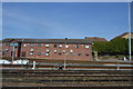
Living in SE12 0SY grants you access to a wide array of amenities within a short walk. Five retail locations serve your daily shopping needs, including Co-op Burnt, Tesco Hither, and Sainsburys Hither. These specific supermarkets and convenience stores ensure you can stock your fridge without lengthy drives. Transportation options extend to five distinct railway stations and five DLR stops. Notable hubs include Lee Station, Hither Green Station, and Grove Park Station for train travel. Commuters also benefit from five terminal ferry crossings at Greenwich Pier, Masthouse Terrace Pier, and Royal Wharf Pier. Short journeys to London City Airport provide quick access to business meetings or leisure flights. The density of these services creates a lifestyle where services are always at hand. You can run errands at Tesco or Sainsburys before catching a train to central London or the airport. The concentration of these five categories of amenities defines the convenience factor for residents of SE12 0SY. Daily life blends the quiet of the residential cluster with the immediacy of retail and transit.
Amenities
Schools
Families living in SE12 0SY have access to two primary schools located within convenient reach. Both institutions serve the education needs of the local community. St Winifred's Catholic Junior School operates as a primary school catering to younger children. St Winifred's RC Primary School also functions as a primary institution and holds a 'good' Ofsted rating. This official endorsement confirms the school meets the required standards for quality education. The presence of Catholic-primary schools indicates a religiously affiliated educational option for parents in this postcode. Both schools share the St Winifred's name, suggesting a strong institutional presence in the Hither Green area. As the most common age group in SE12 0SY comprises adults aged 30 to 64, the demand for primary education is significant. Residents choosing homes in SE12 0SY will find these two named poles of local education. The 'good' rating for the RC primary school provides a concrete data point for assessing educational quality. You can rely on these specific names when evaluating schools near SE12 0SY for your children.
| Rank | School | Type | Entry gender | Ages |
|---|
Explore more schools in this area
Go to Schools tabDemographics
The community in SE12 0SY is defined by an older demographic profile. The median age is 47 years, placing the typical resident well into mid-life. The most common age range comprises adults between 30 and 64 years old. This age distribution suggests neighbourhoods dominated by families with children or couples in their established years rather than a young, single demographic. Home ownership remains the standard living arrangement in this pocket of South London, with 73% of households owning their property outright or with a mortgage. Accommodation types are exclusively houses. You will not encounter flats or apartments within this specific cluster. The predominant ethnic group is White, which shapes the cultural texture of the locality. The high home ownership rate of 73% indicates a stable, settled population with long-term roots in SE12 0SY. Low population mobility is typical for areas where the majority of residents own their homes. This demographic stability contributes to a quiet atmosphere where neighbours know one another. The exclusive nature of house-based accommodation further reinforces the traditional family-oriented character of the area.
Household Size
Accommodation Type
Tenure
Ethnic Group
Religion
Household Composition
Age
Household Deprivation
NS-SEC
Explore more demographic insights in this area
Go to Demographics tabPlanning
Planning Constraints
- Flood RiskPremium
- Ramsar Wetland SitesPremium
- Area of Outstanding Natural BeautyPremium
- Protected Nature ReservePremium
- Protected WoodlandPremium