Area Overview for SE12 0NL
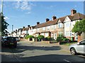
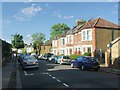
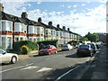
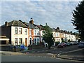
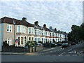
Photos of SE12 0NL
Area Information
Living in SE12 0NL offers a grounded residential experience within a compact cluster covering just 4.4 hectares. You will find a community defined by its Density; with 42,546 people per square kilometre, the environment feels close-knit without the sprawl of wider boroughs. The postcode falls squarely in adults territory, housing 1,853 residents who largely fall into the 30 to 64-year-old demographic group. This concentration of mature adults suggests a neighbourhood focused on stability and long-term settlement rather than transient living. Daily life centres on the immediate proximity of local services and transport links. Residents benefit from a setting where homes in SE12 0NL sit near major rail hubs like Lee and Hither Green. The area is not remote or isolated; instead, it functions as a practical base for those working across London or accessing the capital via London City Airport. The housing stock reflects the needs of a predominantly owner-occupier community, creating a settled atmosphere. You are looking at an environment where the focus remains on functional dwellings rather than high-end luxury, catering to families and dual-income households who prioritise location and ownership.
- Area Type
- Postcode
- Area Size
- 4.4 hectares
- Population
- 1853
- Population Density
- 6318 people/km²
The property market in SE12 0NL is defined by a clear preference for homeownership. With 53% of residents owning their homes, the area is firmly rooted in the owner-occupied sector rather than being a hub for private renting. When you view homes in SE12 0NL, you are looking at properties designed for families and long-term dwellers. The accommodation type is exclusively houses, meaning you will find semi-detached, detached, or terraced housing rather than flats. This stock profile appeals to professionals and families seeking space and garden access. The high rate of ownership suggests that the local market values stability and security of tenure. Potential buyers should expect competition from owners who wish to stay, which can influence pricing dynamics. The concentration of houses in this small 4.4-hectare zone indicates a village-like feel where street frontage is valuable. Unlike districts flooded with short-term lets, SE12 0NL offers a traditional residential model. You are purchasing an asset that aligns with someone who wants to remain in the community for years. The market reflects a practical choice for those prioritising land ownership over the ease of mobility found in rental apartments.
House Prices in SE12 0NL
Showing 12 properties
| Address | Type | Beds | Baths | Last Sale Price | Last Sale Date | |
|---|---|---|---|---|---|---|
| 99 Ronver Road, London, SE12 0NL | Terraced | 3 | 1 | £395,000 | Oct 2017 | |
| 93 Ronver Road, London, SE12 0NL | house | - | - | £400,000 | Jul 2015 | |
| 97 Ronver Road, London, SE12 0NL | house | 3 | - | £265,000 | Jul 2012 | |
| 107 Ronver Road, London, SE12 0NL | house | - | - | £220,000 | Jun 2009 | |
| 95 Ronver Road, London, SE12 0NL | house | - | - | £217,000 | Nov 2006 | |
| 91 Ronver Road, London, SE12 0NL | house | - | - | £210,000 | Feb 2004 | |
| 105 Ronver Road, London, SE12 0NL | Terraced | - | - | £73,000 | Jul 1996 | |
| 91A Ronver Road, London, SE12 0NL | Flat | 3 | 1 | - | - | |
| 109 Ronver Road, London, SE12 0NL | Terraced | - | - | - | - | |
| 101 Ronver Road, London, SE12 0NL | Terraced | - | - | - | - |
Energy Efficiency in SE12 0NL
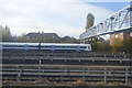
Your daily lifestyle in SE12 0NL benefits from vibrant retail and transport hubs just minutes away. Supermarkets including Co-op Burnt, Budgens Catford, and Tesco Hither line the streets, ensuring groceries and essentials are accessible without a long drive. For commuters, the local rail network at Lee, Hither Green, and Grove Park Station provides direct links to the city. The DLR at Elverson Road, Deptford Bridge, and Cutty Sark for Maritime Greenwich connects you to the Docklands and Canary Wharf. If you prefer waterways, Greenwich Pier, Masthouse Terrace Pier, and Royal Wharf Pier offer ferries that weave through the historic peninsula. London City Airport sits nearby, making short business trips or long-haul travel convenient. This density of amenities means you do not need to travel far for a shop, train, or flight. The area supports a mix of shopping, dining, and leisure activities without the congestion of central districts. Living in SE12 0NL places you in a zone where practicality meets convenience, allowing you to balance home life with work and leisure efficiently.
Amenities
Schools
Families considering SE12 0NL have access to specific educational options within practical reach. Baring Primary School serves the local primary education need and holds a good rating from Ofsted. This designation indicates standards that meet governmental expectations for teaching and student outcomes. For independent education, Hillcrest Community School is the notable option listed for your postcode. The presence of an independent school suggests a community with the means to seek alternative educational paths alongside the state sector. This mix provides families with choice based on their educational philosophy and financial preference. You may choose to send children to Baring Primary School, which is locally established and rated good, or support private education through Hillcrest Community School. The existence of these institutions alongside housing supports a functional family environment. Schools near SE12 0NL form a critical part of the neighbourhood infrastructure, reinforcing the area's appeal to parents in the 30 to 64 age bracket. The proximity of these facilities means short commutes for parents are possible, which is a significant factor for working families managing daily logistics.
| Rank | School | Type | Entry gender | Ages |
|---|
Explore more schools in this area
Go to Schools tabDemographics
The community comprising SE12 0NL is characterised by a mature population snapshot. The median age stands at 47 years old, which aligns with the finding that adults aged 30 to 64 constitute the most common age range. This demographic reality means you are entering a neighbourhood dominated by established households rather than young professionals or retirees seeking downsizing. Over 53% of residents own their homes outright or have a mortgage, indicating a strong culture of homeownership. Only a minority rents, which typically stabilises local investment and neighbourhood character. The accommodation type data reveals that houses predominate significantly in this postcode. This detail distinguishes SE12 0NL from areas filled with apartments or high-rises. You are buying or renting a standalone or semi-detached structure rather than a flat located in a large block. The population composition is predominantly White, reflecting the broader historical makeup of South East London. With 1,853 souls packed into such a small footprint, the area supports a high density of family units and working professionals. This demographic profile supports local businesses catering to steady, repeat customers who have lived in the area for decades.
Household Size
Accommodation Type
Tenure
Ethnic Group
Religion
Household Composition
Age
Household Deprivation
NS-SEC
Explore more demographic insights in this area
Go to Demographics tabPlanning
Planning Constraints
- Flood RiskPremium
- Ramsar Wetland SitesPremium
- Area of Outstanding Natural BeautyPremium
- Protected Nature ReservePremium
- Protected WoodlandPremium