Area Overview for SE11 6UL
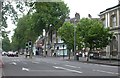
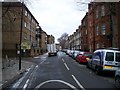
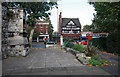
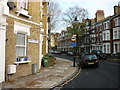
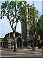
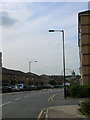
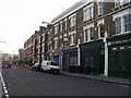
Photos of SE11 6UL


Area Information
Jane E11 6UL represents a compact residential cluster in England, covering a specific footprint of 569 m². You are entering a densely populated environment where nearly 2,000 people make their home within these boundaries. The population density stands at 3,481,635 people per square kilometre, marking one of the most intensive living concentrations in the country. This extremely high density means streets are occupied and movement through the neighbourhood is frequent. Daily life here involves close quarters and a shared sense of space among almost 2,000 residents. Living in SE11 6UL means adapting to a micro-community with limited physical expansion. The area functions as a tight-knit pocket within a larger city framework. Despite the small size, the location offers significant access to wider transport networks and commercial districts. You will find yourself navigating a space designed for high occupancy rather than spacious private gardens or extensive grounds. The character of the area is defined by its concentration of housing rather than open land. Understanding these constraints is essential for anyone considering a move to this postcode. The fundamentals of this cluster point directly to a bustling urban experience. With a resident count of 1,981, the area feels more like a ward within a district than a standalone town. The draw lies in the proximity to major thoroughfares and amenities rather than local isolation. You gain immediate access to employment hubs and shopping centres from within the property boundaries. This density ensures that services remain reachable without lengthy travel times.
- Area Type
- Postcode
- Area Size
- 569 m²
- Population
- 1981
- Population Density
- 26939 people/km²
You are entering a property market characterised almost entirely by rental activity. Only 19% of homes in SE11 6UL are owned by their residents. This low ownership percentage indicates that the local estate is dominated by private landlords and housing associations. Buyers looking to purchase directly in the postcode face significant hurdles as the primary market is let properties. Instead, any fixed-plan purchase will likely involve a property in the immediate surrounding area where ownership rates may differ. The housing stock is predominantly flats. This accommodation type suits the high-density environment of the 569 m² cluster. Flats provide insulation from the elements and maximise the use of available ground space. You will not find detached houses or large gardens in SE11 6UL. The design philosophy here prioritises maintaining structure over expanding private outdoor areas. For those seeking ownership, viewing homes in SE11 6UL requires navigating a small but niche inventory. The 19% ownership figure suggests that if you find an owner-occupied home, it may have been in the market for an extended period or represents a rare sale. Investors will see potential in a high-density rental demand area. Tenants here benefit from proximity to transport and jobs, sustaining consistent interest. However, the scarcity of owned properties limits the ability to find a home here directly for purchase without broadening your search to nearby postcodes.
House Prices in SE11 6UL
Showing 45 properties
| Address | Type | Beds | Baths | Last Sale Price | Last Sale Date | |
|---|---|---|---|---|---|---|
| 12, Tomkyns House, Distin Street, London, SE11 6UL | Flat | - | - | - | - | |
| 13, Tomkyns House, Distin Street, London, SE11 6UL | Flat | - | - | - | - | |
| 10, Tomkyns House, Distin Street, London, SE11 6UL | Flat | - | - | - | - | |
| 23, Tomkyns House, Distin Street, London, SE11 6UL | Flat | - | - | - | - | |
| 5, Tomkyns House, Distin Street, London, SE11 6UL | Flat | - | - | - | - | |
| 6, Tomkyns House, Distin Street, London, SE11 6UL | Flat | - | - | - | - | |
| 7, Tomkyns House, Distin Street, London, SE11 6UL | Flat | - | - | - | - | |
| 25, Tomkyns House, Distin Street, London, SE11 6UL | Flat | - | - | - | - | |
| 32, Tomkyns House, Distin Street, London, SE11 6UL | Flat | - | - | - | - | |
| 45, Tomkyns House, Distin Street, London, SE11 6UL | Flat | - | - | - | - |
Energy Efficiency in SE11 6UL
Convenience defines the lifestyle in SE11 6UL through immediate access to major retailers and transport hubs. Five Tesco supermarkets dot the landscape, including locations at Lambeth, Kennington, and Dumont. You can stock your weekly groceries nearby without travelling far. This proximity reduces the time spent on errands and shopping. The variety of locations ensures that you have options for flexibility. Transport options are plentiful for daily commuting. Five major stations, including Kennington, Oval, and Southwark, provide rail access. Additionally, five metro options and multiple railway services like Elephant & Castle, Vauxhall, and Waterloo allow fast escapes to central London. Three significant coach stations, including Victoria and Green Line facilities, offer long-distance travel links. This network means you can reach city business districts quickly or travel further afield on holiday. Ferry access from nearby piers such as Lambeth, Millbank, and Vauxhall St George Wharf provides alternative routes. Schools, retail, and transport cluster within practical reach. Dining, leisure, and cultural venues are accessible via these networks. The area’s position ensures that nothing vital is far away. You can live simply in the small cluster while accessing the full city experience via transport. Daily life balances a quiet postcode with a world of opportunity through the surrounding station networks.
Amenities
Schools
Nearby schools offer a specific mix of educational options for families considering living in SE11 6UL. Ethelred Nursery School and Children's Centre serves as the primary early years provider. This nursery caters to the youngest residents, supporting parents who work in the surrounding city sectors. For children with special educational needs, two specialist institutions are located close by. Octavia House Schools, London, holds an outstanding Ofsted rating for its special education provision. This designation reflects high standards in care and curriculum delivery. Vanguard School operates as another specialist institution within the network. The presence of these two rated schools means that specific educational needs are met locally without requiring long-distance travel. The school landscape in this area focuses on early years and special needs rather than mainstream primary or secondary education. You will not find standard comprehensive schools listed in the immediate data. Parents with young children or those with special requirements will find relevant facilities within walking distance. For other age groups, families must look beyond the immediate data for primary or secondary options. The concentration of special schools indicates a targeted approach to local education rather than a broad catchment for generalists. It ensures that vulnerable and young students receive dedicated support close to home.
| Rank | School | Type | Entry gender | Ages |
|---|
Explore more schools in this area
Go to Schools tabDemographics
The community in SE11 6UL is defined by a mature demographic profile. The median age for residents is 47 years, indicating that the majority of the population falls into the 30 to 64-year-old bracket. Adults dominate the street scene, suggesting a neighbourhood where professional life and family responsibilities take precedence. Half of the population consists of individuals aged 30, 40, 50, or 60, creating an atmosphere of stability. Housing ownership in this cluster remains relatively low, with only 19% of homes standing in the name of their inhabitants. This statistic confirms that the area functions primarily as a rental market rather than an owner-occupied estate. The vast majority of residents are likely tenants. Flats form the predominant accommodation type, aligning with the high density and limited land available. This structure supports a vertical living arrangement rather than detached or semi-detached houses. Ethnic diversity is a key feature of SE11 6UL. Black residents form the predominant ethnic group within the cluster. This demographic reality shapes the cultural fabric of the neighbourhood. The combination of high flat ownership, a renter-heavy population, and a mature age profile paints a clear picture of urban student or young professional accommodation, though the data suggests an older tenant base. The 19% ownership rate implies a high turnover in contact with landlords and tenancy agreements.
Household Size
Accommodation Type
Tenure
Ethnic Group
Religion
Household Composition
Age
Household Deprivation
NS-SEC
Explore more demographic insights in this area
Go to Demographics tabPlanning
Planning Constraints
- Flood RiskPremium
- Ramsar Wetland SitesPremium
- Area of Outstanding Natural BeautyPremium
- Protected Nature ReservePremium
- Protected WoodlandPremium