Area Overview for SE11 6QR
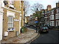
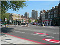
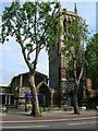
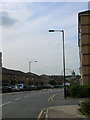
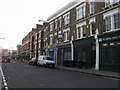
Photos of SE11 6QR


Area Information
Living in SE11 6QR means residing in a compact residential cluster covering just 3,371 square metres. The population totals 1,719 people, creating a dense micro-community with a very high population density of 509,996 people per square kilometre. You will find yourself in a small postcode area that prioritises density and proximity over broad geographical spread. The location is situated in England and functions as a tightly knit neighbourhood where daily life revolves around immediate access to transport links and essential services. This specific area offers a direct connection to the wider London network without the sprawl of larger boroughs. Residents benefit from a environment where every destination is potentially within walking distance of the local transport hubs. The small footprint of the postcode suggests a neighbourhood designed for efficiency rather than open space. You can expect a lifestyle defined by convenience and connectivity, where the physical boundaries of the area are clearly defined by its small size. This makes SE11 6QR distinct from surrounding districts, offering a focused living experience for those who value geographical compactness.
- Area Type
- Postcode
- Area Size
- 3371 m²
- Population
- 1719
- Population Density
- 18000 people/km²
Homes in SE11 6QR are defined by their accommodation type, which is exclusively flats. This housing stock reflects the small area size of 3,371 square metres and the high population density. You are looking at a market where free-standing houses are absent from the immediate postcode data. The property landscape consists almost entirely of residential units designed for vertical living rather than sprawling gardens. Only 25% of residents own their homes, meaning the majority of the housing stock is within the rental market. This high proportion of renters suggests a dynamic market where purchasing power may be lower than in areas with higher ownership rates. Prospective buyers should expect to find a concentration of apartment blocks rather than detached properties. The low ownership rate of one quarter for the population means competition among landlords is significant. For those seeking to buy, you must navigate a market skewed heavily towards tenancy. The accommodation type confirms that SE11 6QR is a flat-first locality, suitable for those who prioritise location over traditional house features.
House Prices in SE11 6QR
Showing 11 properties
| Address | Type | Beds | Baths | Last Sale Price | Last Sale Date | |
|---|---|---|---|---|---|---|
| 156 Kennington Road, London, SE11 6QR | Terraced | 3 | 3 | £1,700,000 | Jul 2022 | |
| First Floor Flat, 150 Kennington Road, London, SE11 6QR | Flat | 1 | - | £1,199,000 | May 2021 | |
| 152 Kennington Road, London, SE11 6QR | house | - | - | £1,895,000 | Oct 2020 | |
| 158 Kennington Road, London, SE11 6QR | house | 4 | - | £995,000 | Aug 2012 | |
| 154 Kennington Road, London, SE11 6QR | house | 4 | - | £930,000 | Feb 2011 | |
| 160 Kennington Road, London, SE11 6QR | house | - | - | £800,000 | Sep 2005 | |
| Basement And Ground Floor Flat, 162 Kennington Road, London, SE11 6QR | Flat | - | - | - | - | |
| First Floor Flat, 162 Kennington Road, London, SE11 6QR | Flat | 1 | 1 | - | - | |
| 150 Kennington Road, London, SE11 6QR | Flat | 1 | 1 | - | - | |
| Basement And Ground Floor Flat, 150 Kennington Road, London, SE11 6QR | undefined | - | - | - | - |
Energy Efficiency in SE11 6QR
The lifestyle in SE11 6QR is driven by the extensive reach of nearby amenities, all within practical reach of residents. You have access to five retail locations, including Tesco Lambeth, Tesco Kennington, and Sainsburys Lambeth. These supermarkets provide daily shopping needs with minimal travel time. Transport links are equally extensive, with five metro stations nearby, including Kennington Station, Oval, and Southwark Station. You can also access five ferry options such as Lambeth Pier, Millbank Pier, and Westminster Pier. Rail connectivity is supported by five stations, notably Elephant & Castle Railway Station, Vauxhall Railway Station, and London Waterloo Railway Station. Additionally, three bus services connect the area, including the Green Line Coach Station and Victoria Coach Station. This network of five metro stations, five rail stations, and five ferry piers gives you unlimited options for travel. Dining and leisure choices are integrated into this transport-heavy environment. Living in SE11 6QR means you can reach major transport nodes and retail parks quickly. The density of amenities ensures that convenience is a central theme of daily life here.
Amenities
Schools
Families considering SE11 6QR have one specific primary school option listed within the immediate educational data. Walnut Tree Walk Primary School stands as the nearest educational institution to the postcode. This school operates as a primary facility and currently holds a good Ofsted rating. A good rating indicates that the school meets expected standards for education and student care. The absence of secondary schools or other primary institutions in the provided data focuses the educational choices strictly on this one facility. You cannot access a wider mix of school types based on the current information available for this specific postcode. The presence of a single primary school with a good rating suggests a functional educational hub for young children living in the area. For parents, this means Walnut Tree Walk Primary School is the designated institution for primary education in SE11 6QR. The concentration of educational data implies that families must plan their schooling routes around this single point of reference.
| Rank | School | Type | Entry gender | Ages |
|---|
Explore more schools in this area
Go to Schools tabDemographics
The community in SE11 6QR is dominated by adults between the ages of 30 and 64 years. This age group forms the most common range within the population, with a median age of 47. Such an age profile typically indicates a stable population where many residents have long-term ties to the neighbourhood. You will find a neighbourhood that has moved beyond its youthful phase into a more settled demographic structure. This stability often brings consistent demand for homes and a sense of established routine within the local streets. Home ownership stands at 25%, which indicates that three-quarters of the residents rent their properties. A quarter of the population owns their homes directly, suggesting a mix of social housing, private rentals, and some owner-occupied flats. The predominant accommodation type in SE11 6QR is flats, aligning with the high-density nature of the postcode. Ethnically, the White group forms the predominant demographic within this area. The high density of 509,996 people per square kilometre means you are living in a space where social interactions are frequent and the community is tightly woven together.
Household Size
Accommodation Type
Tenure
Ethnic Group
Religion
Household Composition
Age
Household Deprivation
NS-SEC
Explore more demographic insights in this area
Go to Demographics tabPlanning
Planning Constraints
- Flood RiskPremium
- Ramsar Wetland SitesPremium
- Area of Outstanding Natural BeautyPremium
- Protected Nature ReservePremium
- Protected WoodlandPremium