Area Overview for SE11 6PT
Photos of SE11 6PT


Area Information
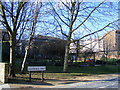
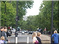
Living in SE11 6PT means residing within a very specific residential cluster in south London. This postcode covers an area of just 2.113 square kilometres, accommodating a population of 1,796 people. The resulting population density is extremely high, creating a tightly packed urban environment typical of central London postcodes. Residents here experience a life defined by immediate proximity to major transport hubs and essential services, rather than space or open green areas. Daily life revolves around navigating a neighbourhood where every step puts you minutes away from tubes, trains, and river crossings. You are part of a community where the built environment takes precedence over natural features. The area functions as a connective node, linking residential streets to the wider city network. Commuters and families alike benefit from this central location, though they must adapt to the lively, crowded nature of the surroundings. This small footprint means the local atmosphere shifts rapidly depending on the time of day. You will find yourself surrounded by neighbours in a setting that prioritises accessibility over quietude. Understanding the scale of this postcode helps explain the fast-paced character of living in SE11 6PT. The high density means you share public spaces with many others, yet remain close to the amenities that define London living.
- Area Type
- Postcode
- Area Size
- 2113 m²
- Population
- 1796
- Population Density
- 12062 people/km²
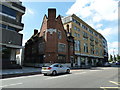
The property market in SE11 6PT is defined by a specific housing stock and ownership pattern. With 26 per cent of residents owning their homes, the majority of the market operates on a tenancy basis. This statistic explains why flats constitute the primary accommodation type within this postcode. Buyers looking at homes in SE11 6PT should expect to encounter a range of rental properties as well as a smaller pool of freehold extensions or conversion opportunities. The high population density of 850,108 people per square kilometre reinforces the prevalence of flat living. This configuration is practical for the area's constraints but dictates a specific lifestyle with shared walls and communal building maintenance. Security and quiet hours often feature prominently in management agreements if you are looking at these flats. The market reflects a location where demand for space is balanced against the convenience of central London access. You may find fewer detached houses and more structural units designed for urban efficiency. Understanding this split between ownership and rental is vital for your decision-making process. If you are a new buyer, competition for flat ownership may be stiff given the low ownership percentage.
House Prices in SE11 6PT
Showing 23 properties
| Address | Type | Beds | Baths | Last Sale Price | Last Sale Date | |
|---|---|---|---|---|---|---|
| 46 Gibson Road, London, SE11 6PT | Maisonette | 3 | - | £447,000 | Sep 2019 | |
| 42 Gibson Road, London, SE11 6PT | Flat | - | - | £460,000 | Jan 2018 | |
| 16 Gibson Road, London, SE11 6PT | Flat | 2 | 1 | £445,000 | Dec 2016 | |
| 20 Gibson Road, London, SE11 6PT | Flat | - | - | £306,000 | Oct 2016 | |
| 22 Gibson Road, London, SE11 6PT | Flat | 1 | 1 | £316,000 | Sep 2014 | |
| 38 Gibson Road, London, SE11 6PT | Flat | 1 | 1 | £345,000 | May 2013 | |
| 28 Gibson Road, London, SE11 6PT | Flat | - | - | £144,500 | Apr 2006 | |
| 26 Gibson Road, London, SE11 6PT | Flat | - | - | - | - | |
| 4 Gibson Road, London, SE11 6PT | Flat | - | - | - | - | |
| 36 Gibson Road, London, SE11 6PT | Flat | - | - | - | - |
Energy Efficiency in SE11 6PT
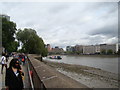
Your lifestyle in SE11 6PT will be shaped by the abundance of amenities within practical reach. You have access to five notable retail options, including Tesco Lambeth, Tesco Dumont, and Sainsburys Lambeth. These supermarkets are a short walk away, ensuring your daily shopping needs are met conveniently. Transport diversifies further with five ferry stations linking you to the Thames, such as Lambeth Pier and Vauxhall St George Wharf Pier. Commuters utilise five metro stations like Kennington Station and Oval to access the Tube network directly. If you prefer trains, five railway stations including London Waterloo and Vauxhall Railway Station are nearby. Three major bus and coach hubs, such as Victoria Coach Station and the Green Line Coach Station, are also close to hand. This mix of transport and retail makes SE11 6PT a practical base. You can load groceries at Tesco before heading to the office via Vauxhall or the riverside. The density of these services means you rarely need to travel far for essentials. This convenience is a defining feature of life in this postcode, supporting a busy but well-served urban existence.
Amenities
Schools
| Rank | School | Type | Entry gender | Ages |
|---|
Explore more schools in this area
Go to Schools tabDemographics
The community in SE11 6PT reflects a mature, urban population with distinct characteristics. The median age stands at 47 years, indicating a neighbourhood where adult life is the norm. Most residents fall into the 30 to 64 years age range, suggesting a demographic focused on career establishment or family life rather than young singles or retirees. Home ownership rates stand at 26 per cent, a figure that clearly marks this postcode as predominantly a rental market. Consequently, many current owners will be accessing the property market from an existing base or investing. The accommodation type is overwhelmingly flats, aligning with the need for vertical living in such a dense setting. White residents form the predominant ethnic group within this specific cluster. Understanding these demographics provides context for your neighbours and local schools. The age profile suggests that families with children and professionals working full-time make up the core of the population. The relatively low home ownership rate means you are likely to encounter landlords and investors as well as tenants. This mix influences the stability of the local community and the pace of turnover in housing.
Household Size
Accommodation Type
Tenure
Ethnic Group
Religion
Household Composition
Age
Household Deprivation
NS-SEC
Explore more demographic insights in this area
Go to Demographics tabPlanning
Planning Constraints
- Flood RiskPremium
- Ramsar Wetland SitesPremium
- Area of Outstanding Natural BeautyPremium
- Protected Nature ReservePremium
- Protected WoodlandPremium