Area Overview for SE11 6NQ
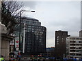
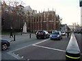
Photos of SE11 6NQ


Area Information
Living in SE11 6NQ places you within a compact residential cluster covering just 5105 square metres. This specific postcode serves London Southwark's SE11 area, home to 1719 residents. The density here is extremely high at 336729 people per square kilometre, meaning you will share close quarters with neighbours. Despite the small size, the location offers immediate access to the wider network of Greater London. Daily life revolves around proximity to major transport hubs and urban amenities rather than green space within the immediate boundary. You might find yourself in a building lined with other flats, as accommodation forms the backbone of this postcode. The area functions as an extension of the busy districts surrounding Lambeth and Southwark. Because the land area is so limited, vertical density defines the neighbourhood character. You do not enjoy views of the countryside here, but you gain walkable access to the Thames and central London. The community is tightly knit due to the space constraints, which can create a lively but crowded atmosphere. Everyone in SE11 6NQ knows that their property is situated in one of the most densely populated zones in the capital.
- Area Type
- Postcode
- Area Size
- 5105 m²
- Population
- 1719
- Population Density
- 18000 people/km²
The housing market in SE11 6NQ is defined by scarce availability and high demand. With only 25% of residents owning their homes, the area operates largely as a private rental market. This means you are unlikely to find traditional owner-occupied semi-detached or terrace houses. Instead, the stock consists primarily of flats designed to maximise occupancy within the small 5105 square metre footprint. Competition for available properties will be intense due to the limited supply of residential units in this specific cluster. If you are looking to buy, expect high prices commensurate with central London locations. The low home ownership rate often correlates with young professionals entering the market without established credit or those who cannot access mortgages for such a high-density build. Selling or renting out a property here requires navigating a competitive environment where tenants and buyers have numerous options in the immediate vicinity. You are entering a market where investment potential often outweighs the prospect of building long-term family ties through ownership.
House Prices in SE11 6NQ
Showing 31 properties
| Address | Type | Beds | Baths | Last Sale Price | Last Sale Date | |
|---|---|---|---|---|---|---|
| 3 Sail Street, London, SE11 6NQ | Flat | - | - | £340,000 | Jun 2024 | |
| 6 Sail Street, London, SE11 6NQ | Flat | 1 | 1 | £340,000 | Aug 2022 | |
| 4 Sail Street, London, SE11 6NQ | Flat | - | - | £340,000 | Jul 2022 | |
| 5 Sail Street, London, SE11 6NQ | Flat | 1 | 1 | £340,000 | Jul 2021 | |
| 7 Sail Street, London, SE11 6NQ | Flat | - | - | £340,000 | Dec 2020 | |
| 2 Sail Street, London, SE11 6NQ | Flat | 1 | 1 | £267,000 | Mar 2017 | |
| Flat 1, 8 Sail Street, London, SE11 6NQ | Flat | 1 | 1 | - | - | |
| Flat 12, 8 Sail Street, London, SE11 6NQ | Flat | 1 | 1 | - | - | |
| Flat 10, 8 Sail Street, London, SE11 6NQ | Flat | 1 | 1 | - | - | |
| Flat 4, 8 Sail Street, London, SE11 6NQ | Flat | 1 | 1 | - | - |
Energy Efficiency in SE11 6NQ
Daily life in SE11 6NQ benefits from proximity to multiple transport hubs and essential amenities. You have five ferry options nearby, including Lambeth Pier, Millbank Pier, and Westminster Pier, offering views across the Thames. Retail choices include Sainsburys Lambeth, Co-op Dover, and Tesco Waterloo, ensuring you can stock up on groceries without a long drive. Five metro stations serve the area, with Kennington Station, Southwark Station, and St James's Park Station providing local access. For longer journeys, London Waterloo Railway Station, Elephant & Castle Railway Station, and Vauxhall Railway Station act as major gateways. Bus services connect you to Green Line Coach Station, Victoria Coach Station, and London Victoria Coach Station Arrivals. This extensive network means you rarely need a personal vehicle to move around the city. You will find your daily needs met within walking distance or a short tube ride away. The density of these facilities supports a lifestyle focused on public transport convenience rather than car ownership. Residents can shop, commute, and socialise using the surrounding infrastructure effectively.
Amenities
Schools
Families considering homes in SE11 6NQ have access to Walnut Tree Walk Primary School as their nearest educational option. This primary institution holds a good Ofsted rating, providing a solid foundation for early education. The specific data provided does not list secondary schools or nurseries, so your options beyond primary level will require a search of surrounding postcodes. The presence of a good-rated primary school suggests the wider area maintains reputable standards for children's education. The mix of educational facilities is limited in this immediate postcode environment. You will need to look beyond SE11 6NQ boundaries to find comprehensive schools or other primary choices. The Ofsted rating of good for Walnut Tree Walk Primary School offers reassurance regarding the quality of instruction available to local children. Parents should verify travel times and catchment areas carefully, as the school district boundaries may extend well beyond the small residential cluster of this postcode. Education remains a priority for the 47-year-old median resident, and the available options reflect the urban character of the neighbourhood.
| Rank | School | Type | Entry gender | Ages |
|---|
Explore more schools in this area
Go to Schools tabDemographics
The people residing in SE11 6NQ reflect a mature demographic profile suited to established urban living. The median age stands at 47 years, indicating a neighbourhood where families and mid-career professionals dominate. Adults aged between 30 and 64 years represent the most common age range, confirming that the area attracts a stable workforce. This profile suggests a quieter environment compared to youth-dominated student zones or retirement communities. House ownership sits at 25%, meaning three out of every four residents rent their homes. This high rental proportion is typical for London postcodes and influences the transient nature of some households. Flats constitute the primary form of accommodation, aligning with the density constraints of the site. You are joining a community where the majority share the value of social housing or private rentals rather than freehold property. While the predominant ethnic group is White, the specific demographic breakdown shows a majority population in this central London postcode. The data indicates a stable, working-age adult population without significant youth or elderly outliers.
Household Size
Accommodation Type
Tenure
Ethnic Group
Religion
Household Composition
Age
Household Deprivation
NS-SEC
Explore more demographic insights in this area
Go to Demographics tabPlanning
Planning Constraints
- Flood RiskPremium
- Ramsar Wetland SitesPremium
- Area of Outstanding Natural BeautyPremium
- Protected Nature ReservePremium
- Protected WoodlandPremium