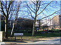
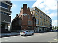
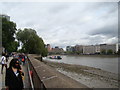
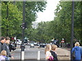
Area Overview for SE11 6EG
Photos of SE11 6EG


Area Information
SE11 6EG represents a small residential cluster in south-east London, covering exactly 2125 square metres with a resident population of 1796. This compact footprint results in an extremely high population density of 845,332 people per square kilometre, indicating a setting where space is at a premium. Living in SE11 6EG means navigating an environment defined by its concentrated urban nature rather than expansive gardens or quiet streets. The area functions as a tightly packed neighbourhood within a larger borough, serving as a functional part of the wider London transport network. Prospective buyers should understand that daily life here involves proximity to major hubs rather than isolation. The immediate surroundings dictate the rhythm of the community, with residents relying heavily on shared spaces and nearby infrastructure for their daily needs. The identity of SE11 6EG is inextricably linked to its location within this dense postcode zone. You do not find detached houses in this specific cluster; instead, the environment reflects its classification as a residential cluster designed for high occupancy. The sheer number of people living in such a limited physical area creates a distinct, high-energy atmosphere typical of central London districts. For those seeking a home in SE11 6EG, the offering is access to a major metropolitan node rather than a suburban retreat. The area's character is pragmatic, prioritising accessibility and convenience over spaciousness. Those considering moving here must be comfortable with a lifestyle centred on public transport links and communal living arrangements.
- Area Type
- Postcode
- Area Size
- 2125 m²
- Population
- 1796
- Population Density
- 12062 people/km²
Homes in SE11 6EG are defined by their accommodation type, with flats forming the predominant structure throughout this postcode. The local market is heavily characterised by rented accommodation, as only 26 per cent of households own their homes. This statistic reveals that the area functions primarily as a rental hub rather than a prime location for owner-occupiers seeking to build equity. Potential buyers must expect a landscape of high-density living where space is maximised within vertical properties. The dominance of flats aligns with the extremely high population density of 845,332 people per square kilometre, creating an environment where individual footprint is limited. Living in SE11 6EG requires accepting that freehold acquisitions are rare compared to leasehold or rental arrangements. The property mix reflects a urban residential cluster where garages or large gardens are unlikely to be found. Instead, the value proposition lies in proximity to transport and amenities rather than curb appeal or land size. If you intend to purchase a home in this specific postcode, you will be looking at multi-unit buildings designed to house the 1796 residents currently situated within the 2125 square metre boundary. This market reality means competitive pricing is driven by location factors, specifically access to the nearby railway stations and piers. Buyers should factor in the rental-heavy nature of the area when evaluating investment potential or community dynamics, as the housing options are tailored to move downsizers and professionals alike.
House Prices in SE11 6EG
Showing 18 properties
| Address | Type | Beds | Baths | Last Sale Price | Last Sale Date | |
|---|---|---|---|---|---|---|
| 224 Lambeth Walk, London, SE11 6EG | house | - | - | £700,000 | Oct 2021 | |
| 212 Lambeth Walk, London, SE11 6EG | house | 3 | 1 | £725,000 | Aug 2016 | |
| 218 Lambeth Walk, London, SE11 6EG | Terraced | 3 | 3 | £725,000 | Apr 2014 | |
| 226 Lambeth Walk, London, SE11 6EG | house | - | - | £499,999 | Oct 2013 | |
| 210 Lambeth Walk, London, SE11 6EG | Terraced | 4 | 2 | £350,000 | Jan 2013 | |
| 236 Lambeth Walk, London, SE11 6EG | house | - | - | £300,000 | Jun 2010 | |
| 230 Lambeth Walk, London, SE11 6EG | Terraced | 3 | 2 | - | - | |
| 234 Lambeth Walk, London, SE11 6EG | Terraced | 4 | - | - | - | |
| 216 Lambeth Walk, London, SE11 6EG | house | - | - | - | - | |
| 220 Lambeth Walk, London, SE11 6EG | house | - | - | - | - |
Energy Efficiency in SE11 6EG
Living in SE11 6EG offers immediate access to a wide range of retail and leisure amenities, all situated within practical reach of the resident population. There are five notable retail options including Tesco Dumont, Tesco Lambeth, and Tesco Kennington, ensuring you have no difficulty finding groceries or daily essentials. Your lifestyle choices are supported by five ferry terminals such as Lambeth Pier and Vauxhall St George Wharf Pier, which provide scenic river crossings and holiday getaways. Transport enthusiasts will find the area well-served by five railway stations including Elephant & Castle and London Waterloo, alongside five metro stops like Kennington and Pimlico. Additionally, three major coach stations operate nearby, linking you to countrywide services from Greenwich to Prestwick. This concentration of amenities creates a convenient daily life where you rarely need to travel far for anything. The availability of multiple supermarkets means you can shop at whichever Tesco outlet suits your schedule best. Access to Lambeth Pier or Millbank Pier grants you easy entry to riverside walks or London Eye visits without a long commute. The proximity to London Waterloo and Vauxhall Railway Station places business meetings and leisure trips at a fraction of the usual travel time. With options ranging from the Green Line Coach Station to the Victoria Coach Station, your transport needs are covered whether you prefer trains, buses, or coaches. The density of these five categories of amenities transforms SE11 6EG into a highly functional base for both work and play, removing the need to venture far beyond the postcode for most activities.
Amenities
Schools
| Rank | School | Type | Entry gender | Ages |
|---|
Explore more schools in this area
Go to Schools tabDemographics
The community within SE11 6EG shows a clear demographic skew towards mature residents. The median age sits at 47 years, with adults aged between 30 and 64 forming the most common age range. This profile suggests the area appeals to families, established professionals, and retirees rather than students or young singles. Only 26 per cent of residents own their homes outright, meaning the vast majority of the population rents their accommodation. Consequently, the housing stock is dominated by flats rather than detached or semi-detached properties. This high rental uptake indicates that SE11 6EG functions primarily as a letting market where tenants make up the demographic majority. Ethnically, the predominant group in this postcode area is White. The age concentration between 30 and 64 implies a population with significant financial stability, likely working in the broader London economy. Because home ownership stands at just over a quarter, residents may be transient or earning premiums that exceed local property values. This dynamic shapes the social fabric of SE11 6EG, where long-term ownership is less common than in other parts of London. The high density and flat-based architecture cater to a lifestyle where neighbours share walls rather than yards. Understanding that most residents are tenants helps you gauge the stability and turnover rate of the community. You are entering a market where occupancy changes frequently, contrasting with the stability of owner-occupied clusters.
Household Size
Accommodation Type
Tenure
Ethnic Group
Religion
Household Composition
Age
Household Deprivation
NS-SEC
Explore more demographic insights in this area
Go to Demographics tabPlanning
Planning Constraints
- Flood RiskPremium
- Ramsar Wetland SitesPremium
- Area of Outstanding Natural BeautyPremium
- Protected Nature ReservePremium
- Protected WoodlandPremium