Area Overview for SE11 6AL
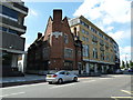
Photos of SE11 6AL


Area Information
Living in SE11 6AL means residing within a specific postcode cluster in south London that serves as a residential settlement rather than a distinct neighbourhood with named boundaries. This small area covers just 3,639 square metres, marking it as an exceptionally compact zone compared to broader districts. You are part of a community of 1,796 people who call this tight-knit spot home. Given the limited footprint, daily life moves quickly without the extended travel times typical of larger suburbs. The high population density of approximately 493,486 people per square kilometre suggests a setting where neighbours are close by, though the exact spatial arrangement relies on the local housing configuration typical of this postcode. Potential buyers often confuse this small code with the wider Elephant and Castle or Lambeth areas, but SE11 6AL functions as a precise micro-location linked to the transport hubs mentioned later. Residents here enjoy proximity to major stations like Vauxhall and Waterloo without needing to venture far. The area's identity is defined by its integration into the wider transport network rather than unique local geography. When you consider homes in SE11 6AL, you are looking at a functional urban space that prioritises accessibility over expansive green surroundings. This density ensures vibrant street life but requires careful consideration of noise and shared spaces. The area offers a straightforward living experience centred on efficiency and connection to the surrounding city infrastructure.
- Area Type
- Postcode
- Area Size
- 3639 m²
- Population
- 1796
- Population Density
- 12062 people/km²
The property market in SE11 6AL is characterised almost entirely by rental stock rather than owner-occupied homes. Only 26% of residents own their homes, a figure that signals a deeply established letting market. This low percentage of homeownership means that when you look at homes in SE11 6AL, you are primarily viewing properties available to rent from private landlords or housing associations. The lack of owner-occupiers reduces the likelihood of long-term community stability but does create a flexible environment for tenants seeking temporary accommodation. The predominant accommodation type is flats, a direct result of the area's compact 3,639 square metre footprint. High-rise apartments and converted residential blocks dominate the skyline, offering maximised use of limited land space. For buyers considering purchasing, this market structure suggests that freehold purchases within the postcodes immediately surrounding this area may be more relevant, as the postcode itself facilitates flat leasing rather than house sales. You might find leasehold flats here with varying service charge structures depending on the building age and management company. This rental-heavy environment affects property value dynamics, as security of tenure remains a key consideration for tenants. Landlords have freedom to modify units to suit market demands, leading to a diverse range of interior conditions. However, with only 26% ownership, moves are frequent and tenants often seek shorter lease terms. If you are a buyer looking for stability, you might want to expand your search to nearby postcodes where homeownership rates are higher. Within SE11 6AL, your main focus should be on leasehold terms, ground rent clauses, and service charges, rather than mortgage affordability for freehold properties.
House Prices in SE11 6AL
Showing 30 properties
Energy Efficiency in SE11 6AL
Life in SE11 6AL is defined by immediate access to major transport hubs and essential retail outlets. You have five ferry terminals nearby, including the iconic Lambeth Pier, Millbank Pier, and Westminster Pier, allowing for a leisurely commute or a quick trip to the South Bank. For shopping needs, the area is supported by five key retail locations, notably the Tesco Dumont and Tesco Lambeth supermarkets. If you need specific clothing items, the Multi-Store (M&S) St location is also within your walking distance. These retail options cover daily necessities from groceries to household goods, enhancing convenience for residents with no car. Transport variety is immense, with five railway stations like Elephant & Castle Railway Station and three major coach stations including London Victoria Coach Station. This concentration means you can access London's cultural sites or regional airports with ease. However, the density of amenities comes with noise and pedestrian traffic. You must weigh the convenience of having supermarkets and ferries on your doorstep against the potential for a busy urban environment. The presence of so many transport modes indicates this is a transit-first neighbourhood where movement is the primary function of the streetscape. For families, the combination of nearby shops and coaches offers flexibility if you plan occasional day trips. While there are no dedicated leisure parks or sports centres listed within this specific micro-area, the broader transport links provide access to larger facilities through Waterloo or Vauxhall. Your lifestyle will largely depend on how you utilise the public networks rather than local green spaces. Living in SE11 6AL is practical, efficient, and highly connected to the wider city of London.
Amenities
Schools
| Rank | School | Type | Entry gender | Ages |
|---|
Explore more schools in this area
Go to Schools tabDemographics
The community in SE11 6AL reflects a mature population dominated by the most common age range of adults aged 30 to 64 years. With a median age of 47, the area attracts families and professionals rather than students or retirees looking for quiet retirement villages. A significant 53% of the population falls outside the median, skewing slightly older than the national average for London housing zones. You will find a predominantly white demographic forms the majority of this local population, creating a specific cultural character that shaped the area's development over decades. Home ownership stands at a relatively low 26%, meaning over three-quarters of the 1,796 residents occupy the homes they live in through tenancy. This statistic highlights that living in SE11 6AL is primarily a rental experience. The predominant accommodation type is flats, which aligns with the high density and small area size of 3,639 square metres. Flat living suits the demographic profile of adults aged 30 to 64 who may prefer low-maintenance housing in the city centre. The concentration of flats also means you will encounter shared entrance systems and communal corridors rather than detached houses or semi-detached properties. This housing stock supports a lifestyle where noise insulation and building management are priorities for tenants. The low ownership rate indicates a high level of turnover and the potential for landlords to renovate units without restriction. For those seeking to buy, the scarcity of owner-occupiers suggests limited opportunities for shared ownership schemes within this specific postcode. Instead, buyers might look toward leasehold properties which are common for flats in this location. Understanding this demographic reality helps you prepare for a neighbour group that may value immediate convenience and access over traditional gardening or large gardens.
Household Size
Accommodation Type
Tenure
Ethnic Group
Religion
Household Composition
Age
Household Deprivation
NS-SEC
Explore more demographic insights in this area
Go to Demographics tabPlanning
Planning Constraints
- Flood RiskPremium
- Ramsar Wetland SitesPremium
- Area of Outstanding Natural BeautyPremium
- Protected Nature ReservePremium
- Protected WoodlandPremium