Area Overview for SE11 5TY
Photos of SE11 5TY


Area Information
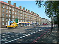
Living in SE11 5TY means residing within a defined residential cluster that forms a distinct micro-community in south London. This specific postcode covers a small population of 1,701 people, creating a tight-knit environment rather than the sprawling neighbourhoods found elsewhere in the city. The area functions as a practical entry point for those seeking proximity to major transport hubs without residing directly within the most saturated zones of central London. Daily life here is characterised by high connectivity, with metres separating residents from several railway stations, underground entrances, and river piers. You can access local amenities efficiently while maintaining a sense of residential separation. The location sits at the intersection of limited flood risks and diverse transport options, making it a logical choice for commuters who prioritise travel time over exclusive estate characteristics. Residents benefit from immediate access to Vauxhall Railway Station and Kennington Station, alongside ferry services at nearby wharves. This postcode represents a stable, accessible part of Elephant and Castle, offering a straightforward living experience defined by its proximity to key infrastructure nodes and its compact residential footprint.
- Area Type
- Postcode
- Area Size
- Not available
- Population
- 1701
- Population Density
- 5590 people/km²
The property market in SE11 5TY is heavily weighted towards rental living, with flats serving as the predominant accommodation type. Home ownership stands at a low 22%, indicating that investors and private landlords play a major role in the local housing supply rather than outright owner-occupiers. This statistic suggests that if you are looking to purchase a freehold home in this postcode, you face significant competition against tenants and leaseholders. The housing stock reflects a high-density urban environment where space is at a premium. Most available properties are flats, which suits the lifestyle of renters and young professionals common in this area. While specific pricing data is not included in the current details, the structural composition points to a market driven by yield and location rather than large land plots. Buyers considering homes in SE11 5TY should expect smaller footprints and shared building facilities typical of London flat markets. The lack of owner-occupier dominance means market fluctuations often depend on broader economic trends affecting the rental sector. Prospective purchasers must evaluate whether the flat layout and rental-heavy status align with their long-term investment or living goals.
House Prices in SE11 5TY
Showing 29 properties
Energy Efficiency in SE11 5TY
Life in SE11 5TY is defined by exceptional accessibility to major transport and retail nodes. You are within practical reach of five nearby stations, including the Oval and Kennington Station, alongside Nine Elms Underground Station. Retail options are equally dense, with five major supermarkets located close by, including Tesco Kennington and Tesco Lambeth. These convenient locations mean groceries and daily essentials are available without a long journey. Transport links extend beyond trains, with five railway stations listed within easy distance, including Vauxhall Railway Station, Elephant & Castle Railway Station, and Loughborough Junction Station. Ferry services provide an alternative route through the Thames, linking you to Vauxhall St George Wharf Pier, Millbank Pier, and Lambeth Pier. Five bus routes and coach services, including Victoria Coach Station, offer flexibility for travel across the capital. This concentration of amenities ensures that residents can meet all daily needs efficiently. The proximity to these venues creates a lifestyle that balances urban convenience with the concentrated nature of a small postcode area.
Amenities
Schools
Education options near SE11 5TY include a mix of community and independent institutions. Kennington Park Bridge To School offers education within the cluster, alongside Kennington Park Academy. Evolve Academy serves the local student body with a focus on general education needs. Families considering schools near SE11 5TY also have access to The Lighthouse Group (TLG) Centre, an independent provider distinct from the state sector. This variety allows parents to choose between traditional academy models or specialised independent learning environments. The presence of multiple institutions within a small radius supports a range of educational requirements for the area's 1,701 residents. While specific Ofsted ratings are not provided in the available data, the diversity of school types ensures that students have various pathways to secondary and adult learning. The proximity of these facilities means children rarely require long-distance commutes to attend school. Residents value having Kennington Park Academy and the Lighthouse Centre immediately accessible, reducing travel time and integrating education into the daily neighbourhood routine.
| Rank | School | Type | Entry gender | Ages |
|---|
Explore more schools in this area
Go to Schools tabDemographics
The community in SE11 5TY consists primarily of adults aged between 30 and 64 years, with a median age of 47 indicating a settled demographic. Most households represent this adult profile, suggesting a population that has moved beyond early childhood stages. Only 22% of residents own their homes outright, meaning the vast majority live in rental properties or shared accommodation arrangements. Flats dominate the accommodation type, reflecting a high-density housing stock typical of inner London boroughs. This low ownership rate contrasts with many suburban areas and implies a reliance on the private rental market or social housing schemes. The resident population is predominantly White, forming the largest ethnic group within this specific postal sector. This demographic profile suggests a neighbourhood focused on professional adults and families navigating the rental sector. The concentration of flats alongside a high proportion of renters creates an atmosphere where neighbours may change frequently, yet the age data suggests long-term residents still form a significant portion of the cluster.
Household Size
Accommodation Type
Tenure
Ethnic Group
Religion
Household Composition
Age
Household Deprivation
NS-SEC
Explore more demographic insights in this area
Go to Demographics tabPlanning
Planning Constraints
- Flood RiskPremium
- Ramsar Wetland SitesPremium
- Area of Outstanding Natural BeautyPremium
- Protected Nature ReservePremium
- Protected WoodlandPremium