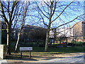
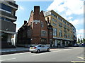
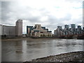
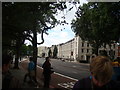
Area Overview for SE11 5PW
Photos of SE11 5PW


Area Information
The postcode area of SE11 5PW occupies a compact residential space covering just over 39,000 square metres. Despite its small footprint, it accommodates 1,706 residents, creating a densely populated cluster within the heart of London. You are not looking at a sprawling suburb but a concentrated environment where daily life is defined by proximity to major urban arteries. This specific location sits at the intersection of significant transport links and commercial zones, yet it maintains a distinct residential identity. The area functions as a small, high-density hub rather than a broad neighbourhood, meaning your routine is shaped by the immediate surroundings of this postcode cluster. Living in SE11 5PW means navigating a space where every square metre is utilised for housing, supported by an accessible network of schools and transport options nearby. You will find yourself in a setting where the scale of the community is intimate, bounded clearly by the data parameters of its size and population. This density suggests a place where neighbours know each other, and amenities are never far away. The area serves as a practical base for those seeking a central London location without the scale of larger districts.
- Area Type
- Postcode
- Area Size
- 3923 m²
- Population
- 1706
- Population Density
- 17808 people/km²
The property market in SE11 5PW is characterised by a predominant presence of rental accommodation. Only 21 per cent of residents own their homes, indicating that the local housing pool is heavily skewed towards renting. You will find that the residential fabric is built largely from flats, a conclusion drawn from the explicit accommodation type data for this postcode. This concentration of flats aligns with the small physical area of 3923 square metres, which simply cannot support a high volume of detached or semi-detached houses. For buyers, this means that purchasing a freehold property here presents a specific opportunity to join a minority group of owners within a sea of renters. The market dynamics suggest that rental yields might be attractive given the high occupancy of these units, though the primary demographic focus suggests stability in tenancy. If you are looking to buy, you are entering a market where the stock is urban and vertical rather than sprawling. The lack of home owners also implies that appeal to landlords can be strong, as demand for housing units in this dense cluster remains relevant. You should consider the implications of buying in a zone defined by high population density and limited land area for traditional housing stock.
House Prices in SE11 5PW
Showing 28 properties
| Address | Type | Beds | Baths | Last Sale Price | Last Sale Date | |
|---|---|---|---|---|---|---|
| 25 Orsett Street, London, SE11 5PW | Terraced | 3 | 1 | £785,000 | Dec 2013 | |
| 31 Orsett Street, London, SE11 5PW | Terraced | - | - | £385,000 | Sep 2003 | |
| Flat 6, 30 Orsett Street, London, SE11 5PW | Flat | - | - | - | - | |
| Flat 4, 30 Orsett Street, London, SE11 5PW | Flat | - | - | - | - | |
| Flat 3, 30 Orsett Street, London, SE11 5PW | Flat | - | - | - | - | |
| Flat 1, 32 Orsett Street, London, SE11 5PW | Flat | - | - | - | - | |
| Flat 2, 32 Orsett Street, London, SE11 5PW | Flat | - | - | - | - | |
| Flat 1, 30 Orsett Street, London, SE11 5PW | Flat | - | - | - | - | |
| Flat 5, 32 Orsett Street, London, SE11 5PW | Flat | - | - | - | - | |
| Flat 3, 32 Orsett Street, London, SE11 5PW | Flat | - | - | - | - |
Energy Efficiency in SE11 5PW
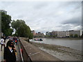
Living in SE11 5PW places you within striking distance of a diverse array of retail and transport hubs. Five major retail destinations operate within practical reach, including the Tesco Kennington, Tesco Lambeth, and Tesco Dumont stores. These venues form the backbone of daily shopping needs without requiring a long journey. The transport network surrounding this area is exceptionally dense, offering five railway stations nearby. Thameslink serves Vauxhall Railway Station and Elephant & Castle Railway Station, while London Waterloo Railway Station provides further connectivity across the capital. Additionally, you have access to five ferry options, including Millbank Pier, Lambeth Pier, and Vauxhall St George Wharf Pier, giving you routes across the river. The metro system also features five stations in close proximity, such as Kennington Station, Oval, and Pimlico Station. Three major coach stations, including the Green Line Coach Station and Victoria Coach Station, complete the transport picture. This density means you have unparalleled choice for commuting, shopping, and leisure, all within a manageable radius of your home.
Amenities
Schools
Families using SE11 5PW as a base have access to a specific selection of educational institutions in their immediate vicinity. Vauxhall Primary School serves the local community and holds a Good rating from Ofsted. This school provides a standard of education recognised by regulators, ensuring a baseline of quality for primary education needs. The area also hosts the Bbi School, which functions as a special school. The presence of both a maintained primary school and a special educational provision indicates a conscious planning of diverse educational options within walking distance. This mix means you have access to mainstream education for typical year groups while also having specialist facilities nearby if required. The schools listed are the only ones confirmed in the data for this location, so your search for institutions is focused on these named entities. For parents navigating the education system, having two distinct options within close reach simplifies the decision-making process. You need to understand that the educational landscape is defined by these two specific providers, Vauxhall Primary School and the Bbi School, which cater to different learning requirements.
| Rank | School | Type | Entry gender | Ages |
|---|
Explore more schools in this area
Go to Schools tabDemographics
The community within SE11 5PW is dominated by adults, with the 30 to 64 age range being the most common demographic group. Your neighbours are likely to be in the middle stages of their careers, resulting in a median age of 47 years. This age profile suggests a population that has settled in the area, seeking stability rather than moving frequently. Home ownership in this specific postcode remains low, standing at just 21 per cent. Consequently, the vast majority of residents are renters, which influences the character of the local interactions and tenancy turnover. The housing stock is composed almost entirely of flats, reflecting the large population density relative to the available land. You will find few detached houses or semi-detached properties within this boundary. The predominant ethnic group is White, providing the primary cultural backdrop of the immediate locality. While specific data on deprivation is not detailed in the records, the low home ownership rate often points to a market where renting is the primary mode of accommodation. This reality shapes the community feel, creating an environment where transient residency might be more common than long-term generational roots.
Household Size
Accommodation Type
Tenure
Ethnic Group
Religion
Household Composition
Age
Household Deprivation
NS-SEC
Explore more demographic insights in this area
Go to Demographics tabPlanning
Planning Constraints
- Flood RiskPremium
- Ramsar Wetland SitesPremium
- Area of Outstanding Natural BeautyPremium
- Protected Nature ReservePremium
- Protected WoodlandPremium