Area Overview for SE11 5HR
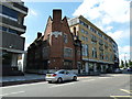
Photos of SE11 5HR


Area Information
Living in SE11 5HR places you at the heart of a dense residential cluster within south London. This specific postcode covers a small population of 1,325 people, creating a tightly knit neighbourhood where daily life revolves close to home. The area is defined by its high concentration of flats, reflecting the urban density typical of this part of the borough. Residents here enjoy immediate access to major transport networks, with five railway stations, including Vauxhall and Elephant & Castle, located within practical reach. The proximity to three ferry piers and four major Underground stations ensures that commuting into central London is a routine matter rather than a challenge. You do not need to look far for essential services. Supermarkets like Tesco Kennington and Sainsburys Lambeth sit nearby, alongside convenient bus links. The location offers excellent potential for remote work, supported by a fixed broadband quality score of 97 out of 100. Mobile coverage rates a strong 85 out of 100, ensuring you stay connected wherever you go. While the area lacks large green spaces like Areas of Outstanding Natural Beauty or protected woodlands, it remains safe from flood risks and environmental planning constraints. SE11 5HR is a established postcode serving a mature market where convenience and connectivity define the homebuyer experience.
- Area Type
- Postcode
- Area Size
- Not available
- Population
- 1325
- Population Density
- 13106 people/km²
The property market in SE11 5HR is distinctly characterised by its reliance on rented accommodations. With home ownership recorded at just 17%, you will find that 83% of households are tenants. This statistic points to a market dominated by flats, which is the predominant accommodation type listed for the area. The high density of next to one another creates a competitive rental environment where availability can shift rapidly. If you are looking to buy in this specific postcode, you face significant challenges as the low ownership rate implies few local freeholds are available. Instead, the focus should shift to investment potential in nearby zones where ownership might be more common, or approaching this area as a prime rental yield location for investors. The housing stock consists primarily of flats, catering to professionals who prioritise proximity to transport over traditional garden homes. For buyers considering homes in SE11 5HR, it is crucial to understand that the 17% ownership figure represents a minority interest in a predominantly tenanted cluster. The small population of 1,325 means there is limited longitudinal data on specific street values, but the accommodation type suggests stable, high-density living. Buyers must also consider that 83% of residents are tenants, which influences the local demand cycles and property turnover rates significantly.
House Prices in SE11 5HR
No properties found in this postcode.
Energy Efficiency in SE11 5HR
Daily life in SE11 5HR is defined by convenience and immediate access to diverse amenities. You are surrounded by five major retail outlets, including Tesco Kennington, Tesco Dumont, and Sainsburys Lambeth, ensuring all grocery needs are met without long journeys. Three ferry piers such as Millbank Pier and Vauxhall St George Wharf Pier sit within practical reach, offering leisure trips across the river. For entertainment, five nearby rail stations act as gateways to cultural venues, while metro stations like Pimlico provide quick access to nightlife and dining. Three coach stations, including Victoria Coach Station, offer organized travel links for longer excursions. The area functions as a practical residential base where essentials are rarely far away. While the focus is on urban institutions like stations and shops, the environment supports a fast-paced lifestyle suited to professionals working in central London. You will find that the mix of supermarkets and transport hubs creates a self-sufficient village feel despite being part of the greater city. Living in SE11 5HR means your weekends are filled with varied choices, from coffee at a station café to cultural events at London Waterloo. The lifestyle is active, urban, and heavily integrated with the city's pulse.
Amenities
Schools
| Rank | School | Type | Entry gender | Ages |
|---|
Explore more schools in this area
Go to Schools tabDemographics
The community in SE11 5HR reflects a mature demographic profile with a median age of 47 years. The most common age group consists of adults aged between 30 and 64 years, suggesting a population that has likely established careers and families. Home ownership stands at a relatively low 17%, indicating that the vast majority of residents occupy their homes through rental arrangements rather than outright purchase. This statistic highlights a dynamic rental market where tenants turn over frequently, often seeking flexibility in their living situations. Accommodation types are almost exclusively flats, which aligns perfectly with the high density of the 1,325 residents living in this cluster. The predominant ethnic group is White, though the close proximity to diverse transport hubs often brings a transient mix of international professionals. The lower ownership rate combined with the flat-based housing stock suggests a lifestyle focused on urban living rather than suburban expansion. You should expect a neighbourly environment where stability is balanced by the inherent movements of a major metropolitan rental zone. The age profile reinforces that this area attracts those who value central location over garden space or detached housing.
Household Size
Accommodation Type
Tenure
Ethnic Group
Religion
Household Composition
Age
Household Deprivation
NS-SEC
Explore more demographic insights in this area
Go to Demographics tabPlanning
Planning Constraints
- Flood RiskPremium
- Ramsar Wetland SitesPremium
- Area of Outstanding Natural BeautyPremium
- Protected Nature ReservePremium
- Protected WoodlandPremium